

The Sandstone Way is a new long distance mountain bike trail in the north of England that runs roughly north to south through the sparsely populated county of Northumberland, it begins in Berwick-upon-Tweed and ends in Hexham, though it is equally possible to do the route in reverse. It is 120 miles long and loosely follows a series of sandstone outcrops and rock features familiar to walkers and climbers who visit the area. Well over half the route is off-road on a mixture of bridle ways, byways, forest tracks and unclassified roads all linked together by very quiet country roads. The driving force behind the creation of this route is Ted Liddle from the Tyne Valley MTB club. The official Sandstone Way website and map give loads of information and are a great help in planning the ride. Its not a technical mountain bike route, there are no jumps or scary descents but it is a tough route and it certainly warrants the use of a good quality mountain bike, a hybrid or cyclo-cross type bike would struggle on some of the rougher rocky sections, especially in bad conditions. The route is signposted all the way though at times I did get a bit confused and you certainly need the Sandstone Way map to guide you. Time-wise you could take a leisurely 4 days to enjoy the route or if you like a real challenge and are very fit you could try to do it in a day, it has been done, Rich Rothwell (an endurance mountain bike rider) managed to get round in just under 11 hours, he used a full suspension mountain bike and said he was glad he did!
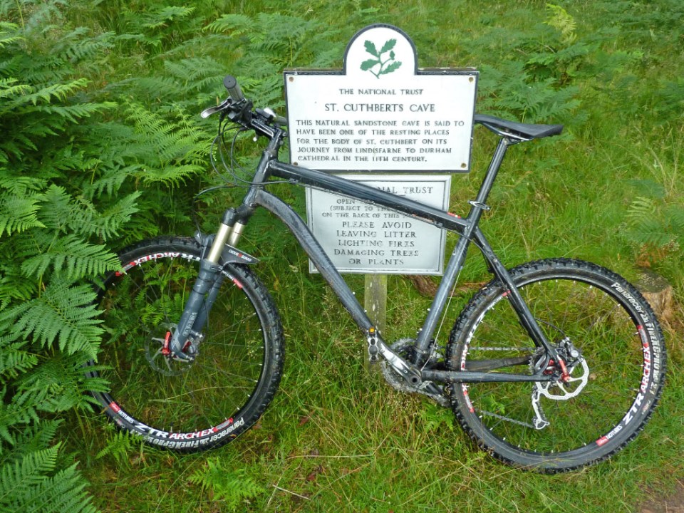
i decided to do it over 3 days and left home early on a Sunday morning to get the train up to Berwick-upon-Tweed arriving there just after 11am in the morning, you need to book a space for your bike in the goods wagon as there was only hangers for 3 bikes on the service i used. After a quick look around Berwick i headed down to the river and the bridges across the Tweed and found the official start of the Sandstone Way, right next to the Youth Hostel. The first 10 miles or so follows the coast and cliff tops and is fairly flat before gaining height as it skirts the edge of the Kyloe Hills to Detchant, here you turn right for a hilly section around Greensheen Hill. I saw quite a few hikers on this section who were doing St Cuthberts Way, a long distance trail (62.5 miles) between Montrose and Lindisfarne. The bike route then descends and passes very close to St.Cuthberts Cave, an impressive sandstone feature and well worth a short detour. Quiet roads take you past the craggs at Bowden Doors, then through Chatton and Chillingham before an energy sapping grassy ride up to the transmitter above Wooler, you get a good view of the town from up here and today the annual Glendale Festival was on and the main road through Wooler was shut and live music was being performed on a stage and there was a party atmosphere in town. I was booked into Wooler Youth Hostel.

The Sandstone Way start in Berwick-upon-Tweed
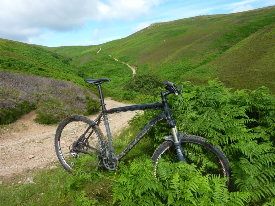
A nice feature about the Sandstone Way is that at certain points it offers a choice of routes, these could be used for day loop rides or bad conditions alternative or simply a more challenging option. The biggest route choice occurs on leaving Wooler, the normal way heads south to Alnham via Ingram and is waymarked with the familiar green roundels while a much more adventurous option heads south-west and into the heart of the Cheviot Hills and is not way marked at all – this is the way I went. The weather was good, a little windy but visibility was good, I took the precaution before I left of packing the OS 1:25000 map of the Cheviots and a compass and I’m pleased I did, a lot of the time there was a recognisable bridle way trail to follow but at other times it petered out to nothing and I was left scratching my head as to which way to go, sometimes having to bushwhack and push the bike over some very rough ground on a compass bearing to try and pick up a trail again. It was quite a relief to finally emerge at Alnham and pick up the normal route again. I finally arrived in Rothbury just after 5.00pm and made my way to Tomlinsons Cafe down by the bridge, which has a rather nice bunkhouse attached to it and has the added bonus of being right on the Sandstone Way route. I was surprised to find out that there was only one other person booked in that night.
Day three dawned nice and sunny and I was on the road again by 8.00am as it was going to be another tough day to get to Hexham, about 49 miles away. It’s quite a hilly start to get out of Rothbury up to Sharpe’s Folly tower before a flatter section and a short downhill to get into the forest, from here it’s a long steady climb up to the foot of Simonside Craggs on a wide, stony forestry track with good views over to the Cheviots, shortly afterwards the track finally starts heading downhill and it’s a fast ride for several miles through Harwood Forest until you arrive at the Elsdon road where you turn right and are soon going downhill passing Winter’s Gibbet on the left hand side. As you approach West Woodburn another one of those route choices appears, conditions were good and I was doing ok time-wise so I chose the more challenging option involving a steepish climb up an old road to a green lane route.

The finish in Hexham next to the golf clubhouse
This grassy and rocky lane was very well-defined at first but after a dip halfway along it seemed to disappear altogether and I just headed for a small forestry plantation visible in the distance (see photo below) and was relieved to pick up the green way-markers again to Bellingham where I stopped at the bakery to refuel. Leaving Bellingham it’s another stiff climb leading up to the transmitter above Shitlington Crags and then some tricky route finding as you cross first Houxty Burn (there is a bridge to your right!) followed by Wark Burn. A roller coaster road section leads to a nice off-road section into Simonburn, which has a cafe if you feel the need. Another stiff road climb takes you up to Hadrian’s Wall at Black Carts, then it’s across the fields dropping down to the South Tyne at Fourstones where one last climb takes you up Warden Hill before dropping down to cross the river and the route follows the railway line into Hexham and the Sandstone Way’s marker stone near the golf clubhouse, arriving at about 5.00pm. The railway station is not far away and I was on the train with my bike going home before 6.00pm. I had enjoyed my time doing the Sandstone way and found it a worthwhile challenge and certainly would consider doing It again sometime, maybe taking two days now that I know the route, going from Berwick-upon-Tweed to Rothbury in one day (and sticking to the signposted normal route) then Rothbury to Hexham the next day.
And finally, already done this ride? Maybe found using a bike a bit tame? Then how about running it? check out the Sandstone Way Ultra There is a good route guide PDF file available here too.
-

- Berwick-upon-Tweed start
-

- Kit for the ride
-
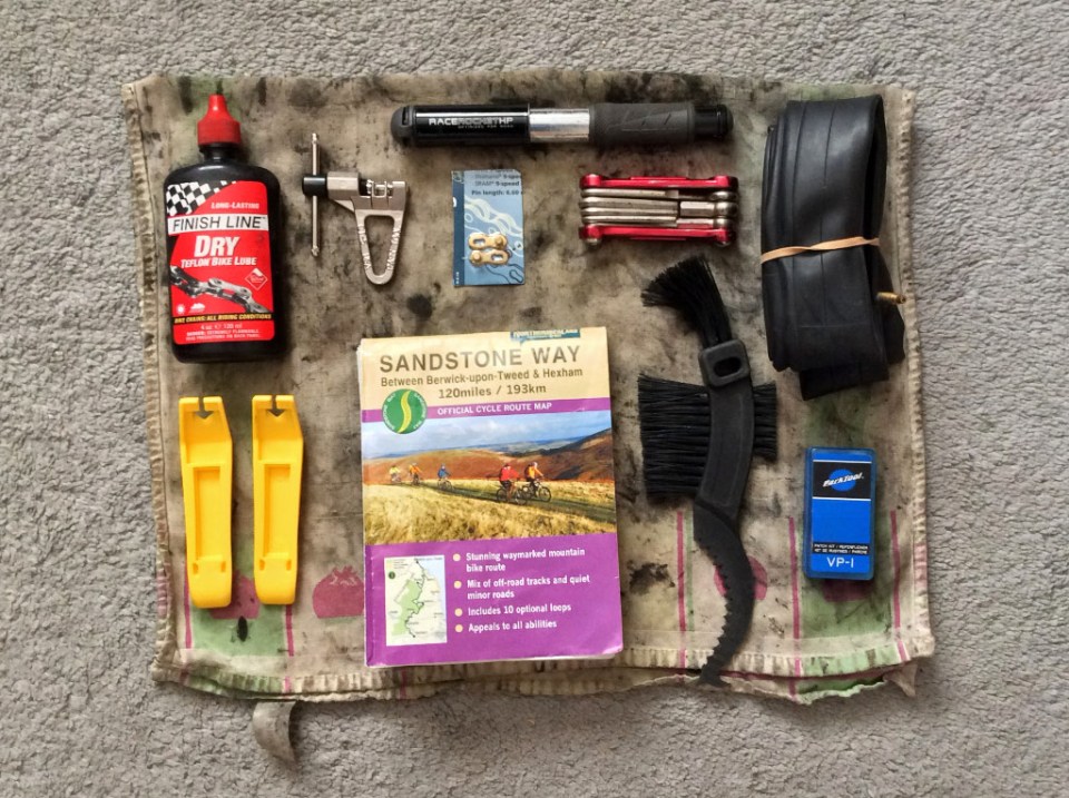
- Bike tools and spares
-
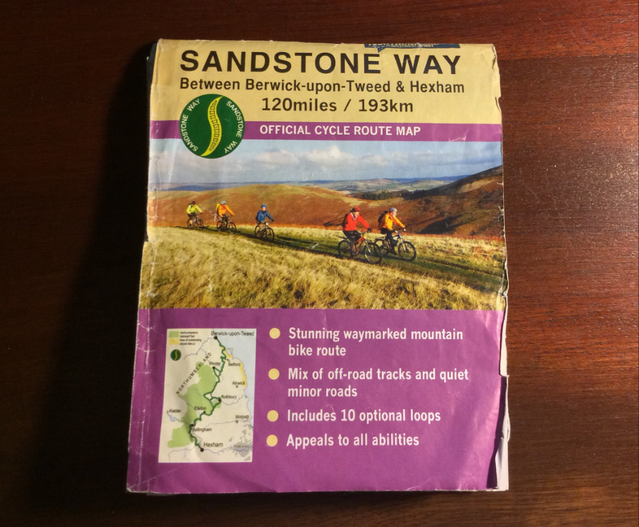
- The Sandstone Way map
-
- St Cuthberts Cave info
-
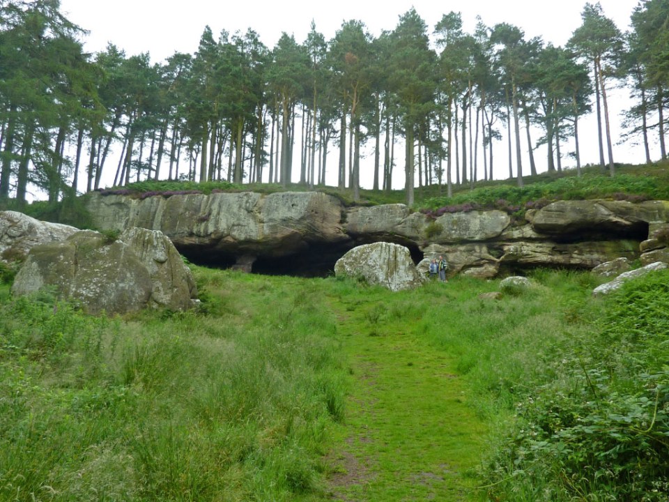
- St. Cuthberts Cave
-
- Cheviot off-road alternative route
-
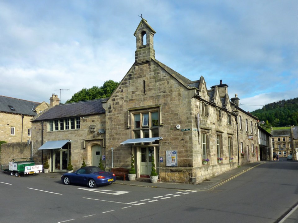
- Tomlinson’s cafe and bunkhouse in Rothbury
-
- Entering the forest on the climb up to Simonside
-
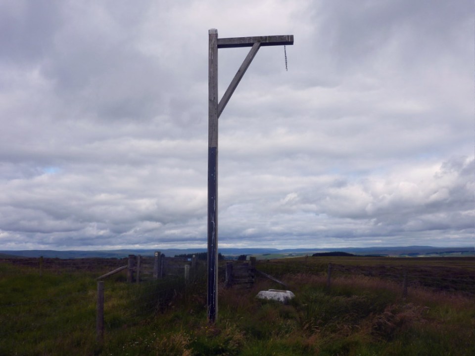
- Winters gibbet near Elsdon
-
- Optional route into Bellingham, Aim to left of plantation!
-

- Bellingham
-

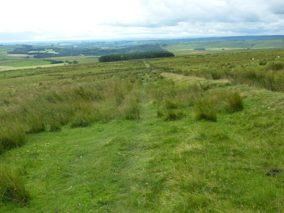
- Looking back on the route-Bellingham lies over the hill
-

- The finish in Hexham next to the golf clubhouse
