

The Glen Coe Skyline fell race takes place in September on the West coast of the Scottish Highlands. it is part of the Skyrunning series and has been held annually since 2015. The race immediately attracted lots of attention as Glen Coe is steeped in Scottish history and mountaineering folklore and is a beautiful and much-loved place, eyebrows were raised however because of the extreme nature of the route, as it includes two of the most famous scrambles in Scotland namely Curved Ridge (grade 3) and the Aonach Eagach (sustained grade 2). The route is 52 km long and this includes 4750m of ascent. My interest in this route was re-kindled after reading that the mountain running legend Kilian Journet who had recently broken Billy Bland`s long standing record for completing the Bob Graham Round (a gruelling 66 miles over 42 peaks in the English Lake District), was going to be running run in this years race. He is the current record holder for this event with an amazing time of 6 hours and 25 minutes. That got me digging the maps out again to see what the full route involved. I know this area reasonably well and it was interesting to see how the route linked up the bits i had previously done, with a week off work coming up i decided to head north to Scotland to do a full recce.
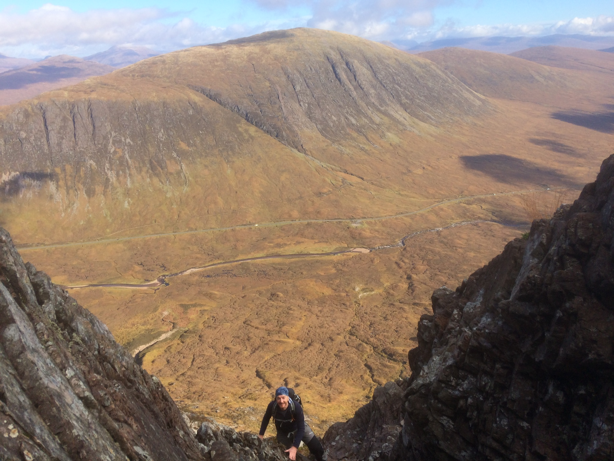
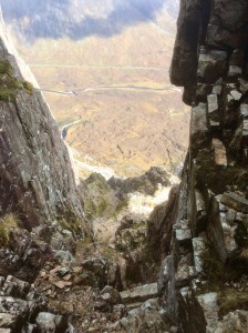
The view from Curved ridge looking back over the A82 road to Beinn a Chrulaiste
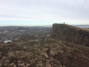
To help split up the long drive north i stopped off overnight in Edinburgh, while there I stretched my legs on a hilly hike up Calton Hill then over to Arthurs Seat and Salisbury Crags with great views over the city and is a thoroughly recommended half-day outing. An early start in the car the next morning saw me arriving at the Altnafeadh car park in Glen Coe at 9.30am and the weather, for today at least, was looking great. The plan today was to climb up to Stob Dearg by Curved Ridge and then traverse Buachaille Etive Mor past Stob na Doire to a col then descend northwards to the Lairig Gartain, where the river is crossed and there is a long climb up to Buchaille Etive Beag col, followed by a descent to the Lairig Eilde. Here i would make my way back to the car at Altnafeadh, by a track of sorts just north of the busy A82 road. The highlight of the day was going to be climbing Curved Ridge and the first challenge of the day was to locate the start of the scramble. From Altnafeadh you cross the river by the bridge then just after Lagangarbh cottage the path splits and you take the left hand track that curves south-eastwards around the mountain, gaining height all the time. If the visibility is good you can keep an eye out on the left for a track coming up from Jacksonville climbing hut. Another good marker is a huge stone slab that appears on your right. From here the going gets a lot rougher as you ascend a scree slope to the rocks above where the scrambling starts, easy at first but as you approach Rannoch Wall it steepens considerably and so does the exposure, holds are good but care is needed as a slip here could be very costly. After this 45m section I found the rest of the route much easier and I was blessed with good weather and visibility with great views in particular out over Rannoch Moor.
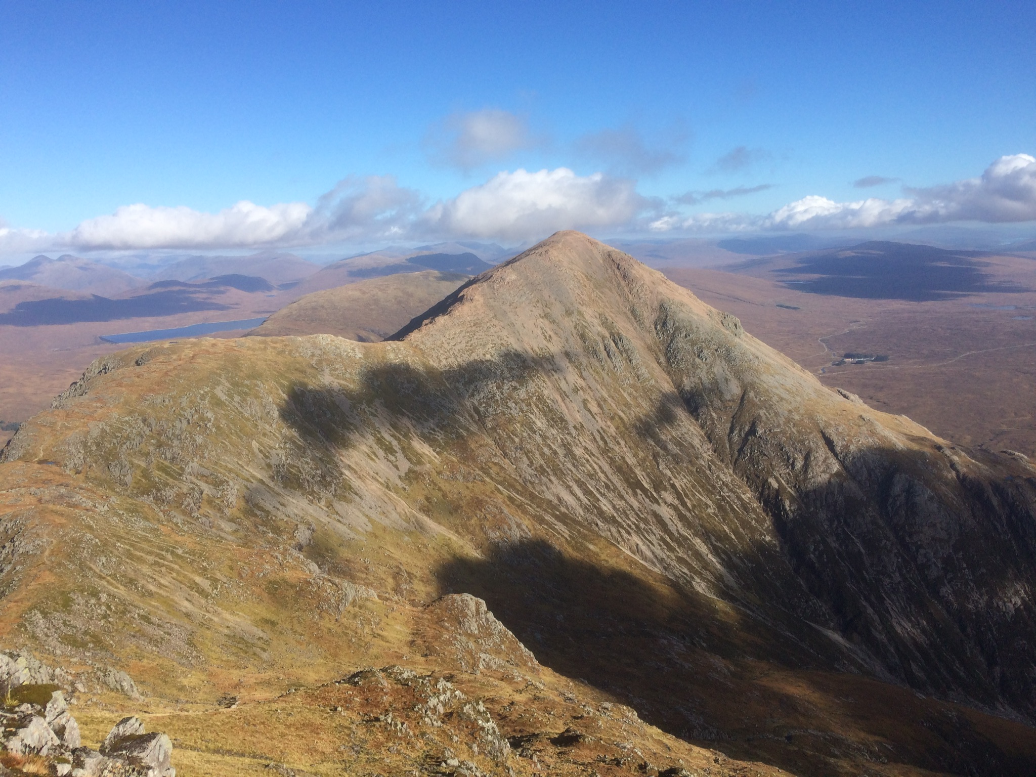
Looking back to Stob Dearg from Stob na Doire
My base for this week was the Glen Coe Youth Hostel, which is only a mile or so away from the Clachaig Inn which serves hearty meals and real ale. The next morning a guy from the Hostel very kindly drove me back to where I finished the route yesterday – the Lairig Eilde carpark on the A82 road that runs through Glen Coe. The plan today was to complete the Bidean nam Bian section, finishing off at Loch Achtriochtan, leaving a two-mile or so walk back to the Hostel. I set off up the Lairig on a good path in a blustery wind, after an hour so it started to rain, hard enough to get the rain jacket on but not too bad for now. High up the valley you reach a large cairn, this is where you leave the path and head south-west to a col, here you turn right and climb your way up to Stob Coire Sgreamhach, the wind was now increasing with bursts of stinging rain every so often but visibility was still good. On reaching Bidein nam Bian this all changed, the mist came down and it started raining heavily. I made the traverse out to Stob Coire nan Lochan ok and quickly had something to eat, now I had to retrace my steps back to Bidean but somehow In the mist and rain I ended up taking the way down to Gearr Aonach, it was a good 10 or 15 minutes later and several hundred feet of descent lower that i had to finally admit to myself that I didn’t recognise any of this terrain! Cursing, I had to retrace my steps in the foul weather back to the summit of Stob Coire nan Lochan and this time I used the compass to locate the right direction in the whiteout back to Bidean. Cold and soaking wet I scurried along the ridge, dropping down to Stob Coire nan Beith, then down again to a cairn marking the top of the An-t-Sron path which leads down to Loch Achtriochtan. I found this rocky man-made path very tricky in the soaking wet conditions, the rocks were treacherously slippy and there are a couple of places where the path seems to disappear altogether, it was a relief to finally end up on level ground. Unfortunately for me the wet weather killed my phone and I was unable to take any more picture from this point onwards.
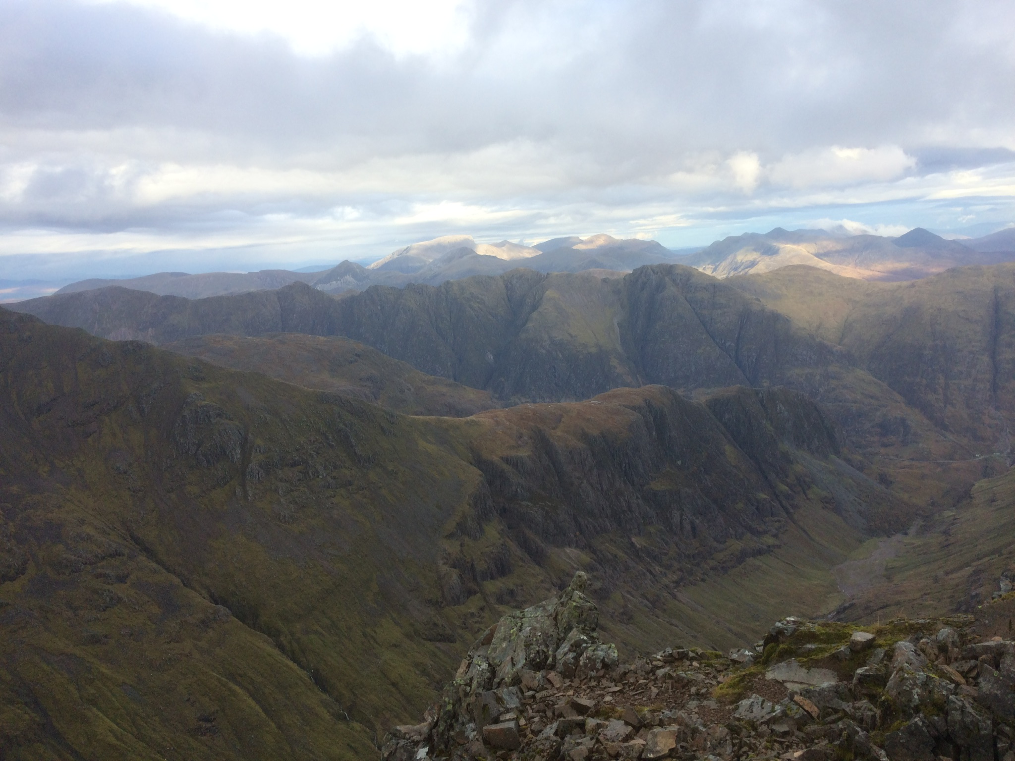
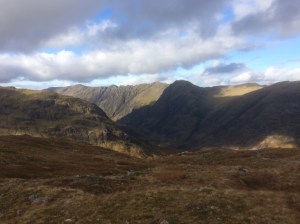
The long ridge of Gearr Aonach with the Lost Valley to its right. In the distance is the jagged ridge of the Aonach Eagach and behind that, in the sunlight, is Ben Nevis
Day three dawned and after another fine meal at the Clachaig last night and several pints of the wonderful Cairngorm Black Gold stout, I was ready to go again. I walked from the Hostel back along the road to Loch Achtriochtan and just before this side road joins the main A82 there is a faint trail that heads north, straight up hill, along side a gully with a stream in it, this takes you all the way up to the summit cairn of Sgorr nam Fiannaidh. After a quick check of the compass (lesson learned from yesterday!) I set off to Stob Coire Leith and the start of the infamous Aonach Eagach ridge, a sustained grade two scramble. The weather had been dry So far but now I could now feel drops of rain in the wind and then for a while there was hail mixed in as well. In the conditions and with the rock feeling cold and wet I found the ridge quite a challenge and I took it very steadily. After an hour or so the weather and visibility improved and with the major difficulties of the ridge behind me I could relax and enjoy what turned out to be a very pleasant mountain walk with great views all around. The route goes from Am Bodach to Sron Garb to point 903 to Sron a Choire Odhair-Bhig, then taking the north-west spur that leads down to join the West Highland Way. Here I turned right (south) and followed the Way up to the summit of the Devil’s Staircase and then descended down to the car park on the A82 road at Altnafeadh. Here my plan was to hitch a lift back to the Hostel. It has been a while since I last tried hitching a lift on a busy road and I did feel a bit of a pillock standing there with my thumb out being ignored by passing motorists, luck however was with me, after only 5 minutes a young French couple who were just leaving the car park kindly stopped and gave me a lift back to Glen Coe village – merci beaucoup!
Day 4 … I drove round to Kinlochleven to complete the last couple of miles of the recce from the official start of the race, which is at the Ice Factor Building, this involved a steep hike up the West Highland Way to where I joined it yesterday. Visibility was good with great views out over the Mamores mountains and it was Na Gruagaichean in particular which was the focus of my attention and where I would be going this afternoon…..the day before the Skyline race there is a lung-bursting Vertical Kilometer race from Kinlochleven to the top of this mountain where the race ends. To round off my stay in Glen Coe I checked out this route too and I take my hat off to anybody who runs up that!
-

- Glen Coe Skyline route
-

- Salisbury Crags, Edinburgh
-
- Salisbury Crags with Edinburgh Castle in the distance
-
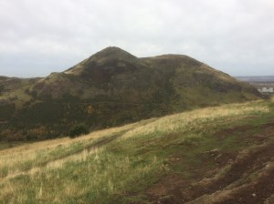
- Looking back to Arthur`s Seat from Salisbury Crags, Edinburgh
-

- Lagangarbh Cottage in front of Buachaille Etive Mor
-

- The “Waterslide Slab” – a useful landmark in locating the start of Curved Ridge
-
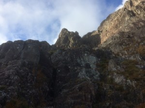
- Easy scrambling leads to the base of Rannoch Wall and the steep crux pitch of Curved Ridge
-
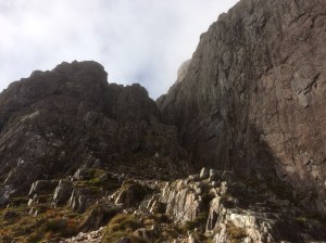
- curved ridge makes its way up the buttress on the left, on the right is Rannoch Wall
-

- Rannoch Wall with two climbers doing Agags Groove
-
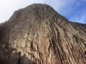
- Climbers on Agags Groove (Rannoch Wall)
-

- The view from Curved ridge looking back over the A82 road to Beinn a Chrulaiste
-

- The next big obstacle is this narrow gully , i went under the top chockstone.
-
- Looking down the narrow gully from the top with the A82 road in the distance
-

- Crowberry Tower and Rannoch Moor
-
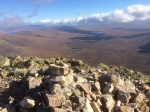
- Looking over to Rannock moor to the Kingshouse Hotel and the A82 road
-
- Stob na Broige, Buachaille Etive Mor`s other Munro
-

- Looking back to Stob Dearg from Stob na Doire
-

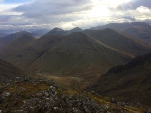
- The route crosses the col between the two Munros on Buachaille Etive Beag
-
- The serrated Aonach Eagach ridge on the other side of the valley
-

- Stob na Broige, Buachaille Etive Mor`s other Munro
-
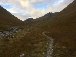
- Heading up the Lairig Eilde to the low col in the distance
-
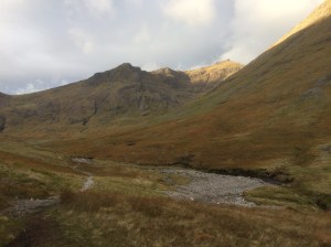
- Stob Coire Sgreamhach and Bidein nam Bian from the Lairig Eilde
-

- Looking back down the Lairig Eilde from the col
-

- The Lairig Eilde and Buachaille Etive Beag tops from the climb up to Stob Coire Sgreamhach
-
- The long ridge of Gearr Aonach with the Lost Valley to its right. In the distance is the jagged ridge of the Aonach Eagach and behind that, in the sunlight, is Ben Nevis
-
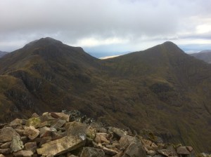
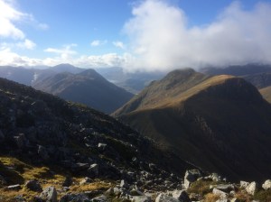
- From Stob Coire Sgreamhach the route heads for Bidian nam Bian (the peak on the left) and then does an “out and back” to Stob Coire nan Lochan (the peak on the right) before continuing on to Stob Coire nan Beith
-
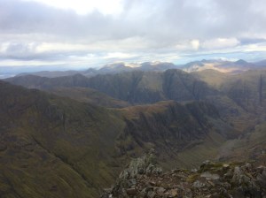
- The view from Stob Coire Sgreamhach towards Buachaille Etive Beag and behind that Buachaille Etive Mor.
-
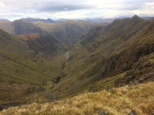
- The Lost Valley (Coire Gabhail) with the ridges of Gearr Aonach on its left and Beinn Fhada on the right
