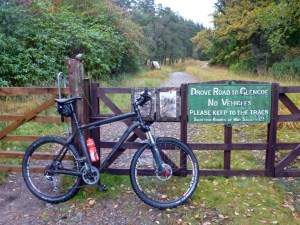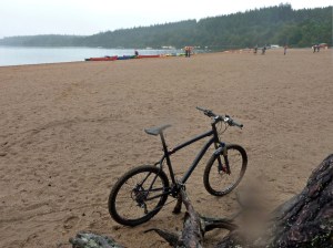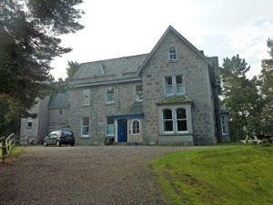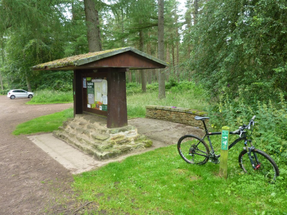
Early February 2017 I had a week off work and decided to head north to the Cairngorms once again. Last year sometime I requested to enter the group ride for the Cairngorm Loop which is a mountain bike challenge ride that takes in most of the Cairngorms in two loops (see map here) there is no entry fee or prize money and you have to be totally self supported. It’s a tough challenge, 186 miles in 56 hours, most of it off road. The group ride takes place at the very end of April……February is usually not the best month to go mountain biking around the Cairngorms but this year has been relatively mild so far and not a lot of snow. The plan was to take my mountain bike and riding gear and also take my hill walking kit too so if riding was impossible then at least I had something else to do. I based myself for the week at Cairngorm Lodge Youth Hostel next to Loch Morlich, about 7 miles east of Aviemore, which is an excellent, comfortable base to explore the area from.

Lochan Uaine
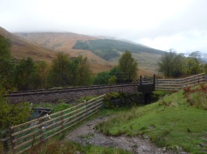
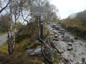
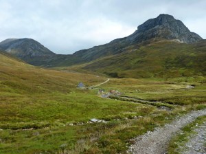
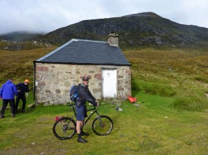
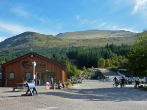
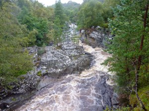
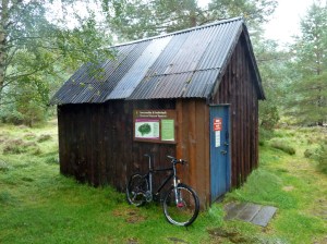
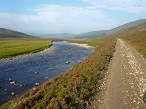
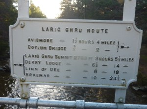
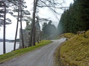
Monday The first day was cold about 3 or 4 degrees but the weather forecast was predicting very strong gusty winds late on in the afternoon (80mph!). My original plan was to try and do the inner loop on the Cairngorm Loop with a bothy stop halfway at Derry Lodge but this wasn’t really possible with the forecast. So instead I headed off on some of the excellent trails around Loch Morlich and Rothiemurchus Forest, crossing the Cairngorm Club footbridge and onto the path that goes around the picturesque Loch an Eilein, a rocky side trail from here goes up to the lovely little Drakes Bothy before continuing on through the forest to Feshiebridge. Here I turned right along the B970 road and headed north-east to Inverdruie. After a short detour along the “The Old Logging Way” into Aviemore for some lunch I returned to Inverdruie and turned left over the bridge to pick up the B970 road between Coylumbridge and Nethy Bridge, after 5 km or so turned right on a wide track and headed east to Forest Lodge in the Abernethy Forest, which is a RSPB national nature reserve centre, from here I turned south up the trail for the steady climb up to the Ryvoan Pass and down to the Bothy. By now it was late afternoon and the weather forecast was proving to be accurate, as soon as I left the forest I was buffeted by strong gusts and had to get off a couple of times and it was a relief to dive into the bothy to get out of the wind for 5 minutes before continuing downhill past Lochan Uaine and Glenmore Lodge back to the hostel.

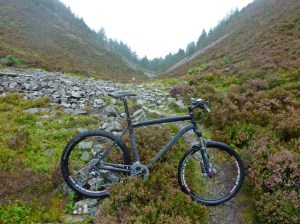
Old Logging Way near Glenmore Lodge
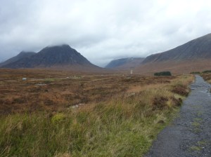
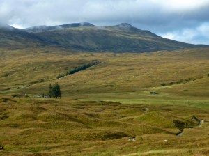
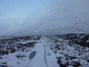
Tuesday The next morning the strong winds had gone but when I opened the curtains and looked outside i was amazed to see everything covered in 3 or four inches of snow, quite a transformation and it looked beautiful. No mountain biking today then, instead it was on with the big boots and hill walking kit. I headed off towards Ryvoan Pass again past Lochan Uaine then followed the trail that crosses over the River Nethy and goes around the back of Bynack More. As I gained height the snow became deeper and the path was difficult to follow and subsequently the going became hard work, eventually I made it down to the Fords of Avon, a strategic mountain crossroads with a small emergency refuge no bigger than a garden shed. Here I turned west and made slow progress in the drifts to Loch Avon which was partially frozen over then headed steeply uphill to a feature called The Saddle, then even steeper ground up through a weakness in the cliffs to the flanks of Cairngorm Mountain itself. After a bit of navigational faffing around I eventually located the Mountain Funicular Railway and ski runs of the Cairngorm resort and slowly waded my way down through the snow drifts and onto the never-ending road that leads back to Loch Morlich, arriving back at the hostel at 7.20pm, it had been a tough day out.

Loch Einich
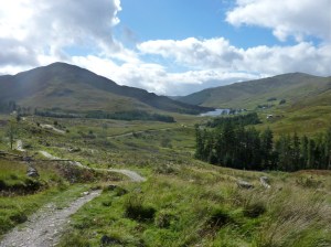
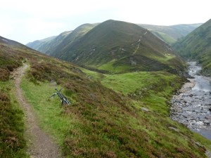
Wednesday Back on the bike again and headed over to Feshiebridge via the same route as Monday to check out another little section of the Cairngorm Loop route. This section started on the west side of the River Feshie and headed south to Ballintean along trails, road and forest tracks to the hamlet of Drumguish, i then picked up the B970 road back to Feshiebridge. With this little job done I retraced my tracks back into the Rothiemurchus Forest, past Loch an Eilein to a cross roads about a km before the Cairngorm Club Footbridge, the route heading north went down to Coylumbridge but I headed south on the track that led to the remote and magnificently located Loch Einich. After a couple of Kms the trail became quite snowy but not icy and the tyres were gripping well, the trail split after a while and for some reason I took the high route and ended up doing quite a bit of climbing for nothing because it soon descended back to the lower trail, which gradually made its way up to the Loch, the terrain is quite easy but there are a couple of stream crossings to keep you on your toes and the snow was becoming deeper and harder to pedal through, especially with a bit of a headwind too, but it was all worth the effort in the end to see the Loch surrounded by imposing snowbound cliffs. The ride back down was a blast, downhill with the wind behind and a great bit of single track along the river which I missed on the way up. It was dark by the time I hit the forest again but a full moon provided enough light to high-tail it back to the youth hostel and it was a great way to end to a memorable ride.
Thursday Similar ride to Monday, around Loch Morlich and through the forest to the Cairngorm Club Footbridge then at the crossroads I turned right on the very pleasant trail that heads down to Coylumbridge. I turned left here on to the Aviemore road then took the next left on a very quiet road that leads to Loch an Eilein and I done a circuit of the Loch once voted as Scotlands favourite picnic spot no less! then picked up the road to Inverdruie where I crossed over the river Druie on a shortcut to the B970 that leads to Nethy Bridge, I followed this road for a few miles before turning off right to cycle past Loch Garten which is famous for it’s Ospreys (which had long since migrated to sunnier climes for the winter), then onto Nethy Bridge. Here I took the road on the south side of the River Nethy that heads south back into the Caledonian Pines of the Abernethy Forest and headed for Forest Lodge and south again to the Ryvoan Bothy and back to the hostel.

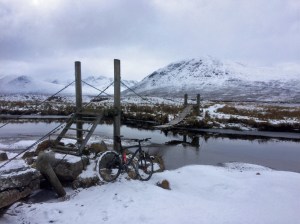
Swing bridge next to the ford at Loch Pattack
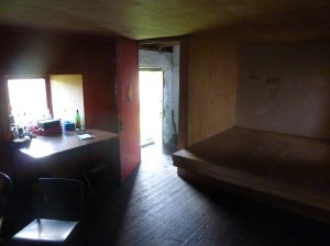
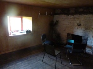
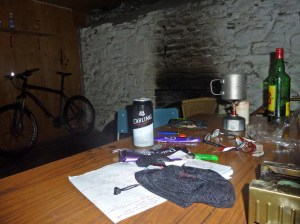
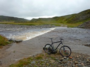
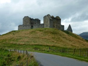
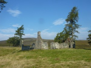
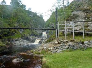
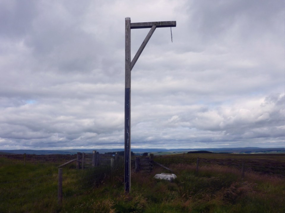
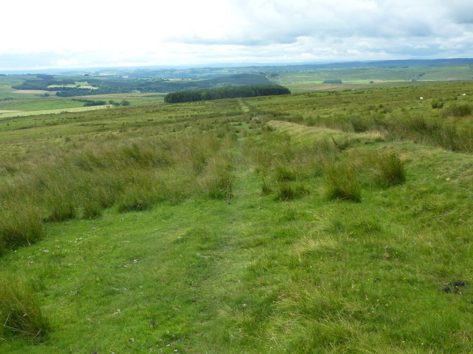
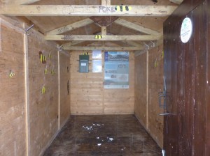
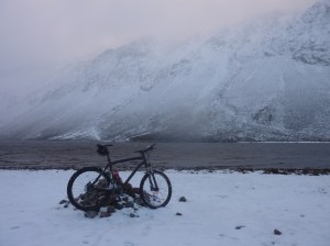
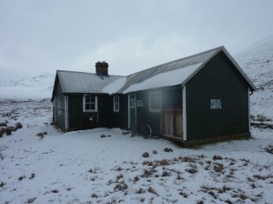
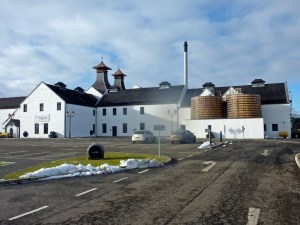
Friday I drove down the A9 to Dalwhinnie and parked up at the railway station, a good track runs along the side of Loch Ericht to Ben Alder Lodge where the trail leaves Loch Erich and heads to Loch Pattack. The snow was a couple of inches deep here but again it didn’t feel icy and the tyres were gripping well so it felt ok apart from being harder work than normal. I turned off left when I reached the Loch and crossed the the river on a rickety wooden swing bridge next to the ford, then kept left at the next junction on the trail to Culra Bothy and Lodge. This bothy is situated in a fantastic remote location amidst grand mountain scenery which looked even more impressive covered in snow. I was surprised to see that the bothy is officially closed due to asbestos being found in its construction and the outer walls of the bothy are spray painted with warnings, however all 3 of the rooms I checked out were open and the main room with the stove in it looked very usable. I had a quick look at Culra Lodge, a short distance away but everything was battened up. Back at the bothy I retraced my route over the swing bridge, here I briefly considered heading left just before the Loch on the track to Lochan Na Earba and onto Ardverikie and back via the River Pattack but decided to leave it for another day! Instead I headed back to the car the way I came. Before putting the bike away I had a ride to the Whisky Distillery at Dalwhinnie had a look around the visitor centre and tasted a wee dram of their 15 year old single malt which i had never tried before but will certainly get a bottle of it in the future.
-
- Cairngorm Club Footbridge inscription
-
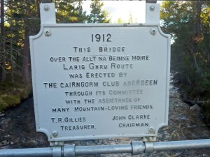
- Cairngorm Club Footbridge inscription
-
- Lochan Uaine
-

- Lochan Uaine
-

- Old Logging Way near Glenmore Lodge
-

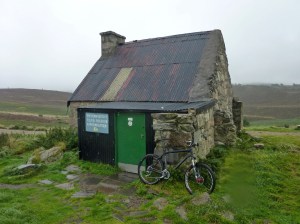
- Fords of Avon Refuge
-
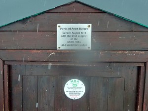
- Fords of Avon Refuge
-
- Fords of Avon Refuge
-

- Track to Loch Einich
-
- Track to Loch Einich
-
- Loch Einich
-
- Ben Alder Lodge
-

- Ben Alder Lodge
-

- Approaching Loch Pattack
-
- Swing bridge next to the ford at Loch Pattack
-

- Bridge near Culra Bothy
-

- Culra Bothy
-
- Culra Bothy
-

- Culra Bothy main room
-
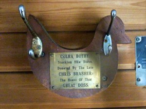
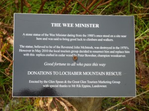
- Culra Bothy plaque
-
- Dalwhinnie Distillery