About six months ago I had a bad accident on a mountain bike which resulted in a clean break of my left patella. The treatment for this in my case was a full-leg cast for six weeks then a hinged knee brace with crutches for another 5 weeks, followed by lots of physio and home exercises to help rebuild the wasted muscles and weakened tendons, now I finally felt ready to venture back into the hills and with a week off work I drove over to the Lake District in Cumbria to do some hill walking to try to get fit again. I was booked into Keswick Youth Hostel for a couple of nights to start with, it’s near to the town centre and right next to the River Greta. I had been here several times but not since 2015 when Storm Desmond hit and the entire ground floor was flooded by several feet of water, this forced extensive renovations and a redesign of the whole ground floor area.

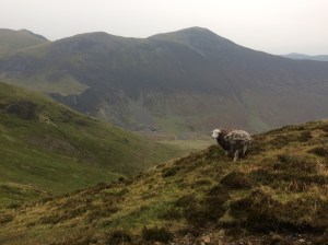
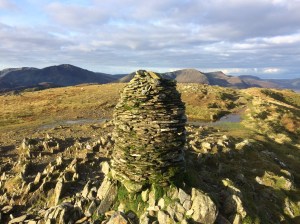
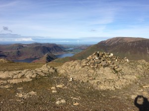
Catbells summit, looking towards Skiddaw
Sunday 15th Oct. I set off walking from Keswick to do Catbells, which has to be a contender for the most climbed hill in the whole of the Lake District and its popularity is well justified as it is a very scenic hike and a good physical challenge too as it is quite steep in places. You can take the Derwent Water Lauch across the Lake to Hawse End or Low Brandlehow, then start walking from there, which is a really good option if you have got kids with you as it cuts the mileage down and adds an extra bit of excitement to the trip. Today though I walked from Keswick over the River Derwent swing bridge to Portinscale then turned left here and picked up the very nice trail through the woods from Nicol End Marina to the start of the climbing. Today the weather was a bit grey and overcast however the views were still good and there was lots of other people including families and groups with small kids working their way up the steep slopes. It got very windy on top so I quickly continued on to a path which descended towards Derwentwater and i turned left before hitting the road and continued back to Keswick the way I came. The knee seemed to be coping well so I started thinking about something more challenging tomorrow.

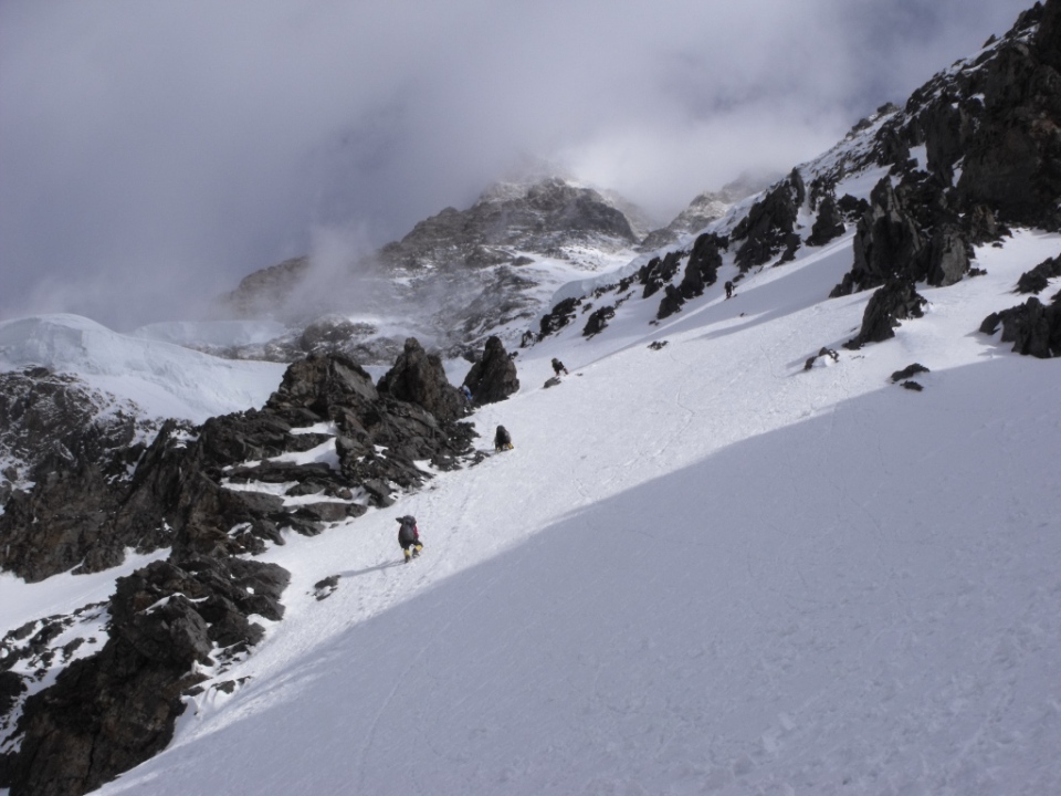
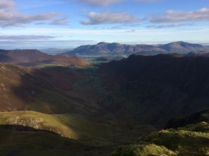
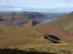
Grisedale Pike with Force Crag Mine in the valley on the way to Causey Pike
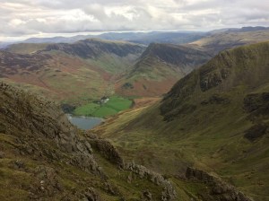
Monday 16th Oct. The Coledale Round. I drove over to Braithwaite which is about 3 miles west of Keswick and parked up in the first car park on the Whinlatter pass road and set off walking up the steep steps through the wood to the open slopes of Grisedale Pike. The weather was very grey and gloomy to start and there was light rain early on but it was only on the tops that i was exposed to the very strong winds, it would only be later on today after 6.00pm and throughout the night that Cumbria would feel the full force of the remains of Hurricane Ophelia. The skies certainly had a menacing look about them and one peculiar effect was that I could smell burnt wood and ashes several times throughout the day which puzzled me, especially on the tops, it was only on the night-time I read somewhere that the high winds heading our way had probably picked up some of the debris from the huge forest fires that had recently happened in Portugal. My route today went over Grisedale Pike and on to Hopegill Head before turning South over Coledale Hause and following the stream up to a path crossroads where I turned East up to the fine viewpoint of Eel Crag. The next peak was Sail where you get some great airy views to your right as you scramble down the ridge, then over Sail Pass to Scar Crags and finally Causey Pike where a steep rocky scramble takes you down to easier paths and the Buttermere to Braithwaite Road, here I turned left to walk along the road for a while before another footpath on the left takes you into Braithwaite.

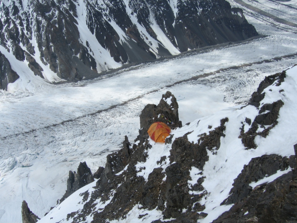
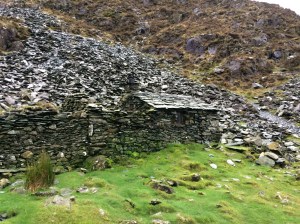
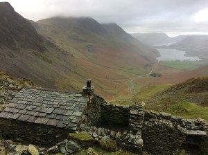
Warnscale Bothy
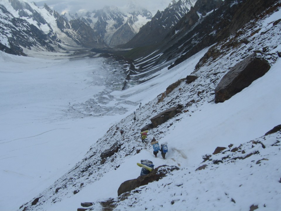
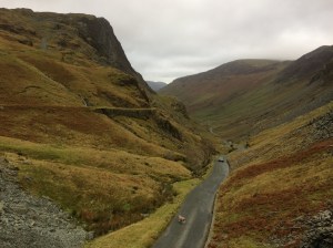
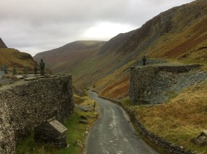
Tuesday 17th Oct. I drove over to Honister Pass and parked up outside the Youth Hostel where I would be staying the night. The hostel is located right next to the working Slate Mine at the top of the pass. I set off walking westwards uphill on the Old Tramway path that takes you over to Haystacks, Just before you cross the stream there is a very nice Bothy (Dubs Hut) which was getting some repair work done on the roof. There is another bothy in this area too and I spent quite a bit of time trying to find it but gave up in the end and continued with my walk to Haystacks where on the summit I was exposed to strong winds again which made for difficult progress over the rocky top and it was a relief to get onto the easy rocky scramble down to Scarth Gap. Here I turned left down to Ennerdale and headed for the Black Sail Youth Hostel where I called in for a coffee and a chat, the high winds last night had resulted in some damage to the hostel, a satellite dish had been blown away, a chimney pot lost and some minor roof damage. Almost as soon as I set off again it started to rain quite heavily, i thought I was heading NW on the Coast to Coast route but instead I was heading straight up a minor path to the source of the River Liza, I decided to just continue up here anyway and eventually after a long climb up alongside the stream I hit the Moses Trod path which heads North to the Old Tramway path. I was still curious about that bothy I couldn’t find this morning, so I decided to have one final go at finding it, so I headed left once I hit the Old Tramway path and descended past Dubs Quarry again and down another path, here I caught a glimpse of the bothy, I won’t say exactly where it is, but from where I was it involved a lot of descent and reascent to get to it but it was definitely worth the effort and i hope to come back and spend the night in it one day. Then it was back along the Old Tramway path again and the descent down to Honister Pass where I had a very pleasant night at the Youth Hostel.

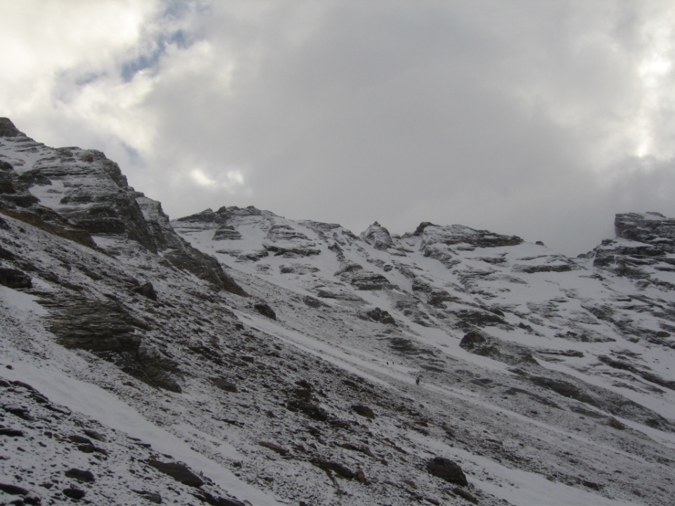
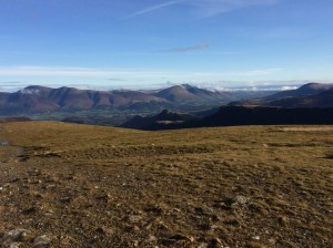
View from Hindscarth Edge looking down to the Honister Pass road
Wednesday 18th Oct. At last the wind had died away and it was blue skies and sunshine most of the day and i was treated to seeing the autumn colours of Lake District at its very best. My route today started from the hostel door where i crossed the road and headed straight up the slopes of Dale Head, then Hindscarth, Robinson and High Snockrigg before dropping down to Buttermere for some lunch. Then it was the brutal climb up the stone steps to Red Pike, the only respite being a brief flat section where Bleaberry Tarn is. After scrambling up the loose red gully to the summit of Red Pike the going gets a lot easier and on a clear day like today the views are superb. Next up was High Stile, you have to be careful with navigation here if you are heading for High Crag next as it’s very easy to just follow the cairns and end up descending into Birkness Comb which is not an easy way out, instead I checked the map and headed right along the ridge leading to High Crag and the long descent to Scarth Gap where i turned right and dropped into Ennerdale heading for Black Sail Youth Hostel, where I spent the night, arriving shortly after 5.00pm.

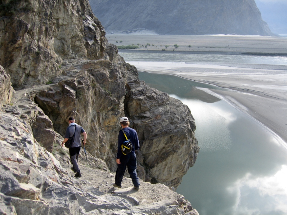
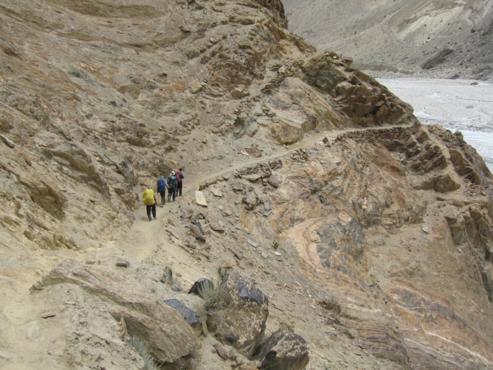
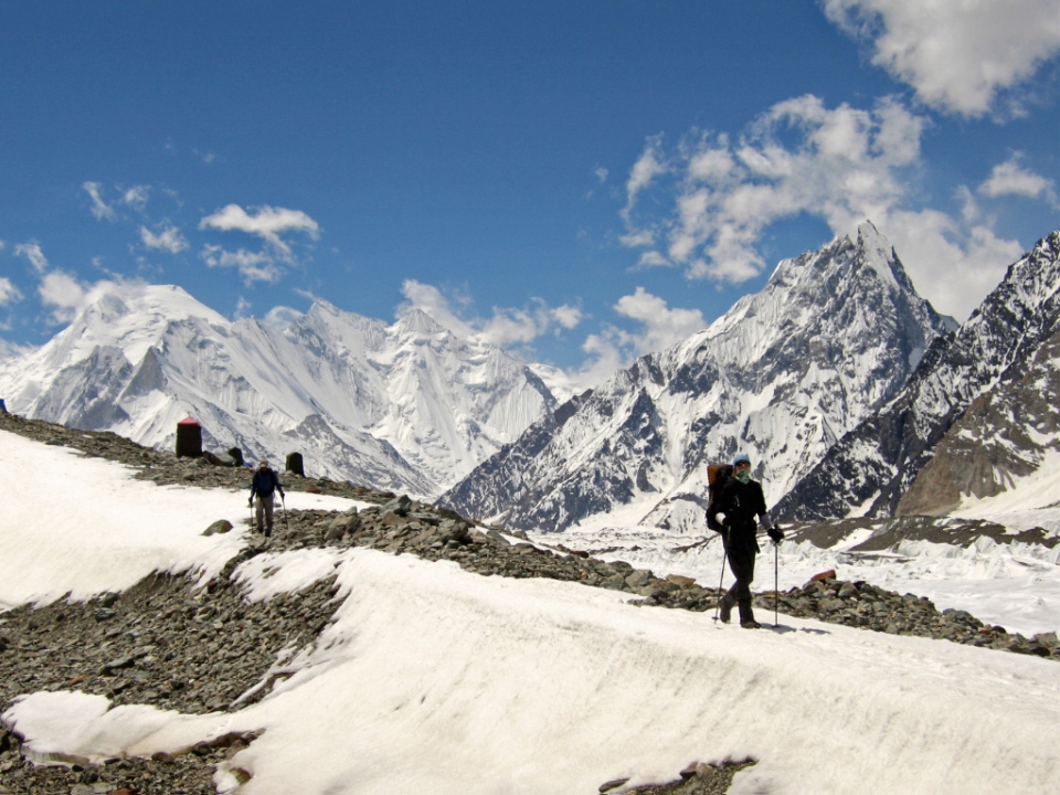
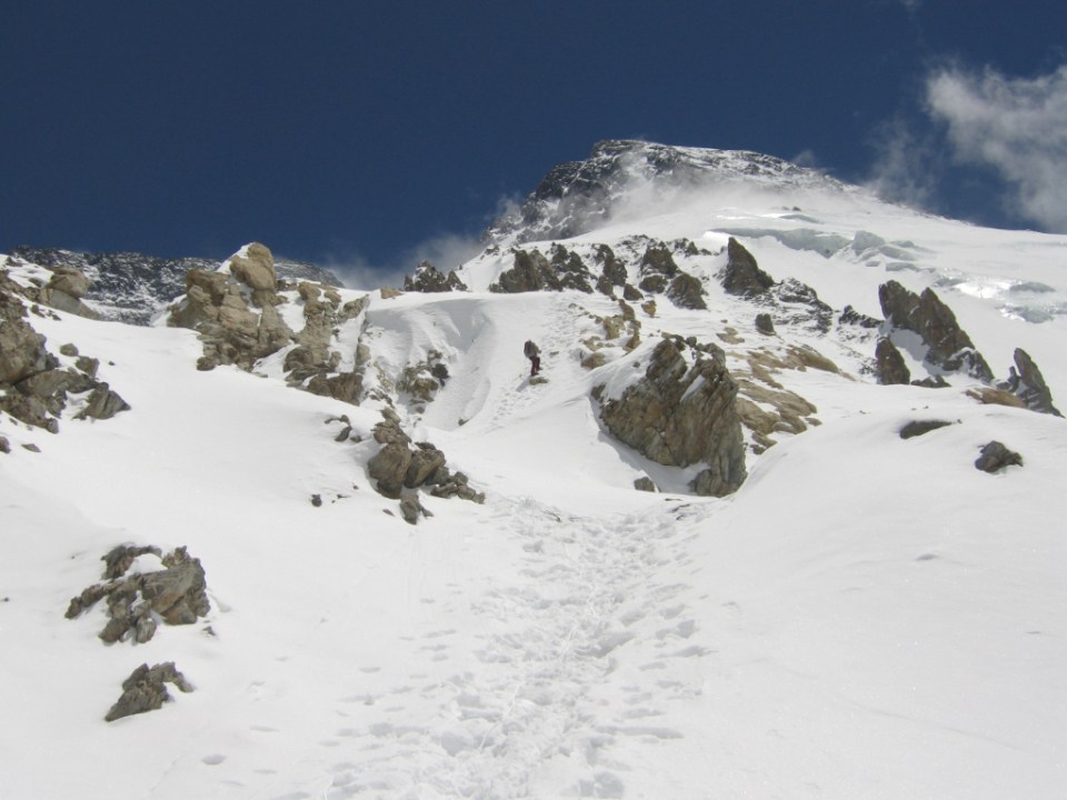
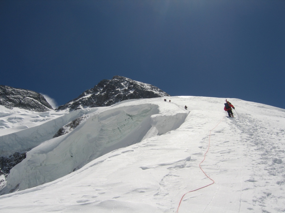
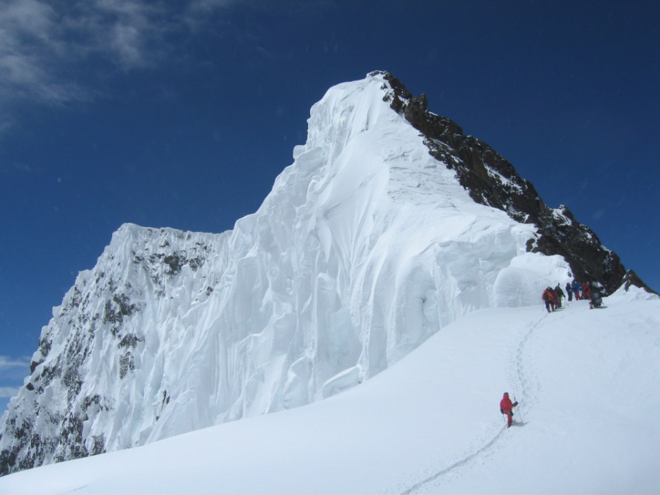
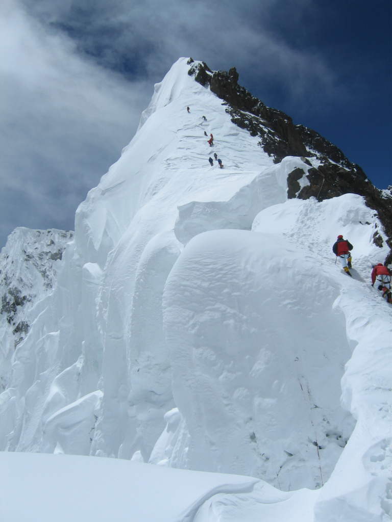
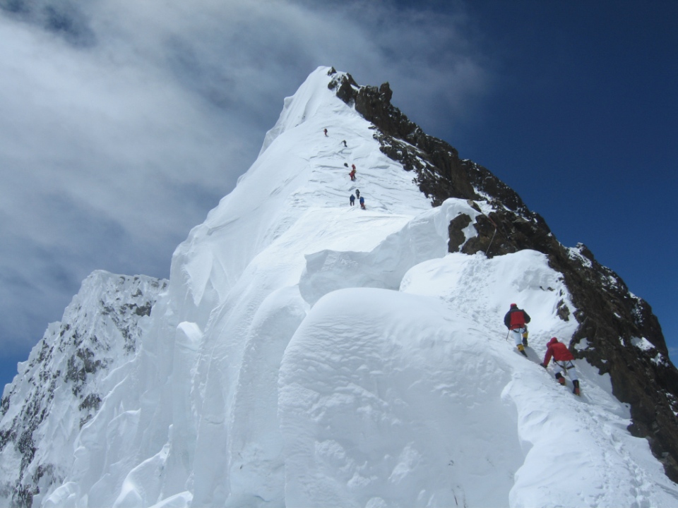
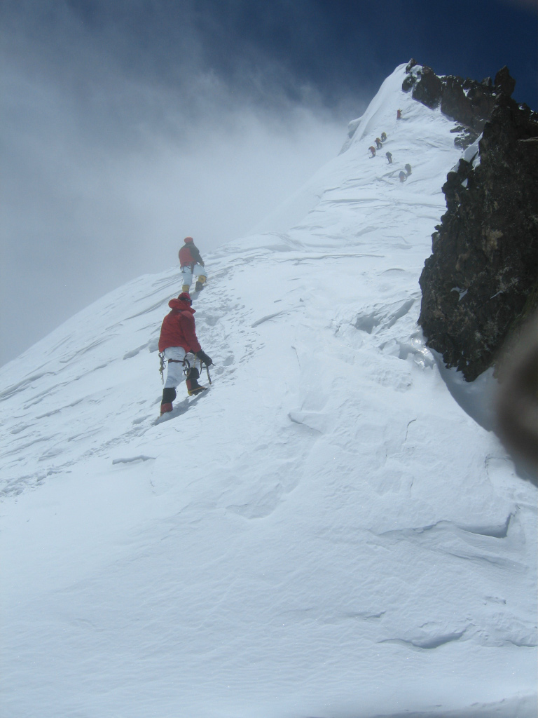
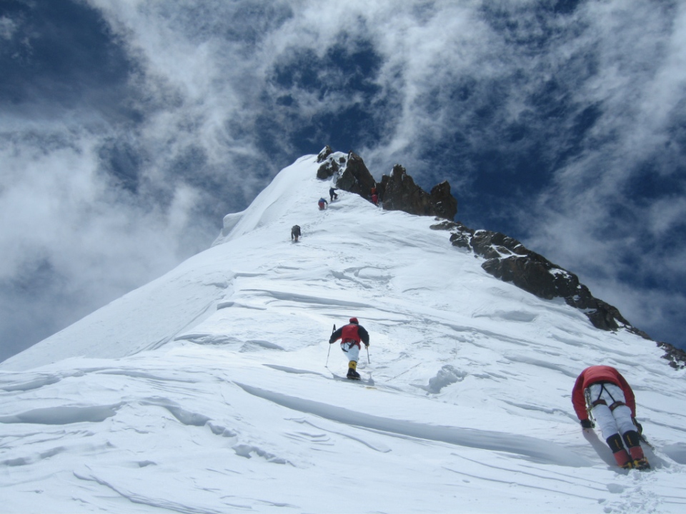
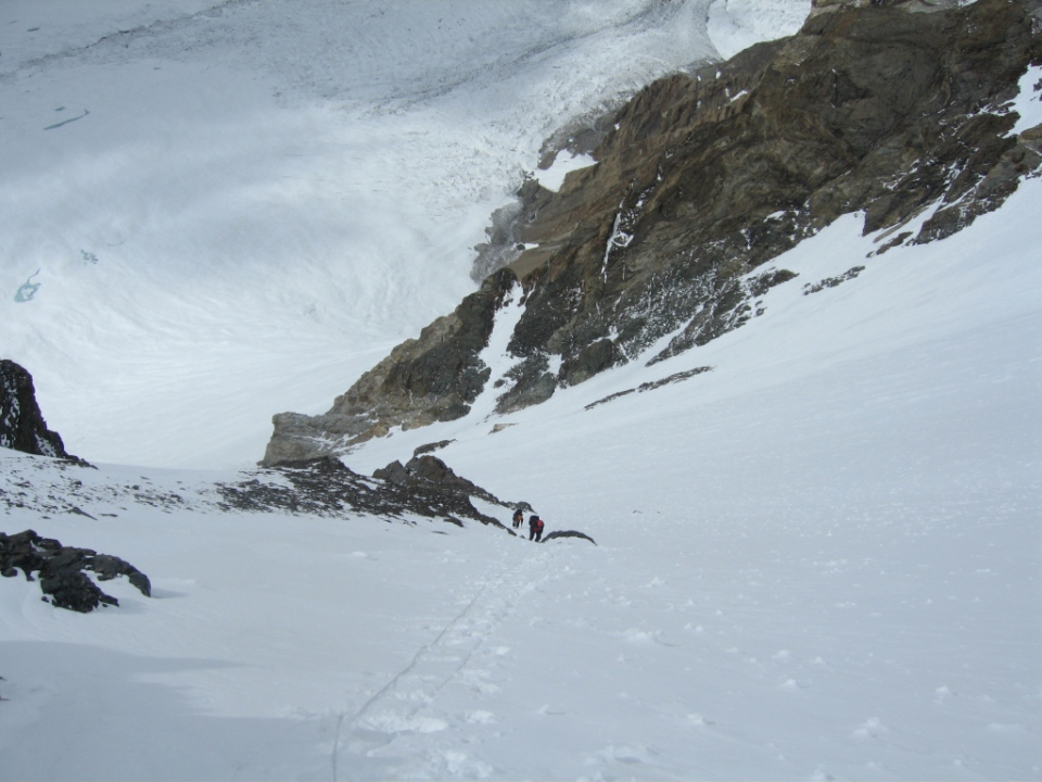
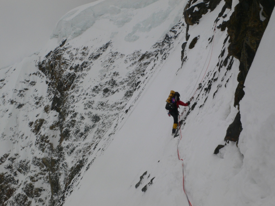
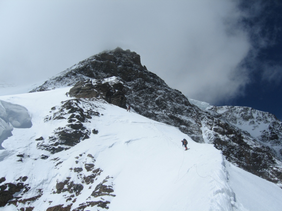
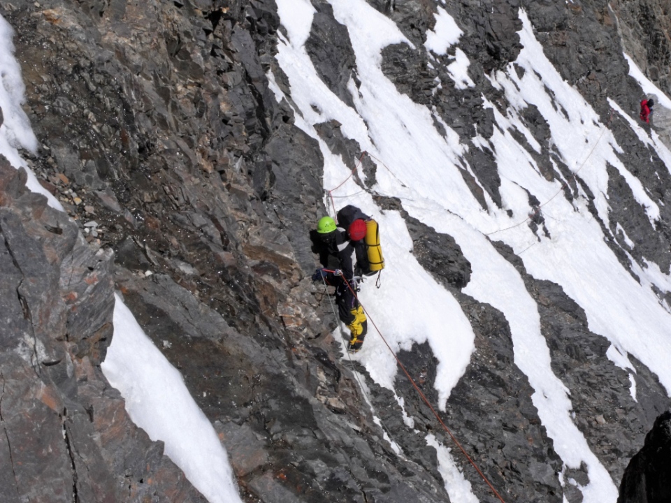
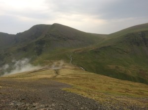
After Lords Rake there is another easier gully to negotiate
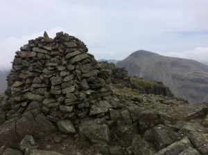
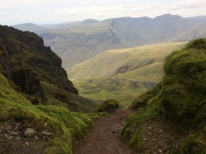
Thursday 19th Oct. After a good breakfast at the hostel I was on my way again at 9.00am, I headed off on the Coast to Coast path in the direction of Honister, this time i found it no problem, then picked up a good track that heads to Brandreth, Green Gable and the rocky climb up to the summit of Great Gable. From here I descended directly to the stretcher box at Styhead Pass and then picked up the Corridor route to Scafell Pike, this route passes Skew Gill and the impressive Piers Gill, shortly after passing this second Gill the route to Scafell turns left at a junction, however first I wanted to make a short detour up to Lingmell first to check out the view then i retraced my steps and climbed up to Scafell Pike. From the Pike I headed down to Mickledore, where there is another stretcher box. I continued right up to the cliff face and turned right and descended the loose gravelly West Wall Traverse down to the foot of Lords Rake and then scrambled up this. At the top you drop down a little and then climb a second easier gully to emerge on the flanks of Scafell where I turned left and climbed up to the summit cairn. From Scafell I descended into Wasdale, a very long descent. The way I went was via a gully just after Rakehead Crag which I think fell runners use when doing the Bob Graham round, then headed for Brackenclose and the National Trust campsite, once on the road I turned right and headed for the pub at Wasdale Head where I had a very nice meal. A second pint of Hobgoblin would have been brilliant but it was now well after 5.00 pm and I still had to make it back to the car at Honister Pass, so out I trudged into the now steady rain and headed off on the long climb up to Black Sail Pass, just after the Pass crests I turned right along another trail that traverses below Kirk Fell and Great Gable and joins up with the Moses trod path which would take me back to the Old Tramway and onto Honister. By now though it was pitch black and still raining steadily and with the beam of my head torch bouncing off the swirling mist it was quite an eerie and difficult walk across the moor. Finally with much relief the Old Tramway loomed into view, I turned right and dropped down to Honister. One final scare lay in wait however, it was such a fowl night that two pigeons had decided to roost on the path and they waited until I was almost on top of them before flapping and noisily flying away nearly giving me a heart attack. I finally reached the car at 8.10pm it had a been a very long walk but a very enjoyable one, my plan was to get in the car and drive home but because of the hour I thought I would ask at the Hostel to see if they had any room left for the night… they had one space…! the 2 chess players who had been at Black Sail the previous night were there also and along with a student geologist and an ex-paratrooper we had an interesting night.
-
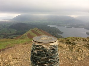
- Catbells summit, looking towards Skiddaw
-
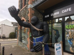
- Kong Adventure, Keswick
-

- Kong Adventure climbing wall in Keswick, there is also an indoor ice climbing room here and a caving section for kids
-
- Hobcarton Crag on the way to Hopegill Head
-
- Coledale Hause
-

- Eel Crag looking towards Causey Pike
-
- Grisedale Pike with Force Crag Mine in the valley on the way to Causey Pike
-

- Honister Youth Hostel
-

- Honister Pass
-
- Honister Pass
-
- Honister Pass
-

- Mine workings on Fleetwith Pike at Honister
-

- Dubs Bothy near Honister currently getting some repairs done, Haystacks is on the left.
-

- Dubs Bothy near Honister
-
- Spot the Bothy….
-
- Warnscale Bothy
-

- Warnscale Bothy
-
- Dale Head summit cairn, looking East
-
- View from Dale Head looking towards Skiddaw
-
- View from Hindscarth towards Skiddaw, Blencathra and Keswick
-

- View from Hindscarth Edge looking down to the Honister Pass road
-
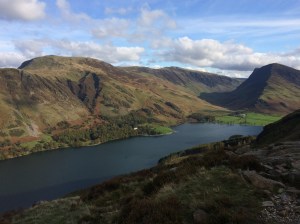
- View from Robinson towards Crummock Water
-
- View from Robinson towards Rannerdale Knots and Mellbreak
-

- View from Robinson towards Buttermere and Crummock Water
-

- View from Robinson towards Buttermere and Crummock Water
-

- Looking along the fine ridge of Rannerdale Knotts from the flanks of Robinson
-
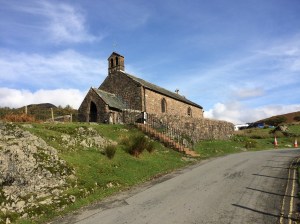
- St James` Church, Buttermere
-
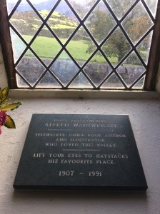
- Wainwright memorial in St James` Church, Buttermere
-

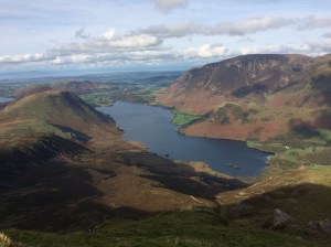
- Buttermere with Fleetwith Pike in the distance
-
- Looking over to Robinson on the left and Fleetwith Pike on the right from the climb up to Red Pike
-
- Looking down on Crummock Water with Mellbreak on the left and Grasmoor on the right on the climb up to Red Pike
-
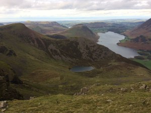
- Red Pike on the left and Bleaberry Tarn from the High Stile ridge
-
- The Honister Pass road in the distance from High Crag area
-

- Fleetwith Pike and Haystacks on the descent down to Scarth Gap
-
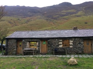
- Black Sail Youth Hostel
-
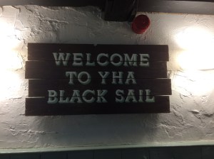
- Black Sail Youth Hostel
-
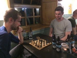
- High tension at Black Sail Youth Hostel
-

- Black Sail Youth Hostel
-
- Black Sail Youth Hostel
-

- Memorial on the summit of Great Gable
-
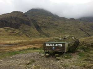
- Styhead Pass
-
- Looking over to Great Gable from Lingmell summit
-

- Piers Gill from the Corridor route up to Scafell Pike
-

- Piers Gill from the Lingmell side
-

- Mickledore and Scafell
-
- The rocky gully at Mickledore that leads down to Hollow Stones
-

- Lords Rake on Scafell with two people nearing the top
-

- Looking down Lords Rake with what looks like the remains of the hanging pinnacle visible
-
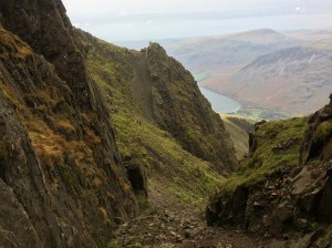
- After Lords Rake there is another easier gully to negotiate