 I have been travelling up to Scotland in February for many years now, it’s one of my favourite times to visit one of my favourite places. The harsh weather transforms the place and the hostels, bothies and pubs and cafes are usually very quiet. I’ve never been to Knoydart before and I started thinking about the place just after Christmas and the more I read about it the more I wanted to visit. Starting at Glenfinnan Railway station really appealed to me as it meant I could leave the car at home and use the train, then at the end of the trip I could catch the ferry from Inverie to Mallaig and get the train back home from there. It also gave me the chance to travel on the famous Fort William to Mallaig railway line and to visit the Glenfinnan Memorial and railway viaduct. Unfortunately I was booked to travel on Sunday 9th Feb, the day storm Ciara hit the UK and all the trains were cancelled, so I had to travel the next day instead, the good news was i will get a full refund on my ticket, as well as free travel. On the journey up North on Monday I stayed overnight at Fort William and the next morning after stocking up with goodies at the supermarket and cramming them into an already very heavy rucksack I caught the early morning train to Glenfinnan Station.After a quick look in the station museum and a chat with its curator,
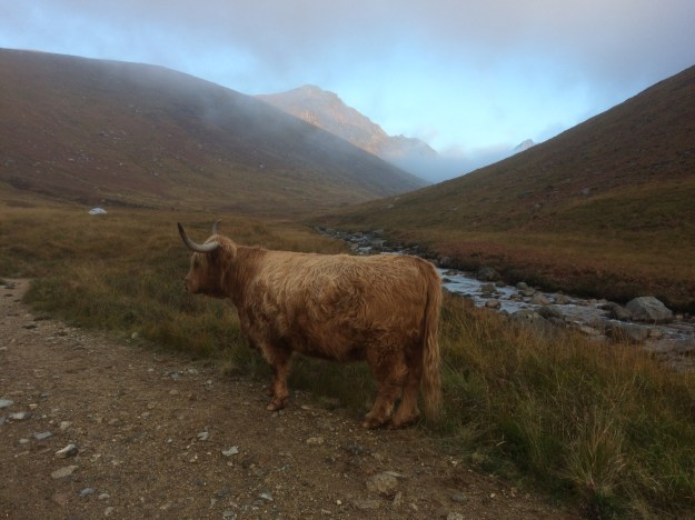
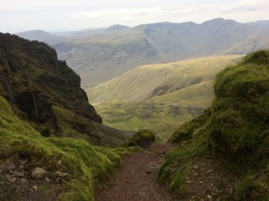
who pointed me in the direction of the short but scenic Viaduct Trail, I headed off to explore the famous monument and railway arches. After this short detour I headed North up Glen Finnan to Corryhully Bothy (the electric bothy) and had a cup of coffee before pressing on North-Eastwards, heading for the pass at 471m between Sgurr Thuilm and Streap, on the lower slopes of this wintry climb I was followed overhead for a short while by a Golden Eagle. Once over the plateau at the summit there is a steep down section which was quite tricky with a big pack and all the deep snow which had accumulated there but after this obstacle it got much easier and I squelched my way down to the River Pean, where I crossed over the bridge and turned left and headed for Glenpean Bothy. I was using an old OS map of 1984 vintage a friend had loaned me and the forest on the North side of the River Pean wasn’t shown on it at all, so I made the mistake of just trying to follow the river left straight to the bothy, it quickly turned into a nightmare of boggy ground, impenetrable forest and then tree stumps and dead wood where the forest had been cleared, eventually the bothy loomed into view just as the rain started to pour down, I quickly gathered some of the dead wood which was lying everywhere and made a dash for the shelter, arriving there at about 5.30pm.

I filled the water bottles up from the nearby stream and that was me settled in for the night. I had the place to myself, I emptied my rucksack and laid out my mat and sleeping bag, got the stove on for a much needed soup, then put a match to the fire which the previous occupants had kindly prepared and instantly felt much better! The wind that night was very strong, with Westerlies blowing straight up the valley and bringing in volleys of hailstones every now and then which rattled noisily on the tin roof but tucked up in my thick down sleeping bag, with a small bottle of whisky for company, I was toasty warm. After a great nights sleep I was up at 8.00am the next morning and with the stove purring away in the background I packed all my gear back into the rucksack, a couple of cups of coffee and some muesli had done a great job of warming me up again. Before leaving the bothy I cleaned the ashes out from the night before and prepared a small fire for the next bothy occupant, then gathered some wet wood and brought it indoors to let it dry out a bit. Back on the trail again I headed East, back along Glen Pean but this time i used the track through the forest, which takes you after crossing the River Dessary, to the collection of buildings at Strathan, here I picked up the track to Glendesssary and as I continued onto Upper Glendessarry I could see A ‘Chuil bothy over the river on the edge of a conifer plantation, I made a small detour from my route to visit it and crossed the River Dessarry via a rickety old bridge and made my way up to the bothy over some boggy ground, again it was deserted. I had another coffee and some food here and checked the map. I was heading West and had a choice of routes, I could have gone through the conifer plantation but decided instead to cross the rickety bridge again and head uphill to pick up the track from Glendessarry, this path gradually climbs up to a pass (at about 300m) and the scenery changes to rugged mountain country, with steep sided mountains, hanging valleys and remote mountain Lochans. The path keeps to the left of Lochain a’ Mhaim before dropping down to Mam na Cloich Airde, where you need to need to look out for a river crossing to avoid the steep gorge and waterfall lower down. This path climbs up the hillside before crossing a spur and you get the first views of Loch Nevis in the distance, it’s then downhill all the way to Sourlies Bothy which is nestled at the head of the loch. Again I was lucky enough to have this beautifully located bothy all to myself and arrived just after 5.00pm which was a perfect time, as the light was just starting to fade and it gave me enough time to scour the area for deadwood (managed to find some on the shore line tangled up in the piles of seaweed) and to fill the water bottles from a nearby stream. The open fire at Sourlies wasn’t as good as the one at Glenpean, it was a bit smoky and I struggled to get it really going with damp wood but it did keep me entertained for a couple of hours as the stove boiled water for numerous drinks and food. Before turning in for the night I went outside to brush my teeth and got a genuine wow moment as I saw all the stars shining in a very dark sky.
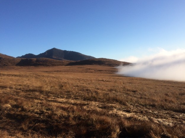
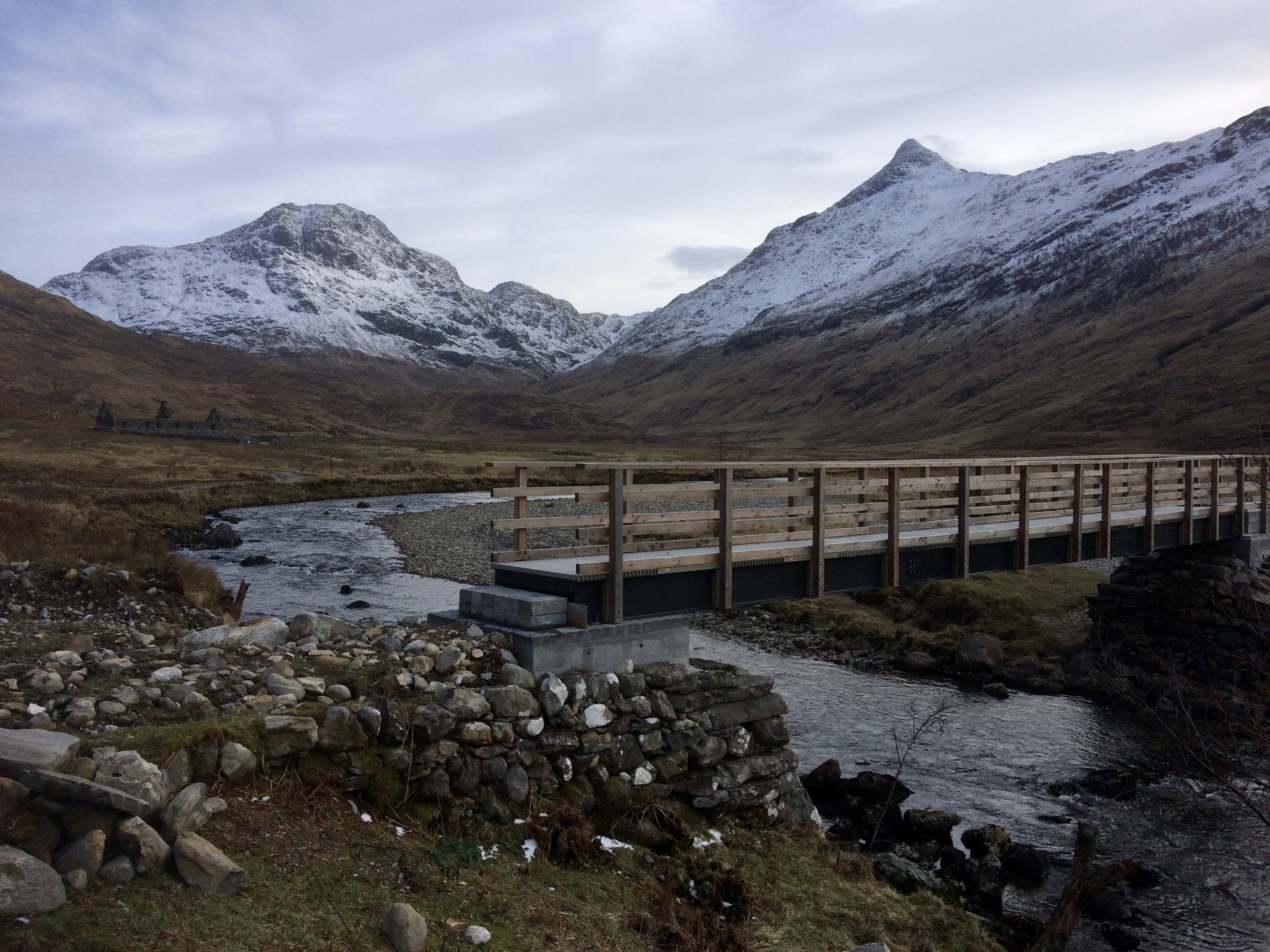 After another good nights sleep, I was packed up and on the trail again just after 9.00am, today was to have the best weather of the whole trip with blue skies and sunshine for most of the day. The tide was in, so I had to climb up the hillside a little to get round the spur that leads to the large floodplain of the River Carnoch, where I headed for the bridge and ruins, it’s very boggy here but you can weave your way through it. The new bridge over the Carnoch river is quite impressive and was officially opened on 23rd August 2019 at a total cost of £62,000. My original plan for this trip was to continue on to Barisdale and spend a night at the bothy there but yesterday to my horror I discovered that I had somehow managed to loose my brand new BMC map of Knoydart! I had the maps in a plastic map protector and the velcro at the bottom must have come undone when I was checking the way and the map must have slid out without me noticing it….. so it looked like I would be going to Inverie today instead. I did have lots of time however and it was a beautiful day so I decided to explore the way North, up the River Carnoch as far as the edge of my map and see what it looked like.
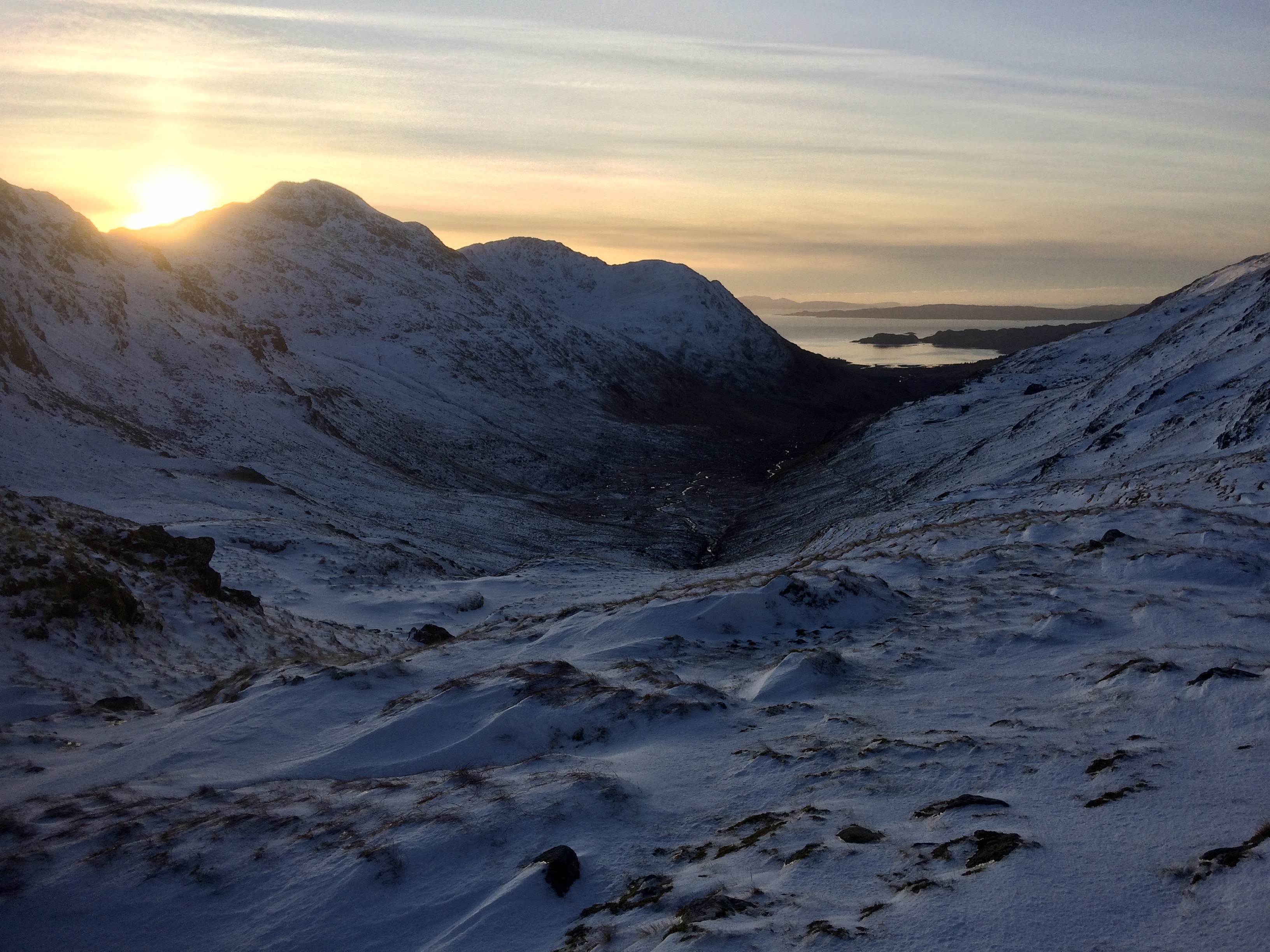 With my curiosity satisfied I trekked back to the Carnoch ruins and began the long ascent up to Mam Meadail at 550m, this took a lot longer than I anticipated as it was well above the snow line and the strong winds had deposited lots of snow on the leeward side of the pass, at times I was almost knee deep in soft snow. I reached the top of the pass as dusk was setting in and I took a few moments to admire the wintry scene before me and to take some photos before setting off again on the last 5 or 6 miles to Inverie. Once I got below the snow line things got dark very quickly and I did the last few miles with a head torch on, carelessly I managed to lose the path and added a couple of extra miles onto an already long day. Finally the lights of Inverie came into view and I followed the signs to the Knoydart Foundation Bunkhouse, the place was light up like a Christmas tree with all the lights on in the kitchen, dorms and lounge but there wasn’t a soul around, it turns out that I would have the place to myself again. After a few coffees and something to eat, followed by a red hot shower, I collapsed onto a comfy bed with my last whisky miniature – an 18 year old Glenfiddich, which I had been keeping for a special occasion and this felt like one to me.
  The next morning (Friday ) i done the 10 minute walk into Inverie to check out the famous Old Forge Pub, the remotest pub on mainland Britain apparently, only to discover that it was closed for a few weeks over the winter! I got chatting to the cafe owner nearby and she informed me that there would probably only be one ferry sailing today, at 11.00am, due to the bad weather and that there was another big storm moving in for the weekend (Storm Dennis) which would probably prevent the ferry sailing then too… so I had to hurry back to the bunkhouse and get my gear together and return to the pier to catch the 11.00am ferry off the Knoydart Peninsula, back to Mallaig. It was a bit choppy on the way back but also quite exhilarating as the ferry was a quite small, sporty looking boat and it fairly zipped along, doing 14 knots for the 6 miles crossing back to Mallaig. Once off the ferry it started raining heavily, so I went to The Steam Inn pub for a full Scottish breakfast, which turned out to be a great choice, the food and coffee were delicious and I was sat by a lovely log fire to dry my wet clothes out. I decided that I would stay in Mallaig tonight and travel back home by train early tomorrow. To fill the rest of the day, I had a wander around town and went on the short circular walk which climbs up and overlooks the harbour, I then booked myself into Mallaig Backpackers Lodge and guess what… ? I had the place to myself yet again!

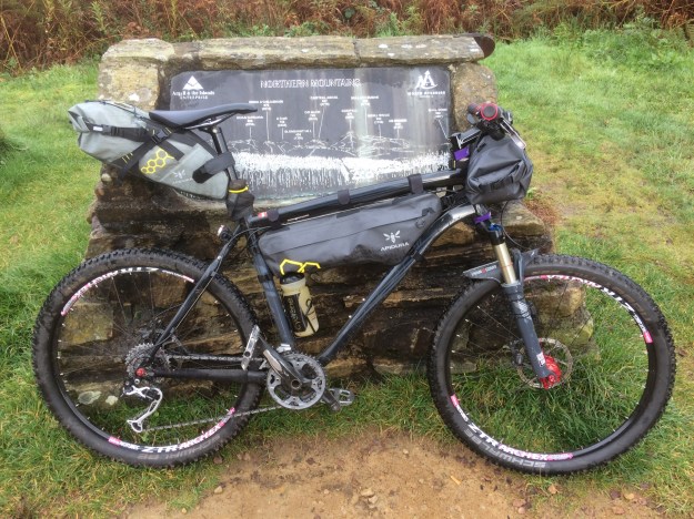
The kit I used on the trip, along with food and fuel for four days 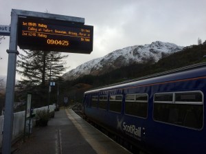
Arriving at Glenfinnan Station on the famous Fort William to Mallaig line 
Glenfinnan Station 
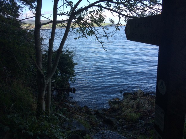
Looking over to the Glenfinnan Memorial at the head of Loch Shiel 
The famous Glenfinnan Viaduct built by Robert (concrete Bob) McAlpine and sons, completed in 1898. The line itself was officially opened in 1901. 
The Glenfinnan Memorial 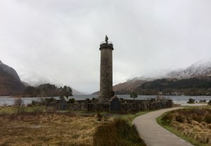
The Glenfinnan Memorial 
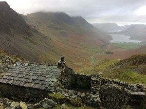
Corryhully bothy in Glen Finnan 
Corryhully bothy 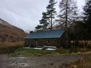
Corryhully bothy 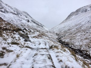
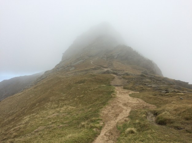
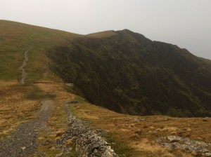
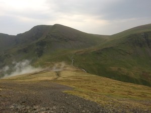
Heading up to the pass (point 431m) Between Sgurr Thuilm and Streap. 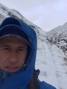
Heading up to the pass (point 431m) Between Sgurr Thuilm and Streap. 
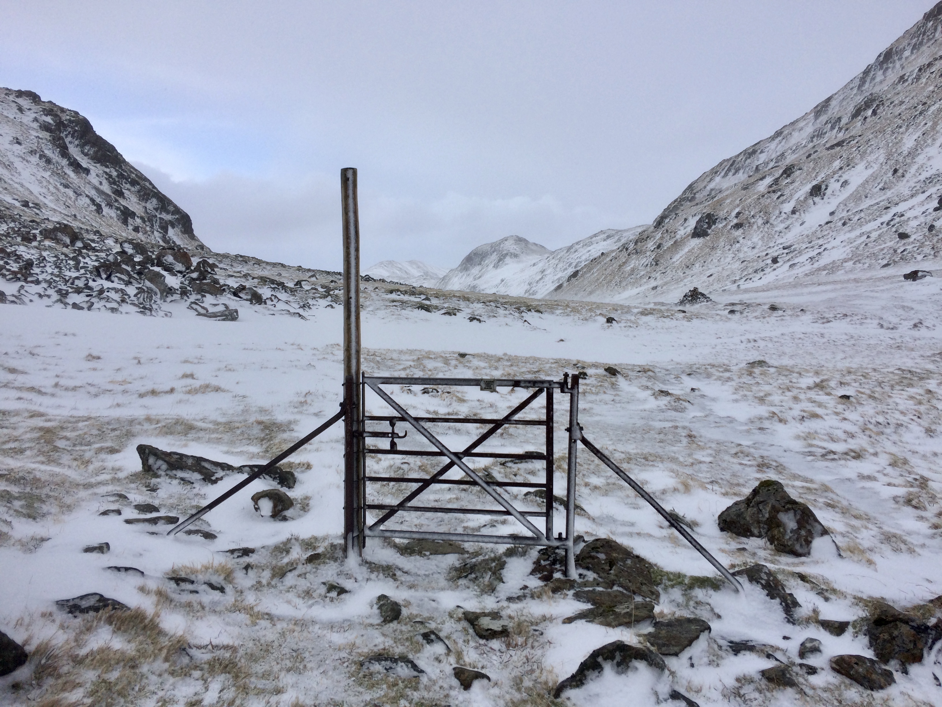
Please shut the gate….! the pass between Sgurr Thuilm and Streap. 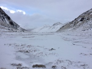
The pass between Sgurr Thuilm and Streap. 
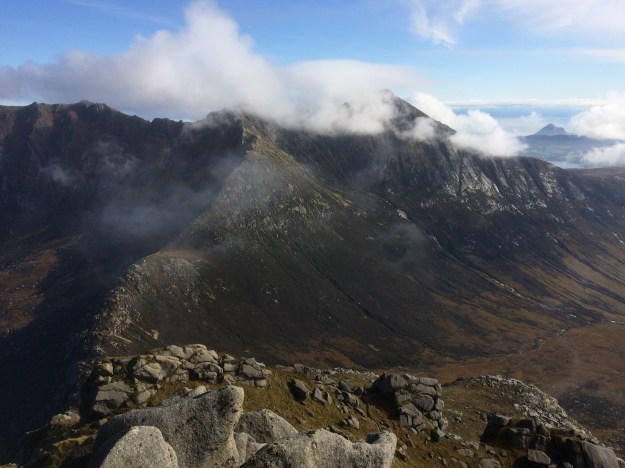
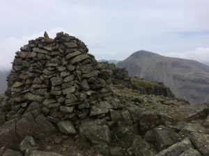
Looking back to the pass at 471m with the pointy peak of Streap on the left. 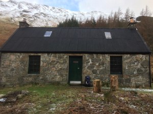
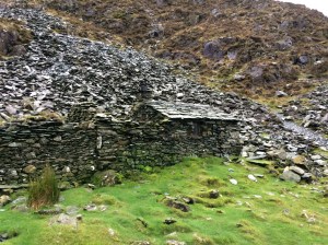
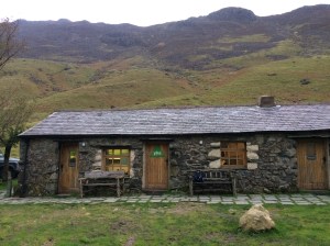
Glenpean Bothy 
Glenpean Bothy 
Glenpean Bothy 
Glenpean Bothy 
Upstairs in Glenpean Bothy 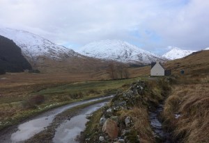
The lonely house at Upper Glen Dessary and A’ Chuil bothy just visible on the edge of the conifer plantation. 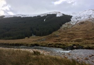
A’ Chuil bothy situated on the edge of a conifer plantation in Glen Dessary. 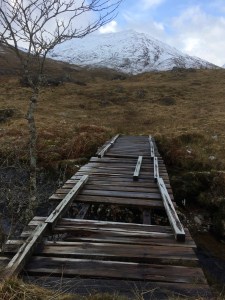
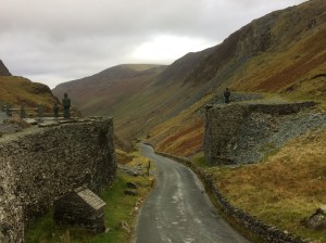
The rickety bridge over the River Dessary 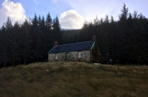
A’ Chuil bothy situated on the edge of a conifer plantation in Glen Dessary. 
The rickety bridge over the River Dessary 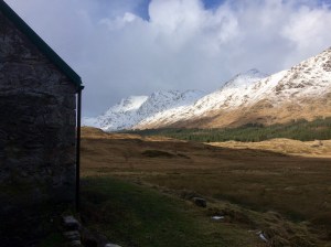
Looking North-West from A’ Chuil bothy 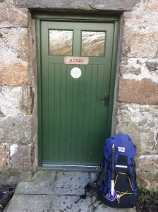
A’ Chuil bothy 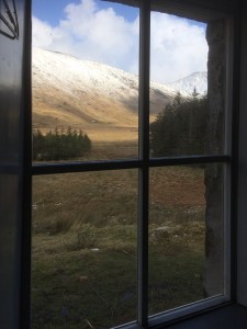
A’ Chuil bothy 
A room with a view…dinner time at A’ Chuil bothy 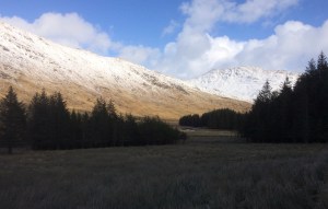
Looking North-East from A’ Chuil bothy 
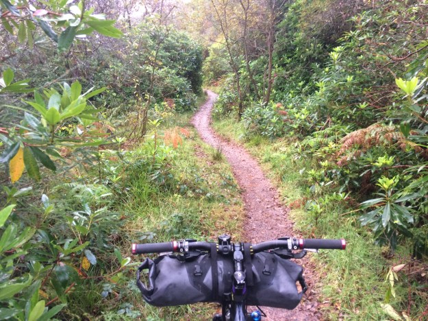
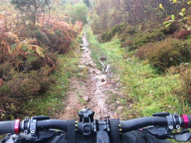
Shortly after leaving A ‘Chuil bothy i was back on the trail again, heading into Knoydart 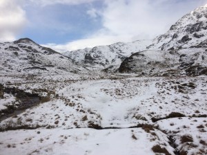
The watershed area at the head of Glen Dessary 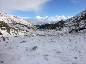
The watershed area at the head of Glen Dessary 
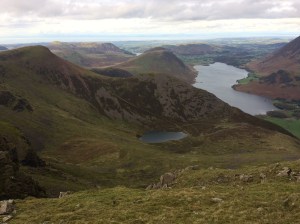
Heading West down to Lochain A’ Mhaim 
Heading West down to Lochain A’ Mhaim 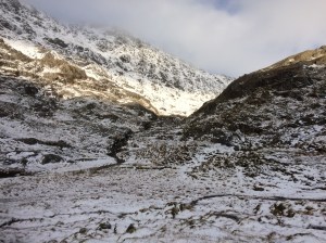
Looking back on the route from Glen Dessary 
Lochain a’ Mhaim 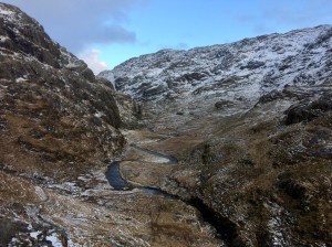
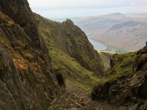
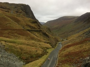
Looking back at the meandering Finiskaig River after crossing Mam na Cloich’ Airde. (Note it is important to cross the river here to avoid the gorge and waterfall). 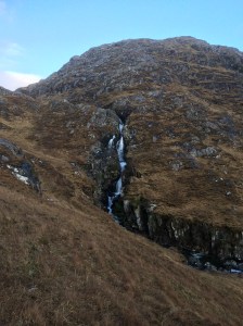
Finniskaig River waterfall 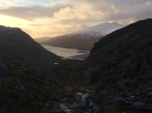
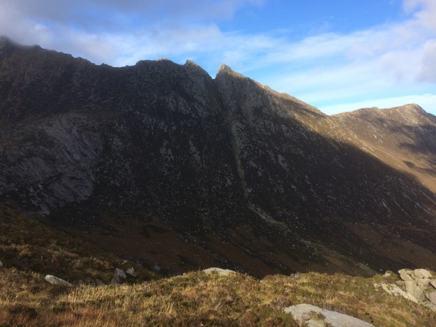
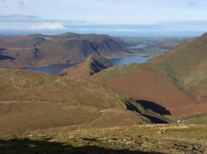
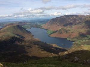
Looking West to a snow capped Beinn Bhuidhe and Loch Nevis 
Sourlies Bothy at nestled at the head of Loch Nevis 
Sourlies Bothy at dusk 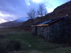
Sourlies Bothy at dusk 
Sourlies Bothy 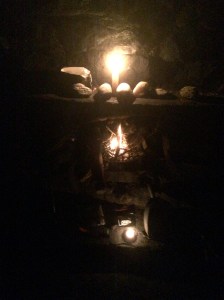
Sourlies Bothy 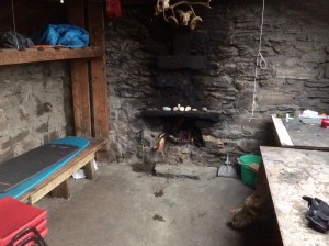
Sourlies Bothy 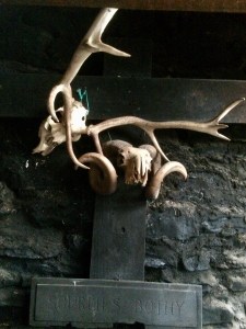
Sourlies Bothy 
Sourlies Bothy 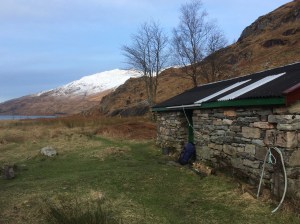
Sourlies Bothy at the head of Loch Nevis 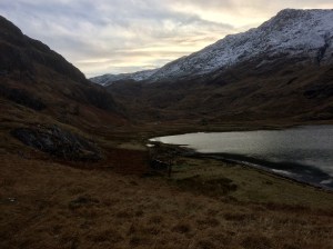
Sourlies Bothy at the head of Loch Nevis 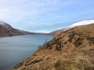
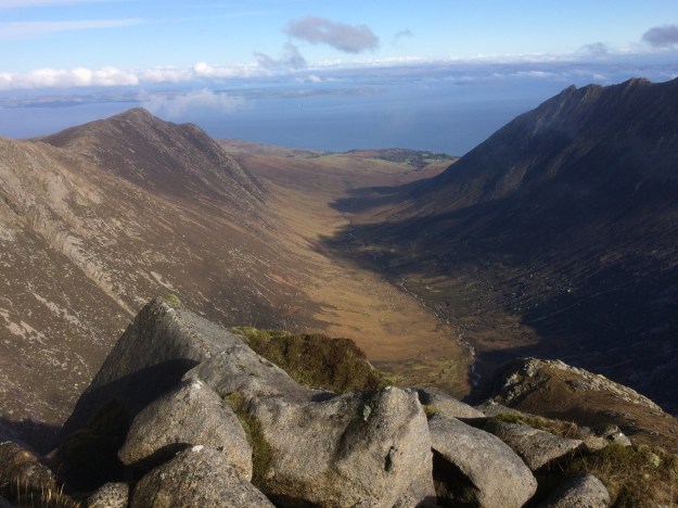
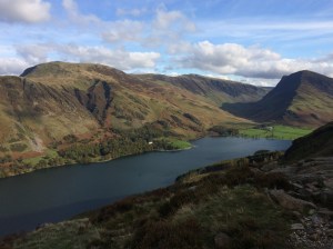
Looking West along Loch Nevis 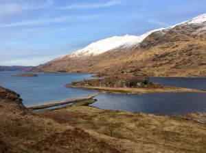
Looking over Loch Nevis to Camusrory 
Looking over the flat floodplain on the way to Carnoch 
The new and very substantial bridge over the River Carnoch 
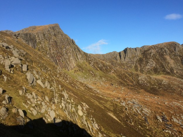
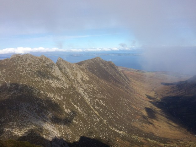
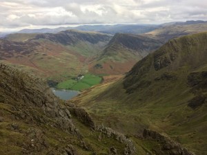
Looking over to Sgurr na Ciche from the Carnoch ruins 
In the end you stop worrying about wet feet… 
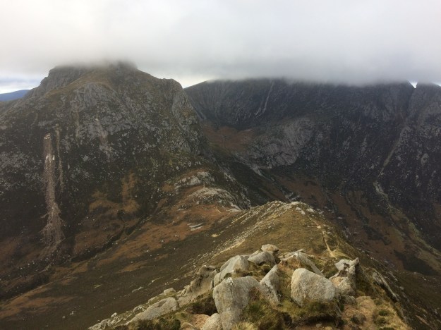
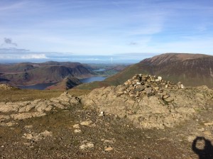
The view over to Sgurr na Ciche on the climb up to Mam Mheadail 
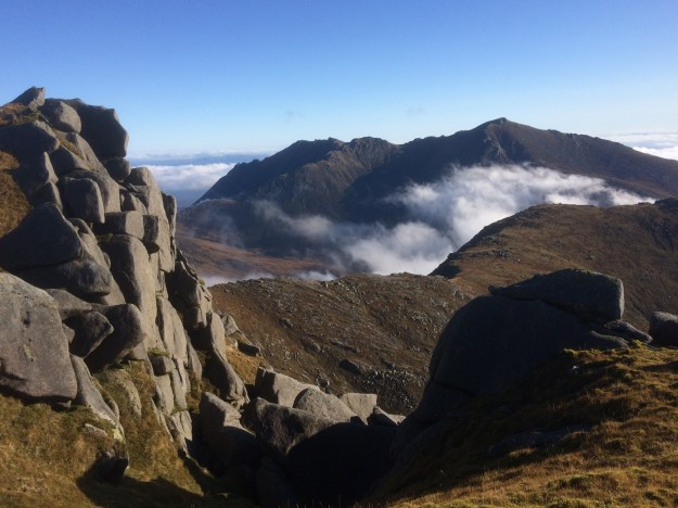
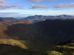
Looking South-East from Mam Mheadail back over the River Carnoch 
Approaching the summit of Mam Mheadail 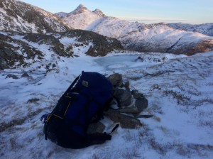
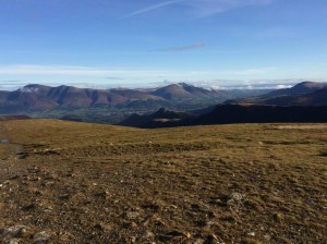
Looking over to Sgurr na Ciche from Mam Mheadail 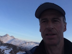
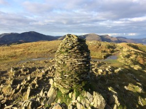
Mam Mheadail summit 
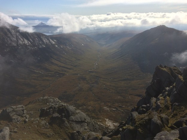
Setting off down Gleann Mheadail from the pass 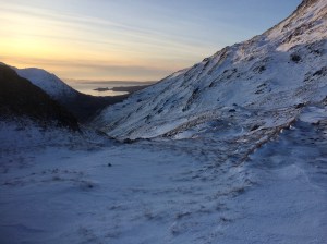
Setting off down Gleann Mheadail 
Looking East down Gleann Mheadail towards Inverie 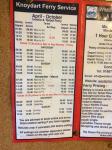
Inverie to Mallaig ferry timetable 
The Shack at Inverie, opposite The Old Forge 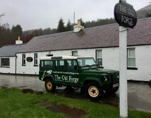
The Old Forge pub at Inverie 
All this way for a pint and ….. 
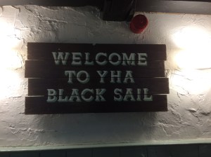
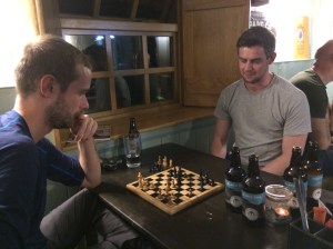
The Knoydart Foundation Bunkhouse lounge at Inverie 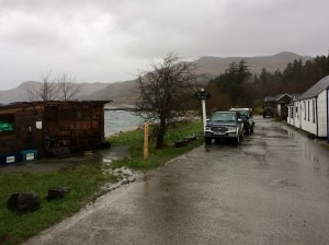
The Old Forge Pub and The Shack at Inverie 
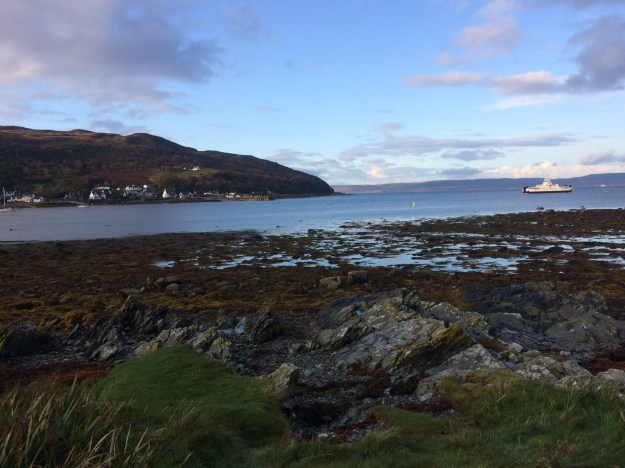
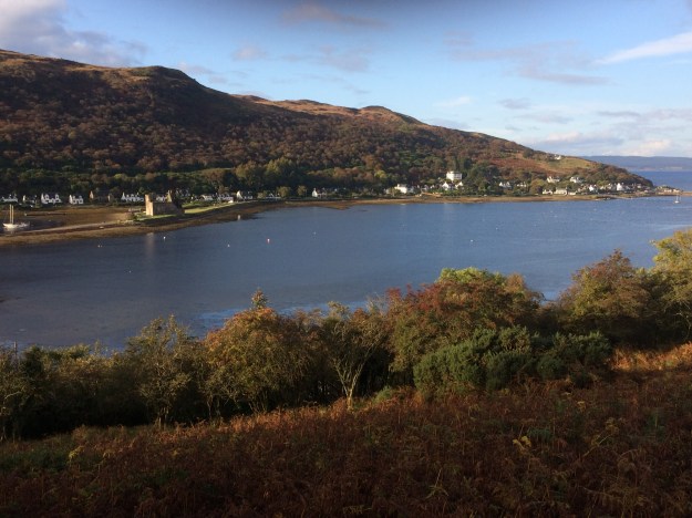
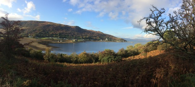
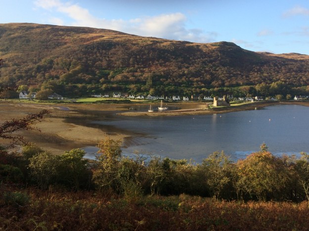
Inverie 
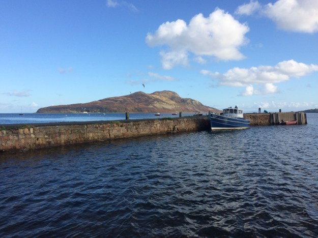
The fast ferry from Mallaig approaching Inverie pier 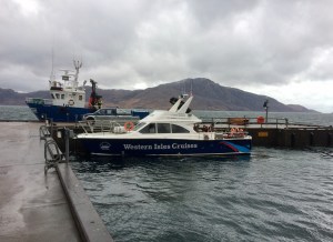
The ferry at Inverie pier 
Looking back at Inverie from the Mallaig bound ferry 
Mallaig Harbour 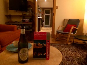
Mallaig Backpackers Lodge