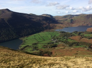
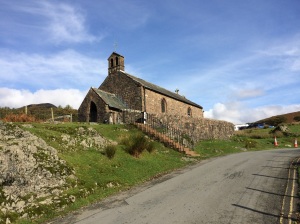
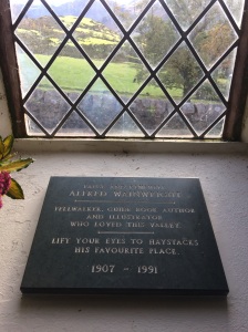
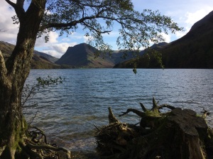
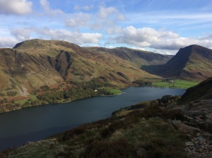
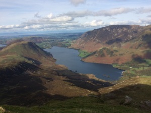
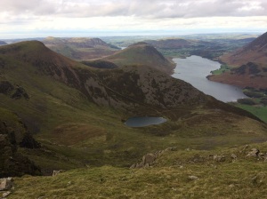
Lake District hiking holiday Oct 2017

About six months ago I had a bad accident on a mountain bike which resulted in a clean break of my left patella. The treatment for this in my case was a full-leg cast for six weeks then a hinged knee brace with crutches for another 5 weeks, followed by lots of physio and home exercises to help rebuild the wasted muscles and weakened tendons, now I finally felt ready to venture back into the hills and with a week off work I drove over to the Lake District in Cumbria to do some hill walking to try to get fit again. I was booked into Keswick Youth Hostel for a couple of nights to start with, it’s near to the town centre and right next to the River Greta. I had been here several times but not since 2015 when Storm Desmond hit and the entire ground floor was flooded by several feet of water, this forced extensive renovations and a redesign of the whole ground floor area.

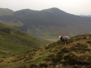
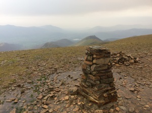
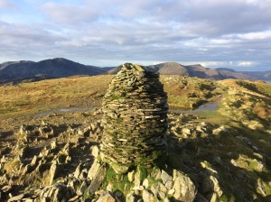
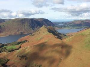
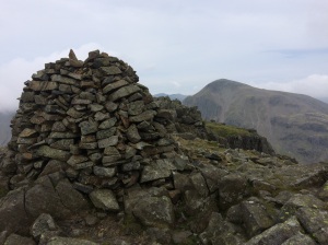
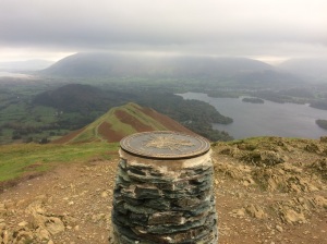
Catbells summit, looking towards Skiddaw

Catbells summit, looking towards Skiddaw

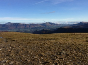
Sunday 15th Oct.  I set off walking from Keswick to do Catbells, which has to be a contender for the most climbed hill in the whole of the Lake District and its popularity is well justified as it is a very scenic hike and a good physical challenge too as it is quite steep in places. You can take the Derwent Water Lauch across the Lake to Hawse End or Low Brandlehow, then start walking from there, which is a really good option if you have got kids with you as it cuts the mileage down and adds an extra bit of excitement to the trip. Today though I walked from Keswick over the River Derwent swing bridge to Portinscale then turned left here and picked up the very nice trail through the woods from Nicol End Marina to the start of the climbing. Today the weather was a bit grey and overcast however the views were still good and there was lots of other people including families and groups with small kids working their way up the steep slopes. It got very windy on top so I quickly continued on to a path which descended towards Derwentwater and i turned left before hitting the road and continued back to Keswick the way I came. The knee seemed to be coping well so I started thinking about something more challenging tomorrow.

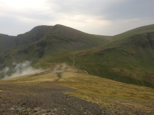
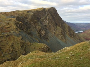
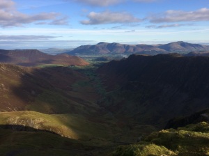
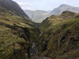
Grisedale Pike with Force Crag Mine in the valley on the way to Causey Pike

Grisedale Pike with Force Crag Mine in the valley on the way to Causey Pike

Monday 16th Oct.  The Coledale Round. I drove over to Braithwaite which is about 3 miles west of Keswick and parked up in the first car park on the Whinlatter pass road and set off walking up the steep steps through the wood to the open slopes of Grisedale Pike. The weather was very grey and gloomy to start and there was light rain early on but it was only on the tops that i was exposed to the very strong winds, it would only be later on today after 6.00pm and throughout the night that Cumbria would feel the full force of the remains of Hurricane Ophelia. The skies certainly had a menacing look about them and one peculiar effect was that I could smell burnt wood and ashes several times throughout the day which puzzled me, especially on the tops, it was only on the night-time I read somewhere that the high winds heading our way had probably picked up some of the debris from the huge forest fires that had recently happened in Portugal. My route today went over Grisedale Pike and on to Hopegill Head before turning South over Coledale Hause and following the stream up to a path crossroads where I turned East up to the fine viewpoint of Eel Crag. The next peak was Sail where you get some great airy views to your right as you scramble down the ridge, then over Sail Pass to Scar Crags and finally Causey Pike where a steep rocky scramble takes you down to easier paths and the Buttermere to Braithwaite Road, here I turned left to walk along the road for a while before another footpath on the left takes you into Braithwaite.

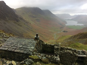
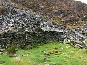
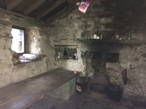
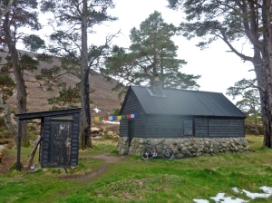
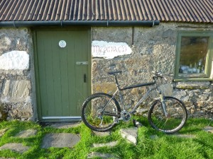
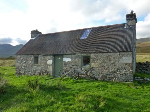
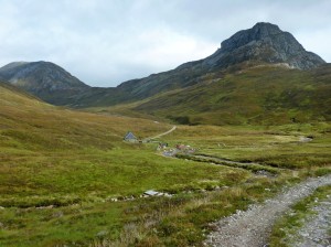
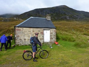
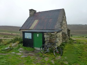
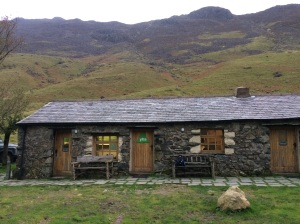
Warnscale Bothy

Warnscale Bothy

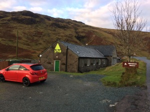
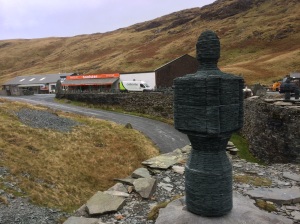
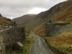
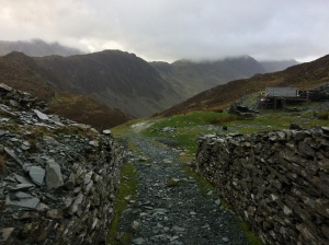
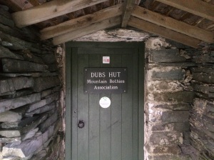
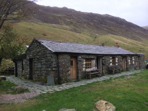
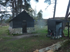
Tuesday 17th Oct.  I drove over to Honister Pass and parked up outside the Youth Hostel where I would be staying the night. The hostel is located right next to the working Slate Mine at the top of the pass. I set off walking westwards uphill on the Old Tramway path that takes you over to Haystacks, Just before you cross the stream there is a very nice Bothy (Dubs Hut) which was getting some repair work done on the roof. There is another bothy in this area too and I spent quite a bit of time trying to find it but gave up in the end and continued with my walk to Haystacks where on the summit I was exposed to strong winds again which made for difficult progress over the rocky top and it was a relief to get onto the easy rocky scramble down to Scarth Gap. Here I turned left down to Ennerdale and headed for the Black Sail Youth Hostel where I called in for a coffee and a chat, the high winds last night had resulted in some damage to the hostel, a satellite dish had been blown away, a chimney pot lost and some minor roof damage. Almost as soon as I set off again it started to rain quite heavily, i thought I was heading NW on the Coast to Coast route but instead I was heading straight up a minor path to the source of the River Liza, I decided to just continue up here anyway and eventually after a long climb up alongside the stream I hit the Moses Trod path which heads North to the Old Tramway path. I was still curious about that bothy I couldn’t find this morning, so I decided to have one final go at finding it, so I headed left once I hit the Old Tramway path and descended past Dubs Quarry again and down another path, here I caught a glimpse of the bothy, I won’t say exactly where it is, but from where I was it involved a lot of descent and reascent to get to it but it was definitely worth the effort and i hope to come back and spend the night in it one day. Then it was back along the Old Tramway path again and the descent down to Honister Pass where I had a very pleasant night at the Youth Hostel.

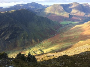
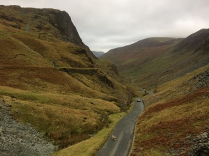
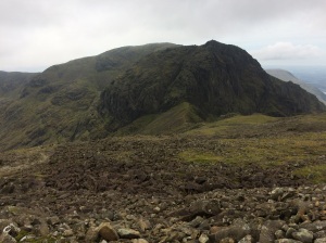
View from Hindscarth Edge looking down to the Honister Pass road

View from Hindscarth Edge looking down to the Honister Pass road

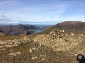
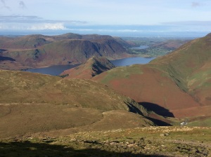
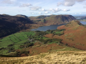
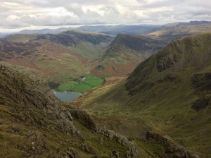
Wednesday 18th Oct.  At last the wind had died away and it was blue skies and sunshine most of the day and i was treated to seeing the autumn colours of Lake District at its very best. My route today started from the hostel door where i crossed the road and headed straight up the slopes of Dale Head, then Hindscarth, Robinson and High Snockrigg before dropping down to Buttermere for some lunch. Then it was the brutal climb up the stone steps to Red Pike, the only respite being a brief flat section where Bleaberry Tarn is. After scrambling up the loose red gully to the summit of Red Pike the going gets a lot easier and on a clear day like today the views are superb. Next up was High Stile, you have to be careful with navigation here if you are heading for High Crag next as it’s very easy to just follow the cairns and end up descending into Birkness Comb which is not an easy way out, instead I checked the map and headed right along the ridge leading to High Crag and the long descent to Scarth Gap where i turned right and dropped into Ennerdale heading for Black Sail Youth Hostel, where I spent the night, arriving shortly after 5.00pm.

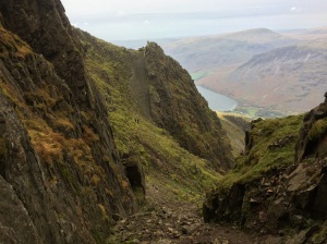
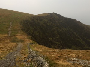
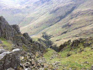
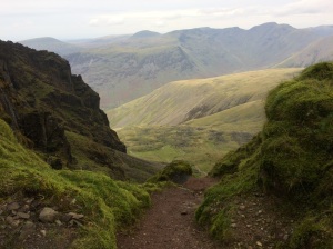
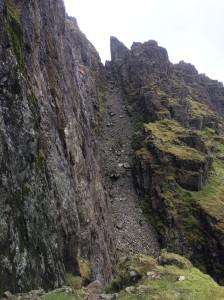
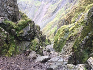
after Lords Rake there is another easier gully to negotiate

After Lords Rake there is another easier gully to negotiate
Thursday 19th Oct.  After a good breakfast at the hostel I was on my way again at 9.00am, I headed off on the Coast to Coast path in the direction of Honister, this time i found it no problem, then picked up a good track that heads to Brandreth, Green Gable and the rocky climb up to the summit of Great Gable. From here I descended directly to the stretcher box at Styhead Pass and then picked up the Corridor route to Scafell Pike, this route passes Skew Gill and the impressive Piers Gill, shortly after passing this second Gill the route to Scafell turns left at a junction, however first I wanted to make a short detour up to Lingmell first to check out the view then i retraced my steps and climbed up to Scafell Pike. From the Pike I headed down to Mickledore, where there is another stretcher box. I continued right up to the cliff face and turned right and descended the loose gravelly West Wall Traverse down to the foot of Lords Rake and then scrambled up this. At the top you drop down a little and then climb a second easier gully to emerge on the flanks of Scafell where I turned left and climbed up to the summit cairn. From Scafell I descended into Wasdale, a very long descent. The way I went was via a gully just after Rakehead Crag which I think fell runners use when doing the Bob Graham round, then headed for Brackenclose and the National Trust campsite, once on the road I turned right and headed for the pub at Wasdale Head where I had a very nice meal. A second pint of Hobgoblin would have been brilliant but it was now well after 5.00 pm and I still had to make it back to the car at Honister Pass, so out I trudged into the now steady rain and headed off on the long climb up to Black Sail Pass, just after the Pass crests I turned right along another trail that traverses below Kirk Fell and Great Gable and joins up with the Moses trod path which would take me back to the Old Tramway and onto Honister. By now though it was pitch black and still raining steadily and with the beam of my head torch bouncing off the swirling mist it was quite an eerie and difficult walk across the moor. Finally with much relief the Old Tramway loomed into view, I turned right and dropped down to Honister. One final scare lay in wait however, it was such a fowl night that two pigeons had decided to roost on the path and they waited until I was almost on top of them before flapping and noisily flying away nearly giving me a heart attack. I finally reached the car at 8.10pm it had a been a very long walk but a very enjoyable one, my plan was to get in the car and drive home but because of the hour I thought I would ask at the Hostel to see if they had any room left for the night… they had one space…! the 2 chess players who had been at Black Sail the previous night were there also and along with a student geologist and an ex-paratrooper we had an interesting night.

The Cairngorm Loop April 2017

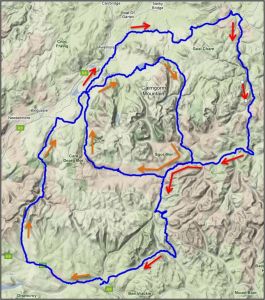
The Cairngorm Loop is a 186 mile mountain bike route that takes in some of the best tracks and trails that the area has to offer, the challenge of the event is to complete the 186 miles in under 56 hours. You can do this at any time but twice a year (April and September) there is a group ride, effectively a race, there is no entry fee or prize money and it is totally unsupported, you ride as if doing it yourself and no caches or pre-booked accommodation is allowed. More information about the challenge is on the Cairngorm Loop webpage. I put my name down for the April group ride and this was to be my motivation over the winter to get in shape to complete the challenge, it also gave me some time to think carefully about the gear and equipment I would need and also plenty of time to get the bike in good mechanical working order. The bike I use is a 7-year-old Specialized Rockhopper SL hardtail mountain bike, with a 21 inch frame, it has 26 inch wheels, Deore XT gears, Avid Elixir disc brakes and a Rockshox Reba front fork. It fits me well and has an excellent light weight aluminium frame. I hit the trails at the weekend with it and use it for commuting to work during the week, I try to clean it regularly, particularly the drive train and keep it well lubed. However little problems were starting to mount up though, skipping gears, damaged chainring teeth, hard gear shifts, rattling pedals and a rough feeling back wheel…. time for a major overhaul.

Preparing the bike…

  • Wheels   The wheels i have at the moment are an upgrade from a couple of years ago and they have Stans ArchX tubeless ready rims and run on Hope hubs which use cassette bearings, which makes servicing a bit easier.Sign on the Linn of Dee roadThe front wheel was running smooth but the rear wheel was feeling rough so I took the cassette cluster off and then removed the free wheel body, on Hope hubs this just pulls off and comes off with a pop, being carefull not to lose the washer which sits behind it. This gives access to the rear wheel bearings and I could feel with my fingers that one of the cassette bearings was turning very roughly and needed replacing, you tap these out with a drift (or a screwdriver if you are feeling brave…) Hope sells servicing kits which makes knocking these bearings out and back in square a lot easier. With the new bearing in the wheel it was turning smooth again. Before replacing the free hub I removed the 4 pawls and springs (responsible for that distinctive Hope buzzing sound) and cleaned everything up for inspection and found out that one of the springs was broken… this seems to be a problem with Hope hubs as I have broken quite a few, anyhow I replaced it with a new one and greased everything and popped the freehub back on the wheel and made sure it was spinning ok.
  • New cassette  (Shimano XT M770) 9 speed 11-32 ratio, replacing the old 11-34 cassette as I found I was very rarely using the largest 34 cog.
  • New chain  (Shimano HG93) 9 speed. The last time I used a reusable link to join the chain, thinking I could then take it apart for cleaning, in practice I never did though so this time just used the pin Shimano supply with the new chain to join it together. Those re-usable links are handy to keep in your saddle bag though together with a small chain tool for any problems out on a ride.
  • New chain rings  (Shimano Deore FCM590) 44-32-22 ratio. I took the crank arms off the bike to clean everything up and fit these 3 chain rings. You need to make sure you fit these the right way round, particularly the middle one. I fitted the last ones and I think I put it round the wrong way…. I’m sure now that this was responsible for some of the gear change slips I was getting as the Ramps and teeth profile wouldn’t be aligned optimally. With the cranks off it was a good opportunity to clean and re-grease the bottom bracket too.
  • new Jockey wheels  (Shimano 105 RD-5700). This set is compatible with lots of derailleurs including mine, again care need as they are slightly different, the guide pulley is the top one and the tension pulley is the bottom one. I took the derailleur off the bike to replace these as I wanted to give it a good clean and was surprising how much gunk came out of it. After a good soaking with bike spray and oil it was moving much more smoothly.
  • New gear cables  (Shimano MTB stainless steel gear cable set). Everything you need in one bag, cables and outer housing, end caps and cable stops too.
  • Headset service The bearings at the top and bottom of the steerer tube taken out cleaned and re-greased. I use a small neoprene collar attached with Velcro around the bottom of the steerer tube to help keep the worst of the mud and water out of the bottom bearing.
  • New pedals  (DMR V12 platform pedals). The old pedals were the original alloy ones that came with the bike, they were still usable but were starting to rattle quite a bit.
  • New tires  (Schwalbe Nobby Nics Evo, tubeless snakeskin, (26×2.25) pace star compound). The rims on my wheels are ZTR Stans Archx which are fully compatible with tubeless setups so this is the way I went front and back. The front tyre inflated straight away and soon after I heard the explosive pinging sound of the beads locking into the rims but with the back tyre I had a much harder job, even getting it inflated was tough but to get the beads locked in I tried all sorts of recommended tricks, washing up liquid on the beads, putting a tube in and trying to seat it that way (that got one side seated ok…) what done the job in the end was removing the core from the tubeless valve to allow a greater airflow from the track pump into the tyre, then pumping away furiously until finally with the sweat pouring from my brow I heard the explosive pings of success as the beads locked in. Once the beads are locked in you can deflate the tyres and the beads will stay in place, then you can inject the recommended amount of sealant into the valve hole and put the core back in and inflate the tyre as normal. They should now be immune to normal punctures as the sealant will quickly find and fill the hole in the tyres as it is spinning inside the tyre. The sealant does eventually dry up so check every now and then, I still carry a spare tube, patches and inflater just in case though!

Clothing and equipment…

Bob Scott`s Bothy

Something you have to think carefully about is the clothing and equipment you take with you on the ride and that is largely dependant on the weather you are expecting, in Scotland at the end of April that can be a very tricky subject to predict! True to form the week before I travelled up to Braemar, winter returned to large parts of the country for a few days, with fresh snow and freezing northerly winds. On a bike it’s the extremities that feel the cold first, so a warm hat that fits under a helmet and winter mountaineering gloves went in the bag, along with a lightweight Montane insulated jacket which provides instant warm, particularly under a thin waterproof. Footwear choice is very important too as the route fords several rivers with no real choice but to wade straight across and this can lead to very cold feet, after much thought I decided on using my old Mammut summer walking boots, they were lightweight, comfortable and had room to get a nice thick wool sock inside too, which I was hoping would feel warm even when wet and they would be perfect on the hike a bike sections too.

Bob Scott`s Bothy

Another big choice has to be made about your sleeping system, how much do you intend to get? and where do you plan to get it? There are bothies on or near the route but conditions on the ground may make you slower than expected or they could be full when you arrive there. I decided to take a lightweight down sleeping bag and a Alpkit Hunka bivi bag, so in theory I could stop anywhere. If you intend riding in the dark you need a good light and these can be expensive, the best mountain bike specific ones are probably by a brand called Exposure, I did have a look at cheap Chinese ones on eBay and was tempted but in the end I decided I would just use my old MYo XP head torch and some spare batteries. I probably would have left the stove and pot in the car just to save weight, the ready cooked meals in a bag are just as nutritious cold. Also there are places on the route to buy hot food if you arrive when they are open. To carry all this gear I used an Apidura seat-post bag (compact size,11 litres), this carried my sleeping bag wrapped inside a plastic bag and I also used a very light-weight OMM 20 litre rucksack for the other stuff including food, some tools, spare socks, maps, compass and a small first aid kit etc.

Waiting for race day…

Confluence of the Eidart and Feshie rivers

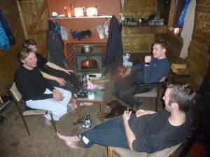
I drove up to Braemar on Thursday arriving just after 6pm, I got something to eat then reassembled the bike and packed some gear for an overnight bothy stop and set off on the 6 mile ride to the Linn of Dee, just past the car park there is a signed track that heads off north into the heart of the Cairngorms, I took this and headed for Derry Lodge, an old abandoned shooting lodge. I was surprised to read on the notice board that there were plans to turn this lodge into a hostel with warden accommodation, I had mixed feelings when I read this, it certainly would be a good location but I think also it would lessen the remote feel and the commitment needed for the long walk or ride to access the Cairngorms from this side. Also there is a very nice bothy nearby and I wondered what the impact of a hostel would have on that….. it was starting to get a bit chilly when I arrived at the bothy, there were 4 people already in, 2 young guys and a Dutchman with his son, they had the stove going strong and candles lit and it was a very cosy warm atmosphere. They had been up in the hills the day before and said the conditions had been really tough, deep soft snow in places, cold wind and rivers in spate with a thaw setting in.

Eidart Bridge

The next morning I wanted to recce a section of the race route from Glen Derry to the Eidart bridge as I would possibly be doing this section in the dark come race day, so I headed off past Derry Lodge and then north up Glen Derry to the edge of the forest to check the terrain out, I turned round here and headed back to the Linn of Dee and carried on west along the track to White Bridge and followed the track heading along Geldie Burn, a couple of hundred meters before this track crosses the river there is a smaller track heading off on the right, this leads eventually to the Eidart bridge. Up until now the cycling had been easy with a nice firm stony track to follow but now on this smaller track it was much harder because it was so wet and boggy and in places soft snow, in fact I ended up pushing the bike nearly all the way to Eidart bridge, this was as far as I went and I now retraced my route back to Braemar, however things didn’t go smoothly, just before White Bridge on a rough land rover type track I caught my front wheel in a rut and I came off the bike and my left knee hit a rock with some force. At first I just tried to walk it off and ride the easy bits but it soon started swelling up really badly and I slowly realised the race tomorrow was over for me, all that preparation and planning ruined by a lapse in concentration on an easy track, by the time I eventually reached the car in Braemar it was hurting quite a lot and it was difficult to bend it. The next day I went to the hospital to get it checked out and an X-ray confirmed that I had a clean break of my left knee cap and I’m writing this with a full leg cast on wondering when I will once again be back in the Highlands…..

Discussing this accident with friends when back home we talked about the best ways to get help if ever you are out in the wilds and need to contact the emergency services, this little video by Lyle Brotherton contains some very useful information. https://www.youtube.com/watch?v=XPZv_8dABfU


Cairngorms February 2017

Early February 2017 I had a week off work and decided to head north to the Cairngorms once again. Last year sometime I requested to enter the group ride for the Cairngorm Loop  which is a mountain bike challenge ride that takes in most of the Cairngorms in two loops (see map here) there is no entry fee or prize money and you have to be totally self supported. It’s a tough challenge, 186 miles in 56 hours, most of it off road. The group ride takes place at the very end of April……February is usually not the best month to go mountain biking around the Cairngorms but this year has been relatively mild so far and not a lot of snow. The plan was to take my mountain bike and riding gear and also take my hill walking kit too so if riding was impossible then at least I had something else to do. I based myself for the week at Cairngorm Lodge Youth Hostel next to Loch Morlich, about 7 miles east of Aviemore, which is an excellent, comfortable base to explore the area from.

Lochan Uaine

Lochan Uaine

Monday   The first day was cold about 3 or 4 degrees but the weather forecast was predicting very strong gusty winds late on in the afternoon (80mph!). My original plan was to try and do the inner loop on the Cairngorm Loop with a bothy stop halfway at Derry Lodge but this wasn’t really possible with the forecast. So instead I headed off on some of the excellent trails around Loch Morlich and Rothiemurchus Forest, crossing the Cairngorm Club footbridge and onto the path that goes around the picturesque Loch an Eilein, a rocky side trail from here goes up to the lovely little Drakes Bothy before continuing on through the forest to Feshiebridge. Here I turned right along the B970 road and headed north-east to Inverdruie. After a short detour along the “The Old Logging Way” into Aviemore for some lunch I returned to Inverdruie and turned left over the bridge to pick up the B970 road between Coylumbridge and Nethy  Bridge, after 5 km or so turned right on a wide track and headed east to Forest Lodge in the Abernethy Forest, which is a RSPB national nature reserve centre, from here I turned south up the trail for the steady climb up to the Ryvoan Pass and down to the Bothy. By now it was late afternoon and the weather forecast was proving to be accurate, as soon as I left the forest I was buffeted by strong gusts and had to get off a couple of times and it was a relief to dive into the bothy to get out of the wind for 5 minutes before continuing downhill past Lochan Uaine and Glenmore Lodge back to the hostel.

Old Logging Way near Glenmore Lodge

Old Logging Way near Glenmore Lodge

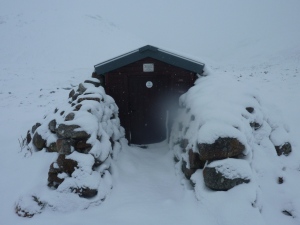
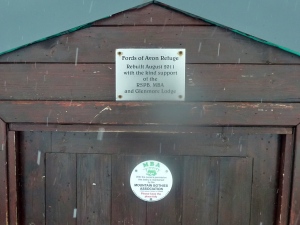
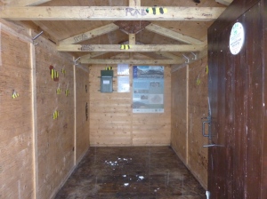
Tuesday   The next morning the strong winds had gone but when I opened the curtains and looked outside i was amazed to see everything covered in 3 or four inches of snow, quite a transformation and it looked beautiful. No mountain biking today then, instead it was on with the big boots and hill walking kit. I headed off towards Ryvoan Pass again past Lochan Uaine then followed the trail that crosses over the River Nethy and goes around the back of Bynack More. As I gained height the snow became deeper and the path was difficult to follow and subsequently the going became hard work, eventually I made it down to the Fords of Avon, a strategic mountain crossroads with a small emergency refuge no bigger than a garden shed. Here I turned west and made slow progress in the drifts to Loch Avon which was partially frozen over then headed steeply uphill to a feature called The Saddle, then even steeper ground up through a weakness in the cliffs to the flanks of Cairngorm Mountain itself. After a bit of navigational faffing around I eventually located the Mountain Funicular Railway and ski runs of the Cairngorm resort and slowly waded my way down through the snow drifts and onto the never-ending road that leads back to Loch Morlich, arriving back at the hostel at 7.20pm, it had been a tough day out.

Loch Einich

Loch Einich

Wednesday   Back on the bike again and headed over to Feshiebridge via the same route as Monday to check out another little section of the Cairngorm Loop route. This section started on the west side of the River Feshie and headed south to Ballintean along trails, road and forest tracks to the hamlet of Drumguish, i then picked up the B970 road back to Feshiebridge. With this little job done I retraced my tracks back into the Rothiemurchus Forest, past Loch an Eilein to a cross roads about a km before the Cairngorm Club Footbridge, the route heading north went down to Coylumbridge but I headed south on the track that led to the remote and magnificently located Loch Einich. After a couple of Kms the trail became quite snowy but not icy and the tyres were gripping well, the trail split after a while and for some reason I took the high route and ended up doing quite a bit of climbing for nothing because it soon descended back to the lower trail, which gradually made its way up to the Loch, the terrain is quite easy but there are a couple of stream crossings to keep you on your toes and the snow was becoming deeper and harder to pedal through, especially with a bit of a headwind too, but it was all worth the effort in the end to see the Loch surrounded by imposing snowbound cliffs. The ride back down was a blast, downhill with the wind behind and a great bit of single track along the river which I missed on the way up. It was dark by the time I hit the forest again but a full moon provided enough light to high-tail it back to the youth hostel and it was a great way to end to a memorable ride.

Thursday   Similar ride to Monday, around Loch Morlich and through the forest to the Cairngorm Club Footbridge then at the crossroads I turned right on the very pleasant trail that heads down to Coylumbridge. I turned left here on to the Aviemore road then took the next left on a very quiet road that leads to Loch an Eilein and I done a circuit of the Loch once voted as Scotlands favourite picnic spot no less! then picked up the road to Inverdruie where I crossed over the river Druie on a shortcut to the B970 that leads to Nethy Bridge, I followed this road for a few miles before turning off right to cycle past Loch Garten which is famous for it’s Ospreys (which had long since migrated to sunnier climes for the winter), then onto Nethy Bridge. Here I took the road on the south side of the River Nethy that heads south back into the Caledonian Pines of the Abernethy Forest and headed for Forest Lodge and south again to the Ryvoan Bothy and back to the hostel.

Swing bridge next to the ford at Loch Pattack

Swing bridge next to the ford at Loch Pattack

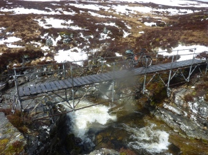
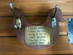
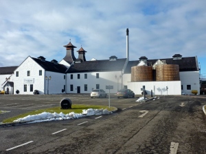
Friday   I drove down the A9 to Dalwhinnie and parked up at the railway station, a good track runs along the side of Loch Ericht to Ben Alder Lodge where the trail leaves Loch Erich and heads to Loch Pattack. The snow was a couple of inches deep here but again it didn’t feel icy and the tyres were gripping well so it felt ok apart from being harder work than normal. I turned off left when I reached the Loch and crossed the the river on a rickety wooden swing bridge next to the ford, then kept left at the next junction on the trail to Culra Bothy and Lodge. This bothy is situated in a fantastic remote location amidst grand mountain scenery which looked even more impressive covered in snow. I was surprised to see that the bothy is officially closed due to asbestos being found in its construction and the outer walls of the bothy are spray painted with warnings, however all 3 of the rooms I checked out were open and the main room with the stove in it looked very usable. I had a quick look at Culra Lodge, a short distance away but everything was battened up. Back at the bothy I retraced my route over the swing bridge, here I briefly considered heading left just before the Loch on the track to Lochan Na Earba and onto Ardverikie and back via the River Pattack but decided to leave it for another day! Instead I headed back to the car the way I came. Before putting the bike away I had a ride to the Whisky Distillery at Dalwhinnie had a look around the visitor centre and tasted a wee dram of their 15 year old single malt which i had never tried before but will certainly get a bottle of it in the future.

Tyndrum to Inverness by Mountain bike


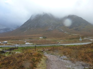
Glen Coe and the West Highland Way

October 2016 saw me heading Back up to Scotland again to continue exploring some of the excellent off-road mountain biking trails to be had up there. Since my last trip up here a few weeks ago I had come across an event called the Highland 550 a very tough mountain bike ride through some of the remotest parts of Scotland. This trip was meant to be a recce of the start of that route though things didn’t go entirely to plan… The starting point for the Highland 550 is Tyndrum, a very well-known stopping point for hikers on the West Highland Way and I booked myself in to the “By The Way Hostel”, i chose a trekker hut, which looked like a garden shed with a bunk bed in it but it had electricity and even a heater which was nice because it had been pouring with rain since I got here and feeling cold and it continued raining heavily during the night as well and I kept thinking might as well get it all out-of-the-way now and it should be dry tomorrow…

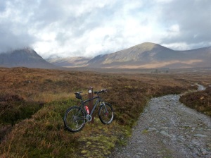
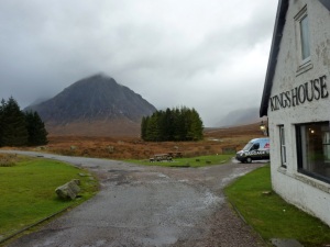
Monday dawned and the rain was still lashing down, I was booked into Loch Ossian Youth Hostel tonight, many miles away, so I had no choice but to set off early into the deluge, as usual it’s the first few minutes are the worst, once you are warmed up it doesn’t seem so bad. The route follows the West Highland Way to Bridge Of Orchy then climbs over Black Mount and descends past the Glen Coe Ski Center and the Kingshouse Hotel, before reaching the formidable obstacle of the “Devils Staircase” which involves a steep climb/push to a summit then leads down to the very long descent into Kinlochleven. Here I called into the Co-op shop for a sandwich and then began the long climb (push would be a better word) up to the transmitter overlooking the village. Up to this point I was still following the West Highland Way but now I turned right and headed past the disused Mamore Lodge Hotel and continued past the two lochs on good tracks to the ruin of Luibeilt and was faced with the infamous crossing of the Abhain Rath. I had been at this point a few weeks ago and the river crossing wasn’t too bad but today, unsurprisingly, after all this rain the river was a different beast all together. After a lot of faffing around I decided on a crossing point, a place where the river split around a mini rocky island and went across with just my rucksack the first time then came back for the bike and carefully picked my way across bracing with the bike at times and was very relieved to safely get to the other side,

Loch Leven from the track below Na Gruachaichean

I called into the Meanach Bothy and was surprised to see there was still some whisky in the bottle there from my last visit and had a much-needed swig to set me on my way. Unfortunately my camera somehow got a soaking on the river crossing and I wasn’t able to take anymore pictures with it from this point onwards. Up until now the route had been on a recognisable rocky trail but in these conditions from the bothy to Creaguaineach Lodge on the shores of Loch Treig it was a very boggy and unrideable section and I ended up walking this whole section. When I got back home I read a very funny and honest account by a guy called Dave Barter of his attempt on the 2014 Highland 550 event and his video diary refers to this very section. It was great to be on a rideable trail again which follows the  loch side for a couple of km before a stiff climb up to the railway line and followed the wide rocky road all the way to Loch Ossian Youth Hostel, by now it was getting dark and it was great to see the lights of the hostel in the distance getting nearer and nearer. The small hostel on the shores of Loch Ossian is a gem in a wild and remote location, the central room contains the kitchen and dining area and has a great log-burning stove which makes it toasty warm, there are overhead racks on pulleys to dry all your wet gear (and cameras…) and  either side of the main room there are male and female dorms. There were 7 other people staying there when I was there and I had a warm pleasant night there with plenty to eat and drink. The weather front bringing all the rain had finally passed during the night and the next day was clear but cold, all the tops of the mountains had a dusting of snow on them and cycling along the shores of Loch Ossian in the shadow of the mountains my hands and toes certainly felt the cold. At Corrour Lodge the route heads North on a very wide smooth track, there is currently a big hydro electricity scheme being built up here and workmen were busy laying big thick power cables along the side of the track.

A Friendly Native...

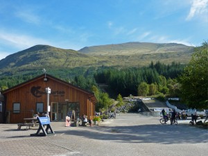
As I entered the forest I noticed my front disc brakes were screeching really noisily after a while I stopped and had a look at them and i couldn’t believe the state they were in… the pads had completely worn away and on one side they were down to the bare metal!  all the rain and grit and mud from yesterday’s ride had taken a terrible toll on them and I wasn’t carrying any spares. My intended route around the back of Binnein Shuas to Wolftrax and then over the Coireyairack Pass to Fort Augustus was no longer possible. I needed a good bike shop and headed for Nevis Cycles at Aonach Mor trail centre. I descended down to Luiblea and turned left on the A86 and headed for Spean Bridge, then turned left to Fort William before getting off the very busy A82 as quickly as possible by heading up to Leanachan and on the bike trails through the forest to Aonach Mor. Unfortunately the shop there was shut for the season so after treating myself to burger and chips at the Pinemarten Cafe i cycled another 5 miles or so to the main Nevis Cycles shop at Inverlochy just outside Fort William and they had the exact brake pads I needed. I spent the night at the Bank Street Hostel in Fort William and on the way there I noticed a sign for the Start of the “Great Glen Way” to Inverness, that got me thinking…  As mentioned before my intended route today would have been going over the Corrieyairack Pass and stopping in Fort Augustus for the night, from there I wanted to head up into to Glen Affric and check out the bothy there and then start heading back via Morvich, Rattagan, Corran and the Scottish Coast to Coast route along Loch Quoich and Loch Garry to Invergarry then back to the car at Tyndrum along the WHW again. The distances were now starting to look too big for me so I had a re-think and decided on Wednesday I would now cycle up the Great Glen Way instead, which runs between Fort William and Inverness and is 73 miles long and largely follows the Caledonia Canal and is very well signposted all the way and has lots of information boards along the way explaining the history and significance of the Great Glen. I stopped off at Fort Augustus for lunch then continued into a hilly forest section heading for the “Lochside Hostel”  3 or 4 miles past Invermoriston on the shores of Loch Ness. Thursday it was back onto the Great Glen Way passing through Drumnadrochit then another climbing section, steep at times, through the forest then onto very quiet minor roads and lanes all the way to Inverness arriving at about 2.00pm. I was pre-booked into the “Inverness Student Hostel” which is centrally located close to the Castle, then spent the afternoon exploring the town.

The Devil`s Staircase, Kinlochleven side

I got an early start on Friday and the plan was to cycle back to Fort William along cycle route 78 which is part of the Caledonia Way (which runs from Cambeltown to Inverness – 237 miles). This was mainly on quiet roads to Fort Augustus, then it was back onto the Great Glen Way reversing my journey on the way up. About 10 miles from Fort William I noticed a problem with the free hub on the bike, sometimes I would pedal as normal and the pedals would just spin and not engage the chain at all, luckily I had enough time to make it back to Nevis Cycles again at Inverlochy while they were still open for business. It turned out that the “Hope Pro2 Evo” hub that is on my bike has 4  pawls and springs that engage and drive the bike forward when you pedal and also give it that distinctive buzzing sound when you freewheel, well it turned out that 3 of the springs on my hub has broken and I was operating on one at the end, I was lucky to make it to the shop! I spent the night in Fort William at the Bank Street Lodge again.

Another early start saw me back on the road for 8.00am heading for Glen Nevis and the start/finish of the West Highland Way, its uphill on wide stony forest roads for the first few km all the way up to the turn off for Dun Deardail Fort, then the riding becomes more interesting and apart from a short rocky section in the forest where you cross a stream and then carry up some steep steps on the other side it’s rideable all the way to the transmitter overlooking Kinlochleven, after this it’s a long steep technical descent into the town, I got off and walked most of it. I stopped off at the co-op again for a sandwich and a drink before starting the long climb up to the top of the Devil’s Staircase, the first half up alongside the giant water pipes is rideable, then it becomes largely a push job, at least for me. I was passed on one of the steep rocky sections by two mountain bikers coming the opposite way and was impressed by the way they seemed to float over some very tricky ground. Visibility was good and the views near the top looking over the Mamores was tremendous. From the top it another technical rocky descent down to the A82 road. After passing the Kingshouse Hotel I was getting hungry again so made a short detour up to the cafe at Glen Coe Ski Centre and had a burger and chips. From Glen Coe it’s a rocky climb for a while then a long fast, rocky descent down to Victoria bridge, then along the road to Bridge of Orchy and finally reaching Tyndrum and my waiting car at about 4.30pm.


West Highland MTB bothy trip, Sept 2016

Many years ago with a friend I did a really good winter walk from Fort William up in the Highlands of Scotland. We got the early morning train from Fort William to the remote Corrour Station on the edge of Rannoch Moor and set off walking westwards back to Fort William, following the Abhain Rath River and over the watershed to the head of Glen Nevis and through the gorge to the car park at the road head. luckily here we managed to hitch a ride back to Fort William. The reason i mention all this is that about half way through the walk we came across the Meanach Bothy and i was very impressed with it and i knew one day that I would come back to stay overnight in it, i never imagined that i would arrive back on a mountain bike though…..

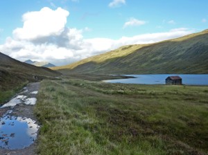
Loch Eilde Beag and the lonely boat shed

Loch Eilde Beag and the boat shed

I started this  2 day ride from Fort William,  where I was stopping at the Bank Street Lodge, a place I have stopped at many times in the winter when mountaineering around the West Highlands of Scotland, it’s a no frills well-run hostel in a good central location and a good place to meet people doing similar outdoor activities. I wanted to go as light as possible and in my small 20 litre rucsac I had my sleeping bag, a thin foam mat, a small stove and pot and lots of food as well as the usual bike essentials. I didn’t want to arrive at the bothy too early so set off riding up Glen Nevis just before noon and soon turned off on the broad trail for The West Highland Way and steadily climbed through the forest overlooking Glen Nevis. After passing the signs for the ancient Fort of Dun Deardail the trail got narrower and rocky and there were some stair sections to carry the bike over before continuing on the rocky old military road which is nearly all rideable. I followed the West Highland Way all the way to the turn off for Kinlochleven, the WHW turns right here and descends into the village but I carried on past the masts and past the derelict remains of The Mamore Lodge Hotel and climbed steadily up a good double width track. After a couple of hours seeing no one I suddenly started seeing lots of runners, its was the Salomon fell running weekend and today was the first of three days of running events, the first event was The Vertical Kilometer, a race from Kinlochleven to the top of Na Gruagaichean (1056m). Tomorrow would be a fell run round the Ring of Steall, then on Sunday the big one, the Glen Coe Skyline  (a 55km gruelling circular route over all the Glen Coe mountains, including Curved Ridge and the Aonach Eagach). Still on the same track the trail heads NW and the next landmarks are Loch Eilde Mor and Loch Eilde Beag with its lonely boat house, shortly after this the trail reaches a crest and in the distance you can see the ruin of Luibeilt and the Meanach Bothy.

The ruin of Luibeilt and the Meanach bothy

The ruin of Luibeilt and the Meanach bothy

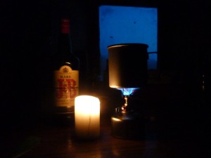
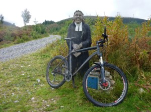
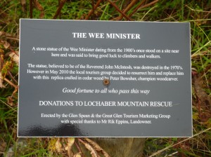
The trail descends to cross the Abhain Rath river at the ruin of Luibeilt (more wet feet!) and 300 metres to the right is Meanach Bothy which has two rooms plus a loft accessible via a metal ladder if things get busy. I got there about 6.00pm which gave me a good hour to fill the water bottles, do the bothy book and generally get organised before the light faded. Then it was on with the stove and lots of food and drink, by 9.30pm it was pitch black outside and i was tucked up in my sleeping bag with only a flickering candle for company drinking a small bottle of Glenfiddich which my sister had given me for Christmas, i was keeping it for a special occasion and this seemed to fit the bill. The next morning I picked up the trail 350m west of the bothy, this heads north over the hill and eventually drops down to the Lairig Leacach valley about 5km away, a lot of this section is steep, rocky and unridable and involves quite a bit of bike pushing, however at the end there is a good descent down to the Lairig Leacach Bothy where the trail flattens out a bit. This bothy which is a lot smaller than the one I stopped at, had a group of people camping outside of it and they were getting ready to climb the nearby Munro of Stob Ban when I passed by. After the Lairig bothy the going is very easy, a wide stony track heading down towards Spean Bridge direction and through a forest for a while passing “The Wee Minister”, shortly after this I turned off left on a track sign posted to Spean Bridge and entered the Leanachan Forest. As usual in forests like this I got a little bit lost but eventually came across one of the Nevis Range man-made mountain bike trails (The Cour), so I followed this knowing it would bring me out at the Aonach Mor Ski Centre car park. It was a lovely sunny day now and there were lots of Mountain bikers out enjoying the man-made trails that start and finish from here, the braver ones doing the World Cup Downhill Course or the Red Giant XC course, both of which you can use the Gondola to get yourself and the bike to the top. I headed for the Pinemarten Cafe to put some calories back first. Suitably refreshed I tried a couple of the intermediate blue routes, Broomstick Blue followed by Blue Adder (which has a really good twisting descent)  both were good fun and then set off on the side road to Torlundy and picked up the cycle way that takes you most of the way into Fort William.
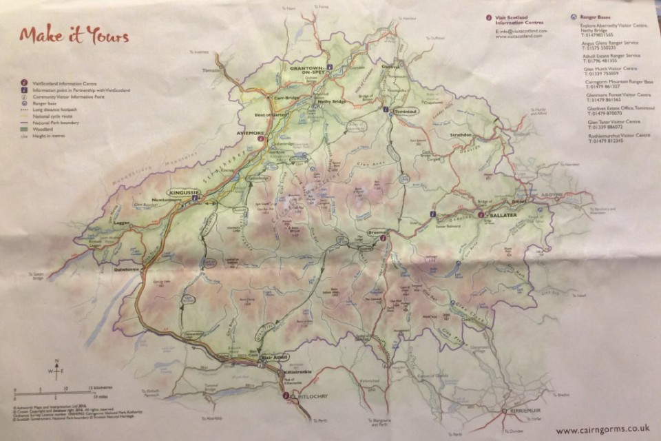
Cairngorms mountain bike tour Sept 2016

During this weeks holiday I had hoped to do the classic Scottish coast to coast mountain bike route that runs from The Kyle of Lochalsh on the west coast of Scotland to Montrose on the east coast. A big problem with doing this route are the logistics of getting yourself and a bike up to the starting point, I had hoped to take the train up to the Kyle of Lochaslsh but I was told all spaces for bikes were full up on the days I wanted. So instead I started looking around for alternatives ride ideas and came across a great one in a book called “Scottish Mountain Biking – The Wild Trails”  by Phil McKane (Vertebrate Publishing). The ride was a 4 day tour of the Cairngorms and had the added bonus of taking in large chunks of the C2C route I had originally wanted to do. Also being a circular route I could drive up to Scotland with the bike in the car and then ride a big loop back to the car. I already had the four Landranger OS 1:50,000 maps I needed (35,36,42,43) from previous mountaineering trips up here and I set about penciling in the route onto the maps. The more I looked at it the more i realised what a great route it was, it turns out that the Cairngorms are ideal for cross-country mountain bike  touring, I would guess that well over 90% of the route is off-road using estate roads, stalkers paths and ancient drovers routes through the mountains. In a nutshell the plan looked like this :-
  • Blair Athol    –   Starting point, leave car here, ride to Kingussie.
  • Kingussie      –  “The Tipsy Laird” bunk house, ride to Tomintoul.
  • Tomintoul    –   The Smugglers Hostel, ride to Braemar.
  • Braemar       –   Stay at  the Youth Hostel and ride back to car at Blair Athol.
Cairngorms map and my route
Cairngorms map and my route
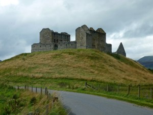
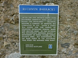
I drove up on the Sunday and spent the night at Pitlochry Youth Hostel about 7 miles away from the start in Blair Athol and made an early start on Monday morning. Quiet roads and tracks follow the main A9 road to Dalnacardoch Lodge, where you cross the busy A9 and the wilderness riding begins on good wide tracks, through the forest to begin with then onto open countryside. The weather was quite wet for the first couple of days and this made crossing the numerous fords on the route quite tricky at times, sometimes having to wade knee-deep carrying the bike on my shoulders to get to the other side. The hardest riding of that first day was along the banked shore of Loch an Duin which was very narrow and boggy at times, after this it was good double-width estate roads past Gaick Lodge and then surprisingly tarmac road for a good while down Glen Tromie. At Tromie Bridge I turned left and headed for Kingussie passing the impressive ruins of Ruthven Barracks on the way, which was well worth a look around. I stopped at the basic but cheap bunk house attached to the Tipsy Laird pub on the main high street.

It rained hard all during the night and for most of the next day as I retraced my way past Ruthven Barracks to Tromie Bridge and picked up the trail to Glen Feshie, crossing a couple of fords on the way. The river Feshie was looking flowing strongly after all the recent rain and i crossed it at the wooden bridge and headed north up the hamlet of Feshiebridge passing the airstrip of the glider station on the way, i turned right here into the forest hoping to navigate myself to Loch an Eilein, i dislike riding in managed forests as it hard to know where you are exactly when surrounded by trees, especially with an old map and tracks going in various directions, however this time i got lucky and picked up the very nice small trail to the lovely Inschriach Bothy. I had been to this bothy a few years previous on a day walk with a couple of friends and it was good to come across it again. After a sandwich in the bothy and adding another layer i set off again on the narrow rocky trail down to Loch an Eilein and then picked up the wide smooth trails that lead to Loch Morlich via the Cairngorm Club footbridge.

Drake`s Bothy near Loch an Eilein

Drakes Bothy near Loch an Eilein

There are lots of way-marked trail around this area and seems a good place to come for day rides. At Lake Morlich i joined the main road that heads up to the big ski centre passing the youth hostel and then branched-off left on the side road that leads up to Glen More Lodge – the Scottish National Outdoor Centre, a place i knew well from having done a couple of courses there many years ago. Continuing along this track brings you past a magical little lochan and shortly afterwards you branch left heading north past Ryvoan Bothy and into the forest, i missed the turn off right here for the ford and ended up at Forest Lodge and i done a u-turn here heading south then east to Loch a Chnuic, some careful navigation is needed here to pick up the small trail to the narrow cleft of Eag Mhor then it’s onto the Braes of Abernethy to the hunting estate of Dorback Lodge. It had been a long wet day so far but my target for the day of Tomintoul didnt seems so far away now, however as i set off across the moors to Letteraitten i came across several 4×4 vehicles  and then the sounds of gunshots nearby and beaters waving white flags, there  was a shoot in progress and my intended route over the moors to Tomintoul was not possible. i had to retrace my route to Dorback Lodge and then down the access road to pickup the main A939 road into Tomintoul, a road that had several steep climbs on it but then again Tomintoul is the highest village in Scotland! i finally reached the Smugglers Hostel at about 6.00pm tired and dripping wet, it had been a long day but an enjoyable one.

Day 3 dawned dull and misty but largely dry just the odd light shower, the target for today was Braemar directly south of Tomintoul. I was on the road by 8.30am and had a short tour up and down the long main street of the village before heading off down the road that turns into a track that follows the River Avon south. i followed this wide easy trail all the way down to Inchrory Lodge, where i left the river Avon and kept heading south into Glen Builg via a vague boggy section then an improved track to Loch Builg after passing some small lochans its south again to the flanks of Cullardoch where a very long climb awaits you. Just before the climb starts i came across a brand new shooting hut, a high-class one that wouldn’t look out of places on the slopes of verbier. Once the high point on Cullardoch is reached all difficulties for the day are over and its a very fast descent down to the forest where there are some very nice old Scots Pines to be seen. Invercauld House leads to the main road turning left over Invercauld Bridge and you pass the old bridge of Dee (Brig O`Dee) after a couple of miles Braemar Castle comes into view and then the village itself, after exploring the village a while and a very nice meal at a local cafe i checked into Braemar Youth Hostel.

The narrow watershed area leading to Glen Tilt

The narrow watershed area leading to Glen Tilt

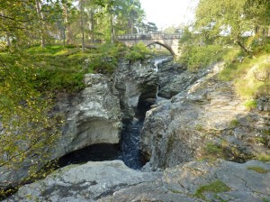
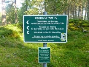
Day 4 and the last day of this tour of the Cairngorms and the weather was the best yet, sunshine and light winds made the 6 mile ride along the tarmac to the Linn of Dee a pleasure, i stopped to take some photos of this impressive gorge before leaving the tarmac and heading west on a good track along the banks of the River Dee as far as the “White Bridge”. Here i left the Dee and headed south crossing the Geldie Burn and up to the ruin of Bynack Lodge, the grassy rocky track climbed steadily and was fairly obvious to follow as it made its way to the watershed and the start of Glen Tilt, here the valley narrowed sharply with the river and trail squeezed on both sides by steep grassy slopes. The very narrow trail became quite a technical challenge to ride with rocks peppering the trail and a large drop on the left hand side i got off and pushed a lot of this section. eventually after 2km or so the terrain opened out again and the going became a lot easier, shortly afterwards the Bedford Bridge came into view which provides a great viewing point for the spectacular Falls of Tarf waterfalls. All difficulties were now over as you follow the River down Glen Tilt, which was looking at its best in the bright sunshine, on a good track for mile after mile downhill, eventually joining the road at The Old Bridge of Tilt, not far from Blair Athol and my waiting car.


The Sandstone Way – July 2016

Sandstone Way map_edited

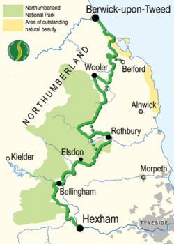
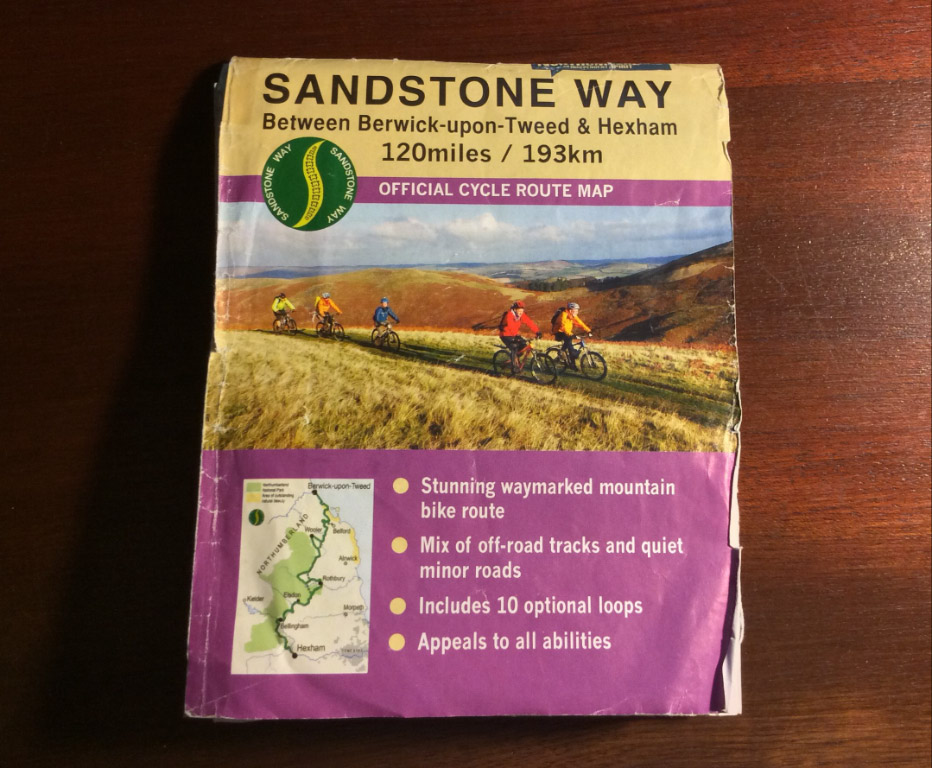
The Sandstone Way is a new long distance mountain bike trail in the north of England that runs roughly north to south through the sparsely populated county of Northumberland, it begins in Berwick-upon-Tweed and ends in Hexham, though it is equally possible to do the route in reverse. It is 120 miles long and loosely follows a series of sandstone outcrops and rock features familiar to walkers and climbers who visit the area. Well over half the route is off-road on a mixture of bridle ways, byways, forest tracks and unclassified roads all linked together by very quiet country roads. The driving force behind the creation of this route is Ted Liddle from the Tyne Valley MTB club. The official Sandstone Way website and map give loads of information and are a great help in planning the ride.  Its not a technical mountain bike route, there are no jumps or scary descents but it is a tough route and it certainly warrants the use of a good quality mountain bike, a hybrid or cyclo-cross type bike would struggle on some of the rougher rocky sections, especially in bad conditions. The route is signposted all the way though at times I did get a bit confused and you certainly need the Sandstone Way map to guide you. Time-wise you could take a leisurely 4 days to enjoy the route or if you like a real challenge and are very fit you could try to do it in a day, it has been done, Rich Rothwell (an endurance mountain bike rider) managed to get round in just under 11 hours, he used a full suspension mountain bike and said he was glad he did!

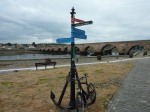
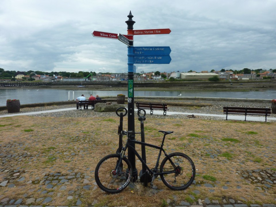
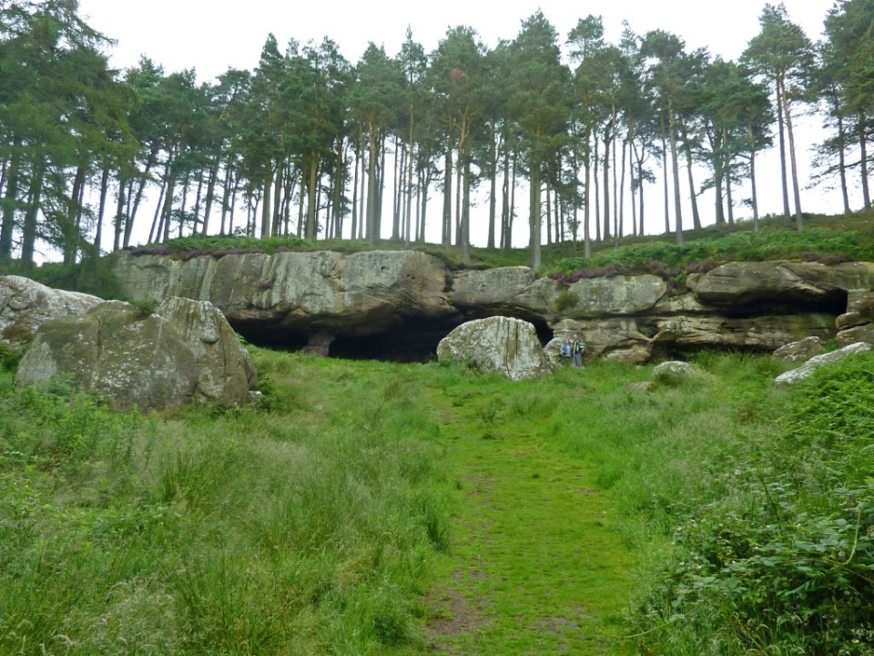
i decided to do it over 3 days and left home early on a Sunday morning to get the train up to Berwick-upon-Tweed arriving there just after 11am in the morning, you need to book a space for your bike in the goods wagon as there was only hangers for 3 bikes on the service i used. After a quick look around Berwick i headed down to the river and the bridges across the Tweed and found the official start of the Sandstone Way, right next to the Youth Hostel. The first 10 miles or so follows the coast and cliff tops and is fairly flat before gaining height as it skirts the edge of the Kyloe Hills to Detchant, here you turn right for a hilly section around Greensheen Hill. I saw quite a few hikers on this section who were doing St Cuthberts Way, a long distance trail (62.5 miles) between Montrose and Lindisfarne. The bike route then descends and passes very close to St.Cuthberts Cave, an impressive sandstone feature and well worth a short detour. Quiet roads take you past the craggs at Bowden Doors, then through Chatton and Chillingham before an energy sapping grassy ride up to the transmitter above Wooler, you get a good view of the town from up here and today the annual Glendale Festival was on and the main road through Wooler was shut and live music was being performed on a stage and there was a party atmosphere in town. I was booked into Wooler Youth Hostel.

The Sandstone Way start in Berwick-upon-Tweed

The Sandstone Way start in Berwick-upon-Tweed

A nice feature about the Sandstone Way is that at certain points it offers a choice of routes, these could be used for day loop rides or bad conditions alternative or simply a more challenging option. The biggest route choice occurs on leaving Wooler, the normal way heads south to Alnham via Ingram and is waymarked with the familiar green roundels  while a much more adventurous option heads south-west and into the heart of the Cheviot Hills and is not way marked at all – this is the way I went. The weather was good, a little windy but visibility was good, I took the precaution before I left of packing the OS 1:25000 map of the Cheviots and a compass and I’m pleased I did, a lot of the time there was a recognisable bridle way trail to follow but at other times it petered out to nothing and I was left scratching my head as to which way to go, sometimes having to bushwhack and push the bike over some very rough ground on a compass bearing to try and pick up a trail again. It was quite a relief to finally emerge at Alnham and pick up the normal route again. I finally arrived in Rothbury just after 5.00pm and made my way to Tomlinsons Cafe down by the bridge, which has a rather nice bunkhouse attached to it and has the added bonus of being right on the Sandstone Way route. I was surprised to find out that there was only one other person booked in that night.

Day three dawned nice and sunny and I was on the road again by 8.00am as it was going to be another tough day to get to Hexham, about 49 miles away. It’s quite a hilly start to get out of Rothbury up to Sharpe’s Folly tower before a flatter section and a short downhill to get into the forest, from here it’s a long steady climb up to the foot of Simonside Craggs on a wide, stony forestry track with good views over to the Cheviots, shortly afterwards the track finally starts heading downhill and it’s a fast ride for several miles through Harwood Forest until you arrive at the Elsdon road where you turn right and are soon going downhill passing Winter’s Gibbet on the left hand side. As you approach West Woodburn another one of those route choices appears, conditions were good and I was doing ok time-wise so I chose the more challenging option involving a steepish climb up an old road to a green lane route.

The finish in Hexham next to the golf clubhouse

The finish in Hexham next to the golf clubhouse

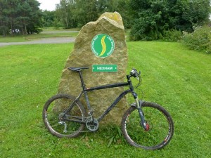
This grassy and rocky lane was very well-defined at first but after a dip halfway along it seemed to disappear altogether and I just headed for a small forestry plantation visible in the distance (see photo below) and was relieved to pick up the green way-markers again to Bellingham where I stopped at the bakery to refuel. Leaving Bellingham it’s another stiff climb leading up to the transmitter above Shitlington Crags and then some tricky route finding as you cross first Houxty Burn (there is a bridge to your right!) followed by Wark Burn. A roller coaster road section leads to a nice off-road section into Simonburn, which has a cafe if you feel the need. Another stiff road climb takes you up to Hadrian’s Wall at Black Carts, then it’s across the fields dropping down to the South Tyne at Fourstones where one last climb takes you up Warden Hill before dropping down to cross the river and the route follows the railway line into Hexham and the Sandstone Way’s marker stone near the golf clubhouse, arriving at about 5.00pm. The railway station is not far away and I was on the train with my bike going home before 6.00pm. I had enjoyed my time doing the Sandstone way and found it a worthwhile challenge and certainly would consider doing It again sometime, maybe taking two days now that I know the route, going from Berwick-upon-Tweed to Rothbury in one day (and sticking to the signposted normal route) then Rothbury to Hexham the next day.

And finally, already done this ride? Maybe found using a bike a bit tame?  Then how about running it?  check out the Sandstone Way Ultra  There is a good route guide PDF file available here too.

Etape du Dales 2016

The Etape du Dales sportive is an event I have wanted to do for a long time, I have cycled many times in the Yorkshire Dales and knew the route well but have never previously linked it all up. This year the omens were lining up nicely, the race date coincided with my weekend off and more importantly the legs were in reasonably good shape from all the training we had been doing for the Mallorca 312 event at the end of April, so after a quick check online to see if spaces were still available, I entered. The Etape is 110 miles long and has about 3500m of climbing in it. According to Wikipedia the Etape was started as an alternative to the regularly oversubscribed Fred Whitton Challenge (112 miles, 3950m climbing) over in the Lake District and while it may lack the horror of being faced with a climb as steep and gnarly as Hardknott Pass after already cycling a hilly 100 miles, the Etape is still a significant challenge for most cyclists, with several long, tough, climbs. The ride features 8 climbs.

  1. Fleet Moss
  2. Buttertubs
  3. Turf Moor
  4. Tan Hill
  5. Mallerstang
  6. The Coal Road
  7. Dent Head viaduct
  8. Dale Head

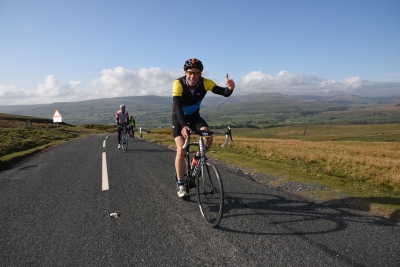
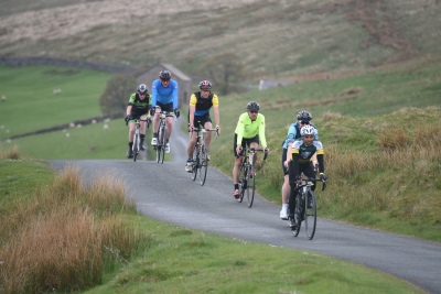
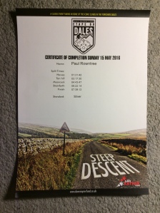
imageThe event starts at Wharfedale Rugby Club in Threshfield, very close to Grassington. I drove over here late on Saturday afternoon, the day before the event, to register and to get familiar with the layout and then had a wander around the attractive cobbled village square in Grassington with its numerous cafes, pubs and shops. After this I drove over to Kilnsey and had a meal in the Tennants Arms Pub, the barman recommended a special on the fish and chips, he said it was quite substantial and he wasn’t kidding, the fish must have been at least 18 inches long, even a couple of locals kept glancing over to see how I was getting on. The plan had been to find a campsite nearby but it was such a pleasant and calm evening I decided to find a quiet bivi spot instead and sleep out in the open. Once the sun went down it did get chilly, down to 1 or 2 degrees but tucked up in a warm sleeping bag inside a gore-tex bivi bag I was comfortable and was treated to a calm starry night. After a restless night (I never seem to sleep well before big events) I was up at 5.00am for a breakfast of muesli and coffee before packing all the gear away and then driving the 10 minutes or so to the start of the event, the marshals were already in place directing the cars into adjacent fields for parking. After reassembling the bike from the car and attaching the race number with its integrated timing chip, the next major decision was what to wear….. It was still rather chilly but everyone seemed to agree that the weather was going to be ok, dry with light winds and sunny, so I set off with a gillet, arm-warmers and gloves and crossed over the starting line, which made a reassuringly large beep sound, at about 6.40am. You can start the challenge at anytime between 6.30am and 9.30am and with over 1000 entrants it’s a good way of spreading the cyclists evenly over the sometimes narrow country roads. The first few miles up to Buckden are quite flat and a good opportunity to find a group of cyclists going at your own pace, at Buckden you turn off left to Hubberholme and Yockenthwaite along a beautiful valley and today the cyclists had it all to ourselves as the road was closed to vehicles as they were repairing the damaged road from the previous severe winter. It’s a gentle climb mostly until you reach Oughtershaw, there the first test of the day starts, the climb of Fleet Moss, even though this is from the “easy side” it’s still a long tough climb. About half way up i came across a cyclist who had snapped his chain and was asking passing cyclists if they had a chain tool, as it happened i did so i loaned it to him and carried on hoping to be reacquainted with it someday! From the top of Fleet Moss it a terrifyingly fast descent down to Hawes and you could certainly break your personal speed record down here, as well as your neck probably if you came off, I like to keep it below 40mph though and keep the wheel wobbles under control. After passing through Hawes main street you turn left on the Sedbusk road and arrive at the first feed station (22.5 miles).image Feeling good at this point and with plenty of fluid in my bottle I didn’t stop for food and just passed over the timing mat and continued up the road heading for the next big obstacle, the climb over Buttertubs, going in the same direction as the Tour de France riders went back in 2014, this is the easiest direction but the 17% climb up to the cattle grid certainly gets the heart rate soaring, once over the grid however it’s a steady climb and not too bad and I was treated to lovely weather, beautiful views and another blistering descent towards Swaledale where the route turns right and it’s a fast run down to Gunnerside and onto Low Row, here you turn left onto a steep side road that links Swaledale with Arkengarthdale. This small side road is the start of the climb of Turf Moor and it was the only section of the route that i hadn’t done before (the bit leading up to the ford). From the main Swaledale road I have often glanced up when passing and thinking, crikey that looks a bit steep, and once on it, it didn’t disappoint, it has just recently been resurfaced with loose stone chippings which made things interesting, once past the cattle grid it eases off a little but is still quite tough. Eventually you drop down to the infamous ford at Surrender Bridge, where a small stream, maybe 2 metres wide and a few centimetres deep, crosses the road, the problem is that the surface underneath the stream is covered in very slippery green moss, I had done a mountain bike route up here previously with a friend and we tried to ride through it and before we knew what was happening we were both lying in the water, so today i unclipped and used the little footbridge to the right. Apparently during last years event there were about 20 bathers…. After a steep but thankfully short climb away from the ford it’s a fast downhill section to Arkengarthdale where the route turns left and heads north-west for about 8 miles to the pub at Tan Hill, it’s a steady climb most of the way but the road is very exposed to the elements and if there is a head wind it can be a tortuous section. The second feed station was located outside this iconic pub (47 miles completed) and was well stocked with energy drinks, sandwiches, fruit cakes, bananas and boiled potatoes, all of which went down a treat. The route then turns left and it is another fast descent down Stonesdale Moor with a couple of technical hairpin bends at the bottom to keep you on your toes before you turn right on the undulating road through Birkdale which eventually climbs up to the border between the Yorkshire Dales and Cumbria before yet another blisteringly fast descent all the way down to Nateby. Here you turn left and begin the long drag up Mallerstang past Pendragon Castle and up past the viaduct at Ais Gill, the high point on the Settle to Carlisle railway line, before eventually you swoop down to the third feed station at the Moorcock Inn (69 miles). imageI had been feeling pretty good on this ride so far and had been pushing quite hard on the climbs but on that last climb up to Ais Gill, while standing up on the pedals I started to get little twinges of cramp in the front of my thighs, this seemed to go away when I sat down again but I was worried because I knew full well what was coming next….the crux of the whole ride, the long steep climb of the Coal Road. From the Moorcock Inn you turn right along the B road through Garsdale then turn off left and climb steeply past the railway station of Garsdale Station, from here the road curves to the right and gets even steeper through the plantation, I was in serious trouble here, because as soon as I stood up on the pedals I got painful cramps in the front of my thighs so was forced to sit and slowly grind away but I could feel the energy slowly draining away but I was determined to keep pedalling and get past the steepest bit, at last the gradient eased a little and I tried standing up again to stretch my aching legs out but again I got cramps straight away, so I was forced into more slow, painful, grinding all the way to the very top, what a relief it was when the road finally flattened out and I began the long technical descent past Dent Station and the hairpin bends to the t-junction at the end. Here the route turns left and follows the stream for a while as it flows over great slabs of limestone, the road then starts to ramp up as it approaches the Dent Head Viaduct and then gets even steeper and turns into quite a vicious little climb which had me zig-zagging across the road and I was mightily relieved to get past it and I knew that once back on the B road the next few miles down to Horton in Ribblesdale, via the Ribblehead Viaduct, would be a lot easier and fast, even with my tired legs I made good progress. imageAfter Horton the route continues down to Stainforth where you turn left and is the location for the fourth and final feed station at 90 miles completed. Straight out of the village you are on to the final big climb of the day up Silverdale to Dale Head, the hardest bit is at the bottom where the road ramps straight up, levels off, then goes up again, once over this I found, much to my surprise, the rest of the climb was ok and as you draw level with Pen-y-Ghent on your left all major difficulties on this ride are over and the last few miles are a pure joy, you are on a narrow strip of Tarmac going through some stunning scenery, the last descent is another fast one down to Halton Gill where you turn right and can zip along the narrow lanes of Littondale at a cracking pace, through Arncliffe to join the B road that goes past Kilnsey Crag and into Threshfield, here a couple of left turns take you back to the pot-holed lane that leads down to the Rugby Club and the Finishing line. All the riders were entitled to a free meal in the rugby club house, I went for the pork pie and mushy peas and a cup of coffee all of which tasted delicious, in the mean time my finishing certificate was being printed off with my times through all the feed stations printed on it. My time for the ride was 7 hours 38 minutes which considering the difficulties I was having from 70 miles onwards I’m pleased with, with hindsight I now realise that I was pushing too hard on the Buttertubs, Turf Moor and Tan Hill sections and paid the price later on, maybe a more even pace/effort strategy would have got me closer to that much sought after gold standard, especially as the conditions on the day were almost ideal, with a new course record being set by Thomas Denwood from Harrogate Nova, beating Malcolm Elliot’s 2010 time and stopping the clock at a very impressive 5 hrs 40mins 32 seconds.

  • Gold : less than 7 hours.
  • Silver : less than 8 hours.
  • Bronze : finishing inside the cut-off time.


Mallorca 312, April 30th 2016

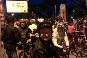
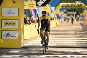
imageThe Mallorca 312 cycle sportive is an annual event that starts in the north-east of the island at Playa de Muro near to Alcudia. The route goes anti-clockwise around the circumference of the island passing through the beautiful Tramuntana mountains to Andratx then onto Palma, Colonia Sant Jordi, Porto Cristo, Arta and finally back to Playa de Muro, a total of 312 km. Or at least this is what we expected the route to be when me and my friend Brian entered the event and booked flights and hotels six months prior to the event. In April however, all the entrants got a surprise email outlining a big change to the route, it would now be confined to the mountainous northern part of the island and there would now also be a choice of three routes, 167km, 232km and 312km. Also the event would now take place on roads closed to other traffic. This was to be the 7th edition of the event, it was first held back in 2010 when a total of 199 riders set off round the island, this years entry was 4400 (with several hundred more on a waiting list). In a way the event has become a victim of its own success, with the organisers coming under pressure from the Police and authorities to make it easier to control and safer for the riders involved, hence the unexpected late changes to the route. We flew in 5 days prior to the event, which was enough time to get some good rides in and explore the island without exhausting ourselves before the big day.

Mon 25th April  An early flight into Palma airport gave us lots of time after the transfer to our hotel in Port d’Alcudia. Our hire bikes were ready and waiting, we both opted for a Canondale Synapse, I chose the version with disc brakes and electronic Di2 gears and Brian opted for one with standard mechanical shifters and brakes. After setting the bikes up we headed out for the traditional first day out ride, to Cap de Formentor, ” the lighthouse ride” a very scenic road along a peninsula with stunning sea views and one of the best rides on the island. 60km ride.

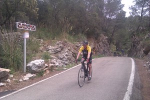
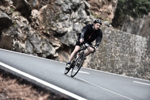
imageTues 26th April  A big day out. We pre-booked places on the Mallorca Cycle Shuttle that leaves from Port de Pollenca and takes cyclists and their bikes to either Soller or in our case Andratx, leaving them free to cycle back to our hotel along the beautiful Ma-10 road through the mountains and along the coast line back to Pollenca. We needed an early start to grab some breakfast and cycle the 8km or so to meet the bus at 7.30am and we were treated to a beautiful sunrise as we rode along Pollenca Bay road. The shuttle bus takes about 90 minutes, along the motorway towards Palma and through the busy early morning rush hour traffic before dropping us all off in a quiet back street in Andratx, right next to the Ma-10. The weather was good all day and we got to see this beautiful route at its best, the climbs are never that steep but are long at times and care is needed on the fast twisty descents. We made a small detour to visit the beautiful bay of Port de Soller, had a coffee and mentally prepared ourselves for what was coming next…. The 13.9km climb up to the Monnaber tunnel on Puig Major, the longest climb on the island. From this high point Port de Pollenca is about 40km away and most of it is downhill with only a couple of shortish climbs to slow you down, at the Port we called into Tollo’s bar and restaurant for a beer and had a look at Wiggo’s world time trial and Tour de France race bikes which hang from the ceiling. We finally got back to our hotel at 7.00pm tired but happy. 142 km ride.

Wed 27th April  After a short lie in to recover from yesterday’s hilly ride we had a look at the map and decided to do the last 80km section of the Mallorca 312 route from Playa de Muro that makes a loop to Arta before heading back to the finish at Playa de Muro. We stopped off in Arta for some lunch in one of the restaurants in the pleasant town square, it took us a while to locate the square through all the narrow alley ways and one way systems but it was with the effort. On the way back we checked out the beautiful beaches and sea front at Can Picafort.

imageThurs 28th April  We awoke to the sound of steady rain and a chill in the air, so after a relaxed breakfast we decided to check the hotel gym out for an hour and done some gentle weights and rowing, followed by a few lengths in the outside swimming pool, an experience that can be best summed up as bracing. After an early lunch the weather was much improved and we headed out for a ride along the Ma-3433 to Sa Pobla, Muro and from Santa Margalida picked up the Ma-3400 to join the Arta road that headed back to Alcudia, about 50km or so. The expo for the Mallorca 312 event was already up and running at Playa de Muro and we called in hoping to pickup our race pack and event race shirt, but there were big queues for everything so we went back to the hotel instead. Later on that night we got the bus back to the expo and got our packs no problem, even the race shirts fitted. We celebrated with an “Indurain” burger (recommended) at the Bike Point Cafe next door.

Fri 29th April  The day before our event so no heroics on the bike today, instead we had a very relaxed ride out in the warm spring sunshine. We headed along the Ma-3433 to Sa Pobla again but this time followed the signs to Buger along lovely quiet lanes and onto Campanet. Here we turned right and headed down to the very old and beautiful church of Sant Miguel and made a short detour to have a look inside and chat with a woman who was a guide or guardian of the church. Back on the bike we headed down the quiet pot-holed country lane and were amazed by the hundreds of cyclists constantly coming the other way, probably heading for the Coll de sa Batalla and beyond. We turned left along the much busier Ma-2200 and followed this all the way to Port de Pollenca where we found a nice quiet bay front restaurant and filled ourselves with pasta, after this feast we crossed over the road on to the beach and relaxed on the sand for an hour, before completing our ride along the bay road back to our hotel in Port d’Alcudia. 60km ride approx.

imageSat 30th April   Mallorca 312 day!   The alarm went off at 5.00am, giving us plenty of time for a good breakfast as it was going to be a long day. All the weather forecasts seemed to vary in details but one thing was certain there would be rain and sure enough as we cycled the 20 minutes or so to the start outside the Iberostar Hotel in Playa de Muro we felt the first drops, cyclists were appearing from everywhere and hundreds were already lined up at the start a good 45 mins before the official start at 7.00 am. The rain got heavier as we waited and there was an air of excitement and anticipation as we chatted and watched the clock tick down. It was good to get moving and the wide closed roads at the start allowed people to quickly find their own space and tempo. The first obstacle of the day was the Coll de Femenia, then up to the aqueduct and the tunnel that leads to Gorg Blau, the blue lake, where the first watering station was located, more climbing leads to the Monnaber tunnel and the start of almost 14km of fast downhill road. In the dry and especially with closed roads, this would be a blast, but today the roads were very wet and at times the mist was quite thick. I found this to be a nervous descent and I saw one guy getting tended too at the side of the road with his head covered in blood. It was a relief to finally hit the outskirts of Soller and begin the climb up to the Coll de ca’n Bleda, however just over the top of this climb as we started to go down again I came off. There were three of us in a line, the first guy went down braking on a slight bend, the second guy squeezed his brakes to avoid him and he came off too and as soon as I braked I was off too, the road was really greasy in the wet.image Physically I was ok, just cuts and bruises down my left hand side, (plus a hole in my new bib-shorts!) but the impact on the bike was on the left hand brake hood and I soon found out that I was unable to shift from the small chain ring to the large one (the hire bike had Di2 gearing – so I guess a wire or contact had come loose in the crash). I was gutted at the time and thought that this would really slow me down but in reality the route was so hilly it didn’t have such a big impact and it was only at the end when the roads flattened out a little that I felt I was being held back by the lack of faster gears. The first feed station was after 94km at Nova Valldemossa but when I got there I was told they had ran out of food…..Just drinks and oranges left! After a couple of minutes chomping on orange segments, Brian pulled in and he told me he had also come off his bike in a similar incident to mine. He was going downhill following someone, they braked and slid off and as soon as Bri touched his brakes he came off too. Fortunately he was ok but now we both had matching holes in our shorts. Conditions however were improving rapidly and the roads were drying out quickly and the rain jackets and arm warmers were stashed away for the rest of the day and we could enjoy fully the fantastic sea views on this elevated roller-coaster of a road. We dropped down to Andratx and started heading back to the finish direction over a series of long hill climbs, never that steep but a lot of them were several kilometres long. The next feed station was after 143km at Galilea and thankfully there was plenty of food this time and we got our fill here. The last long climb was over the Coll des Grau and after this the terrain got noticeable easier and faster and we managed to tag onto the end of a peloton and the kilometres were starting to go by much quicker but just as we were closing in at the feedstation at Biniamar at about 190km, Brian had a major problem with his gears, he was the unable to shift the chain up the cassette and was stuck in the smallest sprocket and with tired legs was reduced to walking up anything remotely steep. imageWith the cut-off time of 5.30pm getting nearer I pressed on hoping to be able to do the full 312km and i teamed up with a couple of others hoping to do the same, but time was against us and we rolled into the Playa de Muro finish line with the way to Arta blocked off, I had missed the cut-off. Initially I was disappointed, I had wanted to do the full 312km but that feeling didn’t last long, it had been a long eventful day which I had greatly enjoyed. I grabbed a free beer and tried phoning Brian to see how he was getting on but got no answer but then a few minutes later I saw him near the finish line, he had battled on gamely with his now single-speed bike and finished the 232km route in good style. As we stood chatting near the finish line a camera crew approached us, the interviewer asked Brian to sum up the event in one word and after a couple of seconds thought and with a flourish he said “Magnifico!” And that sort of perfectly summed up not just our day or even our week but the also the preceding 6 months, because the Mallorca 312 had been our motivation to get out on the bike early on a Sunday morning, sometimes in not so good weather, to get some miles in the legs and prepare properly for this demanding event, it’s good to have something to train for…… We may just have to come back next year and complete it…. The organisers even put Brian on the official you tube video!

Calpe – Cycling in the Spanish Costa Blanca

Calpe beach and the Penon de Ifach rock

Calpe on the Spanish Costa Blanca is a great location for a cycling winter training camp. While Northern Europe endures harsh winters, the climate here seems to be always spring or summer with temperatures ranging from 15 to 20 degrees celsius. Also, apart from the busy coastal roads linking the big resorts, once you turn inland the roads become very quiet and mountainous without being too steep or too long. Having a large international airport at Alicante (about 50 miles away) is very useful too, as is the plentiful supply of cheap, good quality hotels and restaurants, add to this mix the frequently spectacular mountain and coastal scenery and it is easy to see why this area has become so popular with the professional cycling teams and amateurs alike. I stayed at the Hotel Porto Calpe located as the name suggests right next to the fishing port and harbour and very close to the impressive Penon de Ifach – the huge limestone rock outcrop which is a symbol of the whole Costa Blanca region.

Mon 8th Feb  After an early breakfast i got my cycling kit on and took a 20 min brisk walk along the very pleasant sea front promenade right into central Calpe to pick my hire bike up from SolyBike , a carbon framed Orbea Orca. After filling in the paperwork and setting the bike up, I set off on my ride, I thought I was heading for Guadalest,  in fact I was on the right road but going in the wrong direction and ended up in Benissa instead, here I was helped on my way by a very pleasant Dutch cycling couple who suggested turning left and heading for the Coll de Rates instead, which turned out to be an ideal first ride. The Coll de Rates is probably the Costa Blanca’s most famous climb and once I got near the start cyclists started appearing from all directions. At the top of the Coll there is a good restaurant with spectacular views from the terrace of the surrounding area, it was here that I got chatting to a Belgium cyclist called Steven and we agreed to team up together for a ride tomorrow. (46 mile ride).

Guadalest

Tues 9th Feb  After an early breakfast in the hotel again I rode up to the busy coast road (N-332) and met Steven outside of the place he was staying. We were heading for Finestrat to do the Guadalest loop. We went through Altea and kept on the N-332 to more or less opposite Benidorm, then turned right to Finestrat, from now on the roads were very quiet but also started heading uphill, steeply at first before settling down to 4 or 5% average. We passed through Sella and after a long climb, up to the highest point of the day – Puerto Tudons at 1020 m high before descending rapidly to Alcolecha where we stopped off at the cafe for a meal. The next high point was Puerto Confrides (966m) followed by mile after mile of spectacular mountain roads down to Guadalest and beyond. We stayed on the CV-755 passing through Collosa until we hit the busy coast road again for the climb back up to Calpe. (74 mile ride).

Wed 10th Feb   An easier ride today after yesterday’s mountain adventure, headed north on the coast road in the direction of Moraira before turning left for Benissa, I wasn’t expecting such a long climb going this way before dropping down to the town of Benissa and carrying onto Senija and Lliber where I tried to find the road that heads up the Bernia Coll, however I couldn’t find the right road (my map was a bit vague on detail). Eventually I gave up looking and doubled back to Benissa and headed back to Calpe via Teulada, Benitachell and Morairi. (42 mile ride)


Beautiful roads heading for Vall d`Ebo

Thurs 11th Feb   Met Steven again on the coast road at 9.00am for another big ride in the mountains. We climbed up the N-332 main road to just before Benissa and turned off left to Jalon, Alcalali and Parcent for the steady climb up smooth roads to Castell de Castells alongside the dried up river bed down below us, we then had a restaurant stop in Facheca. before joining the beautiful CV-712 road that headed for Vall d’Ebo and climbed up to the high point before the wonderful hairpin-laden descent with great views all the way down to outskirts of Pego, here we turned right to Sagra, then through Orba and back to Parcent. We had a coffee and cake here and sheltered from a brief rain shower before the ride back to Calpe via Benissa. (78 mile ride).


Almond trees and mountains

Fri 12 th Feb   Rode up the Benissa road again, just before the town i turned left and headed up to Pinos and continued up to the Bernia Coll which was a lovely quiet road, quite rough in places but very scenic too. The gradient was quite gradual for first half but certainly ramped up quite a bit for the top section. At the top I turned right and it was another stunning descent all the way down to Jalon. Turned left here for Alcalali and Parcent and climbed up to the Coll de Rates again and stopped off at the cafe for soup and coffee. From the Coll I continued on the road descending and climbing up to the small village of Tarbena and turned right here for the lovely road that goes to Castell de Castells. I turned right here and managed to tag onto the back of a passing peloton for a very fast 12km back to Parcent, then back to Calpe via Benissa again. (67 mile ride).

Sat 13th Feb   Had to get the bike back to the shop for 2.00pm today (early closing day), which  was good because the legs were starting to feel it by now, so headed north on the coast road to Morairi, Benitachell and onward to Javea in windy conditions before heading back to Calpe. (37 mile ride).

Roadtripping Calpe  is a great website which captures the beauty and excitement of cycling around Calpe with some stunning photos and some great insights and a good video at the end.

Cycling locations is another very useful source of advice and information about cycling in the Costa Blanca.