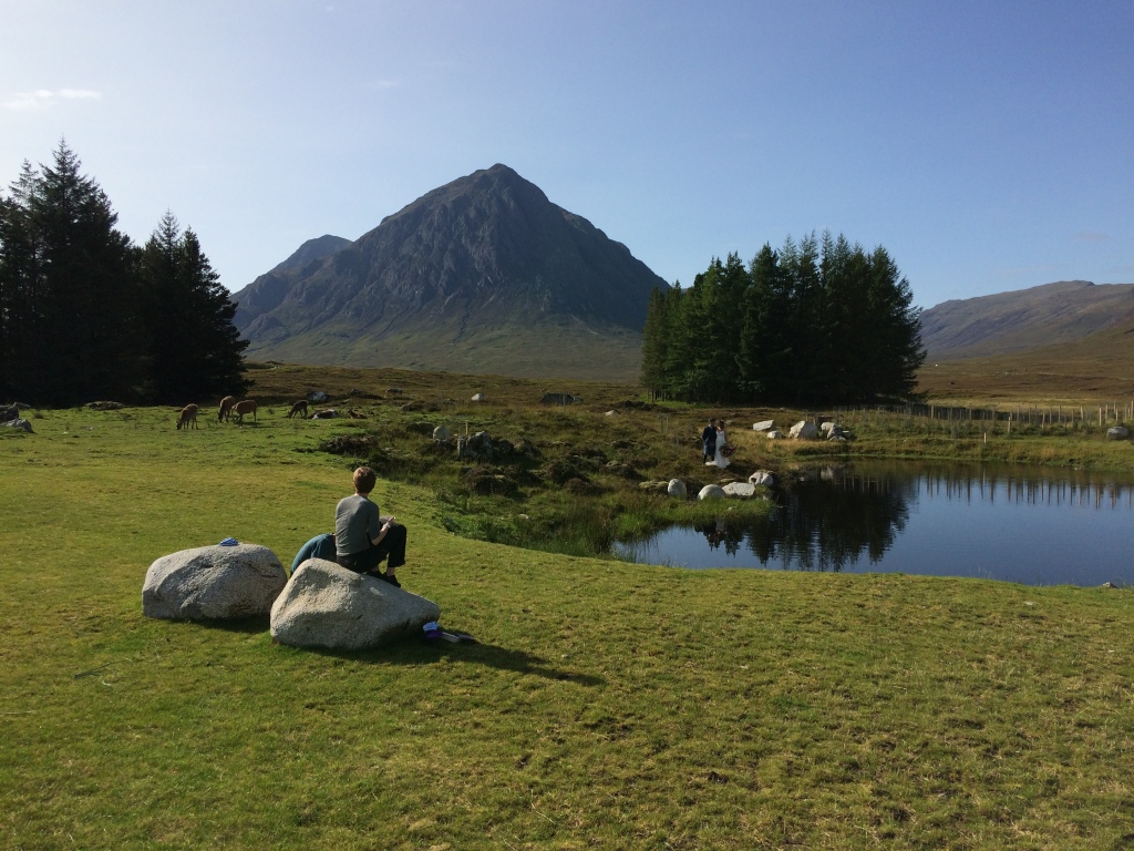
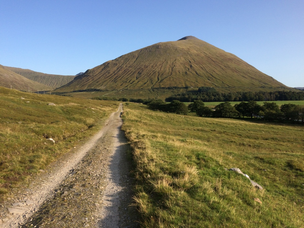
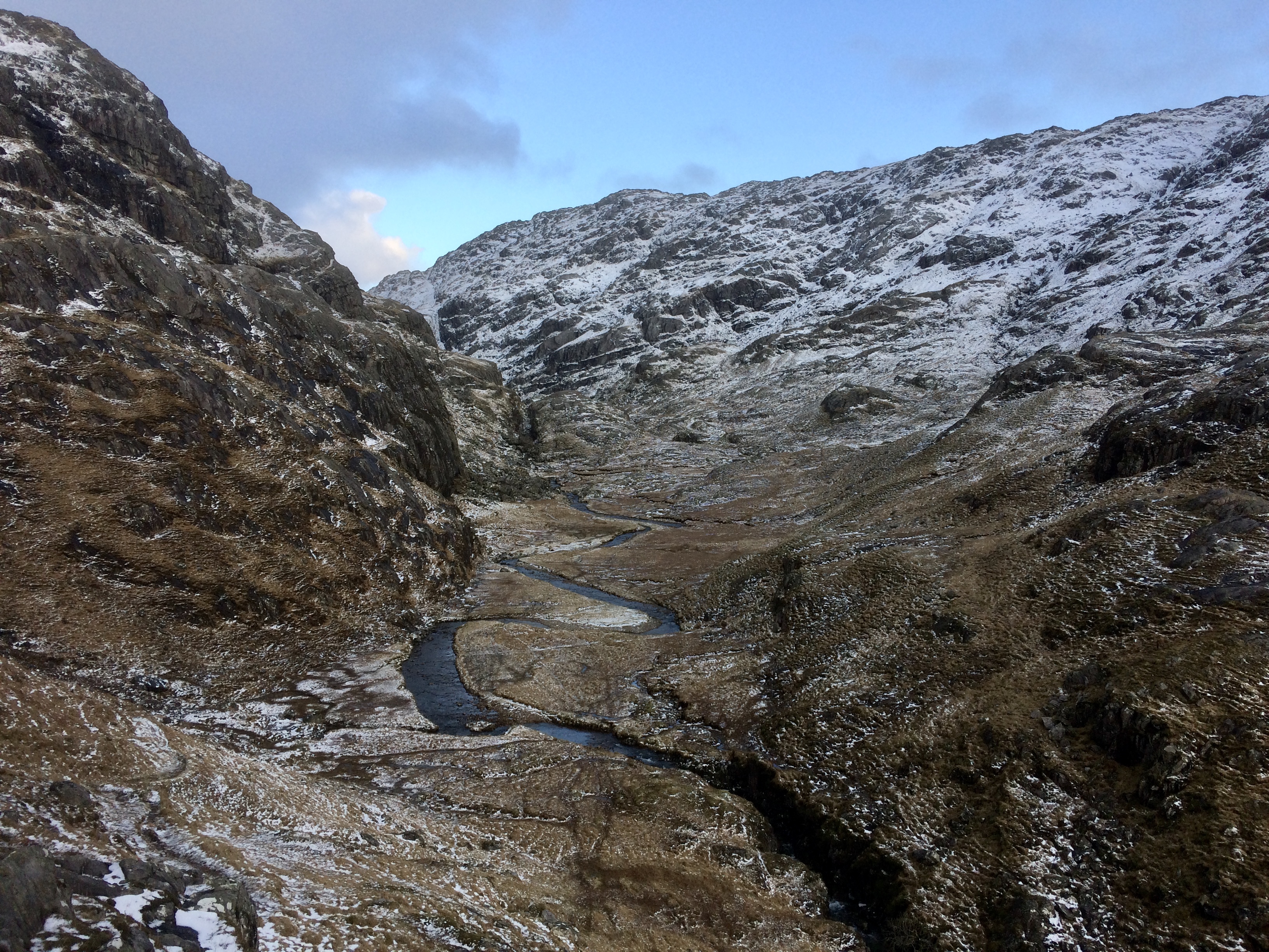
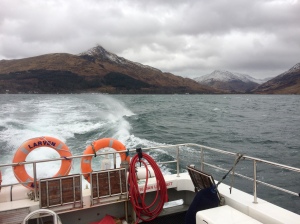
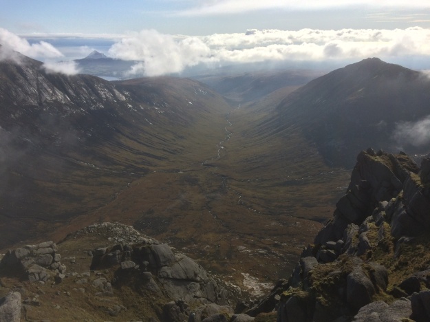
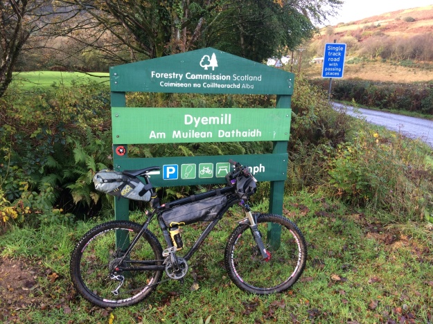
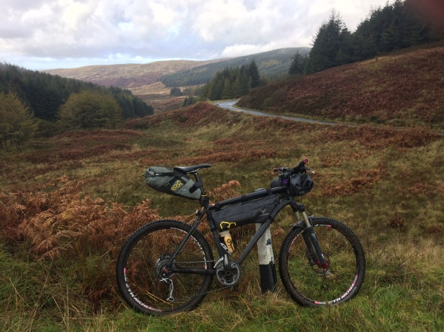
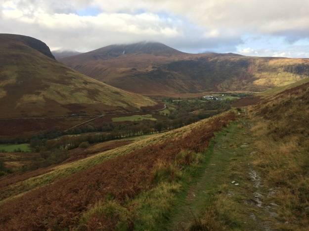
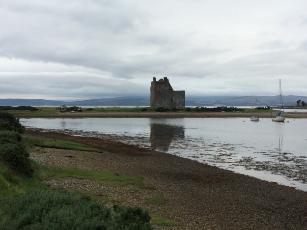
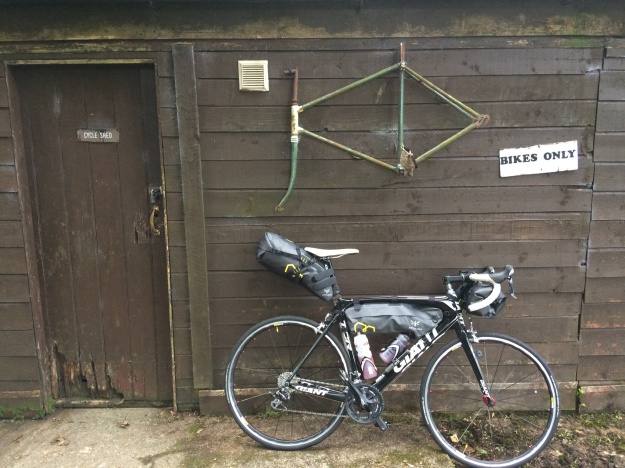
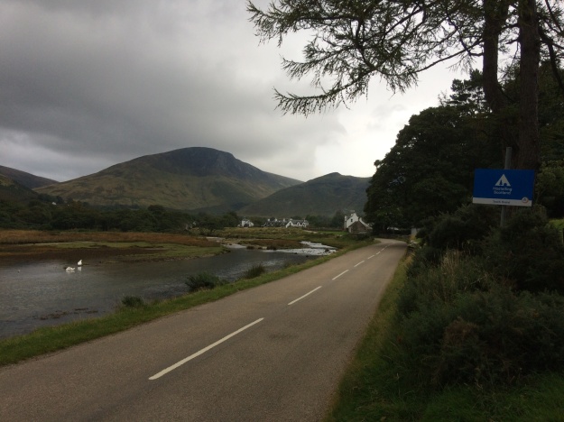
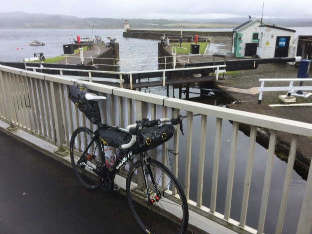
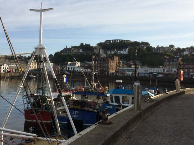
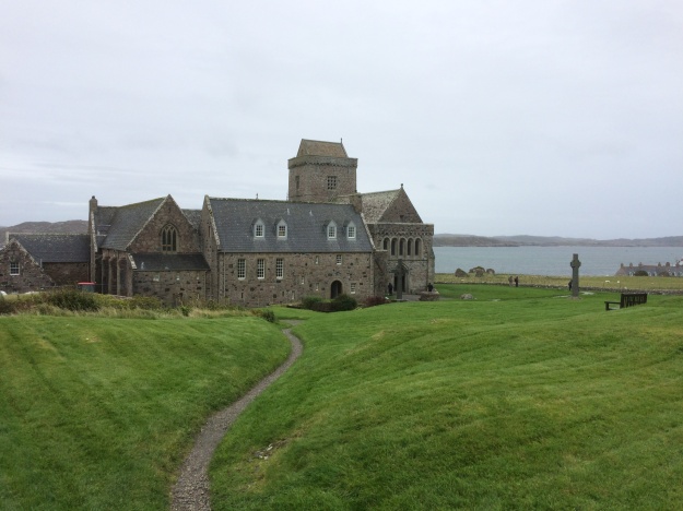
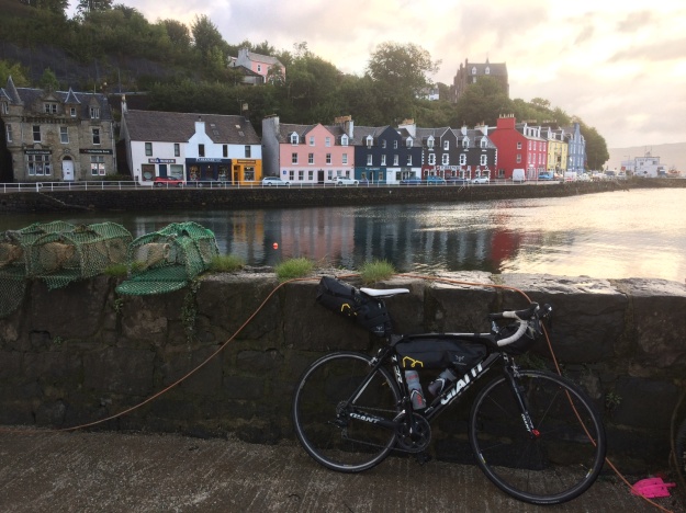
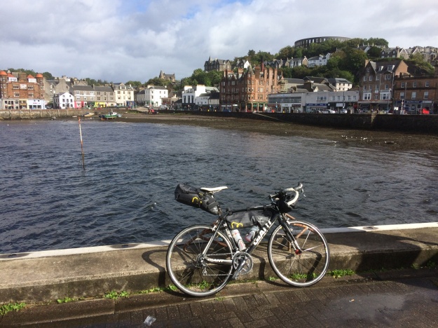
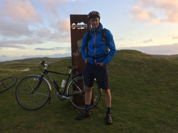
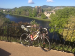
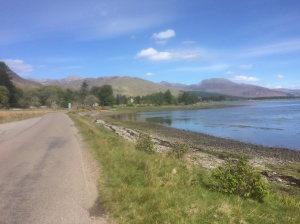
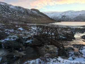
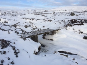
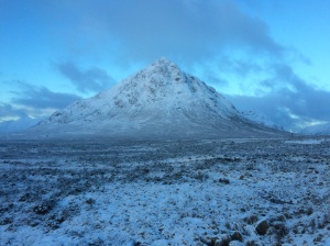
Sometimes the best adventures happen by chance….I had been keeping this week free as my sister and her family were planning on the long journey up from Kent to visit us, however just days before setting off, my young nephew tested positive for COVID and everyone had to isolate… I didn’t want to waste this week off, so I hastily started gathering my bike packing stuff together and gave the mountain bike some much need attention and made sure my tubeless tyres were topped up with fresh sealant. With not much time to plan I decided to go some where familiar and so made an early morning start for the 6 hour drive North up to Tyndrum in Scotland and parked up at the Green Welly shop, a familiar landmark on the busy A82 road to Glen Coe and Fort William. After an hours faffing around in the carpark, the bike was back together again and the bags strapped on, clothing and food decisions were made and I was off riding by noon. The weather was still glorious if a little breezy but this was to be the last day of the heatwave…the plan was to check out Glenkinglass, a well known and popular off road cycling route. From Tyndrum it’s an easy ride North following the West Highland Way and crossing the A82 at Bridge of Orchy, then along the very quiet road to the Inveroran Hotel. I had passed here many times before but never called in, this time I couldn’t resist and had a very nice pint sitting outside in the sunshine. Refreshments over I continued over the Victoria Bridge and turned left at Forest Lodge and headed west along the Abhainnn Shira, it would be off road all the way now to Taynuilt. I didn’t know how far I would get today and there are loads of places to camp/ bivi along the way, but with the lovely weather and the dry conditions making the boggy bits easy, I was flying along and was really enjoying the riding and the scenery. At the mouth of the River Kinglass the track crosses the river and heads South-West following the edge of Loch Etive, the views are great but the wide track undulates a lot with plenty of stiff, short climbs and I found this quite a gruelling section, I finally rolled into Taynuilt at about 7.30pm, tired and hungry. After a quick look around I called into the Taynuilt Inn for burger and chips and a much needed pint. I was looking for a bivi site now and checked out the Old Pier area but there were already quite a few camper vans and tents down there so I continued on the Oban road for a while and turned off at Airds Bay, where I found a grassy spot next to the loch, it seemed ideal and I was soon unpacked and tucked up inside a cosy sleeping bag, inside my bivi, supping on a small bottle of whisky… however it turns out this was not a good place to stop after all… Loch Etive is a sea Loch and during the night with the tide coming in, the water was definitely getting closer… but it also was raising the water table, so everything was getting decidedly squelchy everywhere, in the end I had to retreat a few feet higher up the shore… big lesson learnt, well at least I know my bivi bag is waterproof! The next morning I was up early and away on the A85 for the 12 miles or so into Oban, passing the impressive Connel Bridge on the way, 4 miles before Oban there is a signposted way for cyclists which takes you down to Ganavan Bay and a very pleasant quiet road into town along the coast. I headed straight over to the ferry port to find out when the next ferry was leaving for Mull and bought a ticket. It was here I got chatting to Indra from Wales…. she had travelled up to Scotland yesterday with her fully loaded touring bike and had had a bit of a nightmare due to delayed trains and missed connections, which meant her bike was no longer booked onto the trains she needed to catch. Her original intention was to start her tour from Lochailort but with all the confusion she decided Oban was just as good! As we chatted on the ferry I found out her plan today was the same as mine, to cycle the southern road loop of Mull, clockwise from Craignure and maybe head for the bothy at the end….We stocked up on goodies from the little store and I left Indra to write postcards to her friends and I headed off alone on the ride, which starts off easy enough before a long steady climb up through Glen More and a fast descent down to the road junction at Loch Scridain, the last time I was here I turned left, for the long detour to Fionnphort and ferry to Iona, but today I turned right around the head of Loch Scridain for a few miles, before another steady climb takes you over to the wild feeling Loch na Keal. At the road junction I carried straight on to Salen and called into “The Little Bespoke Cafe” for a much needed toastie and coffee. Suitably refreshed I then set off to check out the nearby Tomsleibhe bothy, which was open and unoccupied… I was there just over an hour when I heard someone else arriving… I was delighted to see it was Indra and we had a good catch up of the days event and I also had the chance to check out her bike – which was a rather fine looking Dawes Super Galaxy tourer, equipped with large Ortlieb panniers, I did wonder at the time what on earth she had in them as they weighed an absolute ton….over the next few days I would find out and the answer was….a little bit of everything!
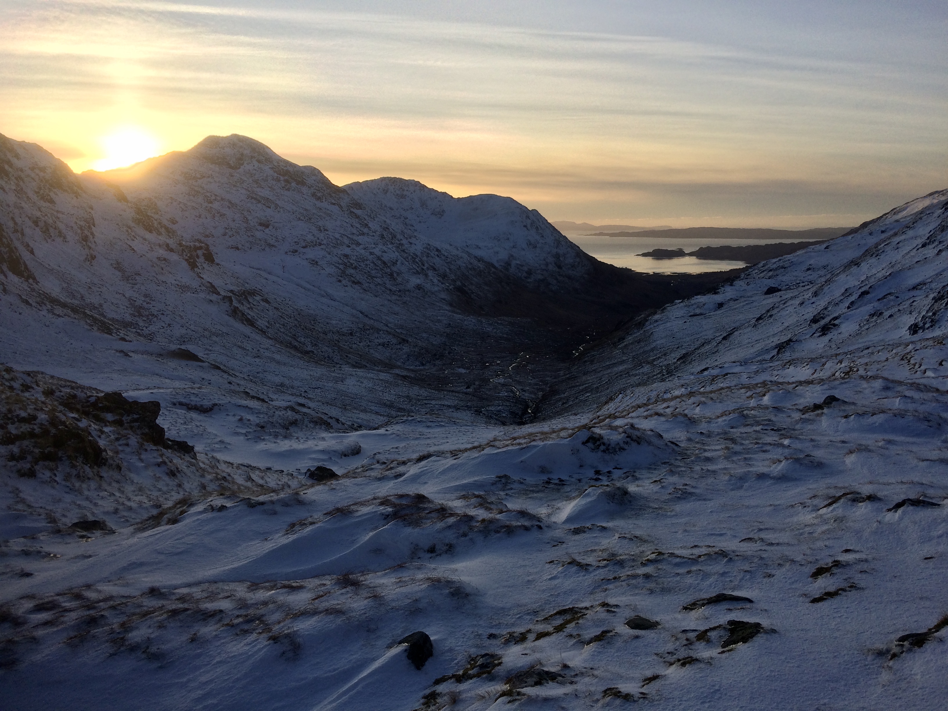
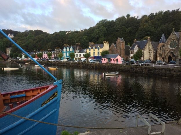
The next morning we set off in the steady rain to do the Northern loop of the island, from Salen we rode the loop clockwise along the narrow twisty roads that included several long climbs before enjoying a really fast descent down to Calgary Bay, where we stopped for some food and coffee at the Calgary Arts Cafe and tried to dry out a little. By now the weather was improving and the rain jackets were soon off as we huffed and puffed our way steeply out of Dervaig and managed to hear and spot a distant Golden Eagle. We stopped to admire the view and take some photos high above Tobermory before dropping steeply down into the colourful harbour village. We wanted to catch the ferry from Tobermory to Kilchoan on the Ardnamurchan peninsula but we were unsure of the times, so we headed down to the harbour to check the timetable, it turned out we were in time to catch the 6.00pm sailing and even had time to get some tasty takeaway fish and chips from the mobile chippy on the Fisherman’s Pier. We stood on the upper deck of the ferry for the half hour or so journey to the peninsula with the warm air from the ferry’s funnel protecting us from the cold Atlantic wind. Once off the ferry we decided that the legs still had enough energy in them to get us to the Ardnamurchan Lighthouse, 6 miles away, we were partly lured on by a sign pointing to a hotel on the way (the thoughts of pub meals and beer did cross my mind) but it turns out the hotel closed some time ago and it seems to be a community garden place now, however the lady who lived there very kindly filled all our water bottles up…..needed for the camp tonight. It was about 8.00pm when we finally got to the lighthouse and from there Indra spotted a fine looking white beach in the distance, so we headed there to set up camp, it was actually a bit trickier to get there than it looked….. and involved a tough yomp over long tussocky grass, a boulder field and a couple of small streams but it was all worth it in the end! We soon had the tent and my bivi set up, carefully avoiding the scores of tiny little frogs which appeared to be everywhere and soon the stove was purring away as the sun was starting to set and the temperature dipped. Indra muttered something about it would be nice to go for a swim and I unenthusiasticly agreed as I pulled up the zipper on my jacket and cupped my chilled hands around the stoves flame….she disappeared into her tent and a few moments later to my amazement, reappeared in a swimming costume, cap and goggles, she was going for it and no messing about neither as she ran through the sea and dived in…… to say I was impressed would be an understatement!!
The next morning we were up early and after a quick brew, we fought our way back to the road and cycled the 6 miles back to Kilchoan and called into the “Puffin Coffee” cafe for much needed coffee and sausage and bacon sandwiches, which went down a treat. Fully refreshed we set off on the 19 mile section of road to Glenborrowdale and then along the shores of Loch Sunart to Salen. Just before Salen there is a very nice sheltered bay with a little path that takes you right to the rocky edge of the Loch, here we stopped to get the stove on and made a meal, once again the lure of the water was proving too much for Indra and it wasn’t long before the swimming costumes were back on for a chilly but enjoyable 10 minute swim in Loch Sunart. Back at Salen was to be the place where we went out separate ways, Indra planned on heading North to Lochailort train station, where she would get the train home early the next day, I was thinking about heading East to Ardgour and the ferry to Corran and cycling along the A82 for a few miles before picking up the West Highland Way, which would be off-road all the way back to Tyndrum. Indra spent almost an hour on the phone trying to confirm a place on the train for her bike but with no success. Having been refused access to a train already this trip she was reluctant to head to a small station without this reassurance, so we looked at the map…after some head scratching we decided on a new plan, in a nutshell the idea now was for us both to head to Oban… (via Mull again!) from here we could both easily get to where we wanted to be. So we set off on the flat, pleasant road that skirts Loch Sunart, past Strontian and around the head of the Loch before heading South on the A884 that goes to Gleann Gael, this route has a sting in the tail though, in the form of a hill that literally goes on for miles, it was gone 8.00pm by the time we finally got to the top, once over this formidable obstacle however there are 2 fantastic warp-speed descents to enjoy… About 4 miles before Lochaline (where the ferry leaves from) with the light fading we pulled off and found a place to camp and get the stove on….it took a while before they found us but word soon got around and before long it felt like half the West Coasts population of midges had come to join the party….. Indra had a rummage in her cavournous panniers and produced some smidge and a bush hat with a midge net on, I told you she had a little bit of everything in them!
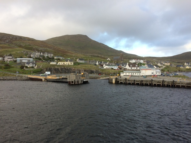
The next morning we rode down to Lochaline for the short ferry crossing to Fishnish on the Isle of Mull and had a quick bacon sandwich at the ferry cafe before cycling the 6 miles or so down to Craignure and waited for the next ferry to Oban. Here Indra met up with Ruth, another cycle tourist whom she met on day 1 of the trip and had a catch up. Back at Oban we all went for a quick meal and pint at the Corryvreken pub before dashing off to catch the same train, Ruth and Indra heading South and me getting off at Tyndrum to see if my car was still there….it had been another memorable Scottish adventure…..
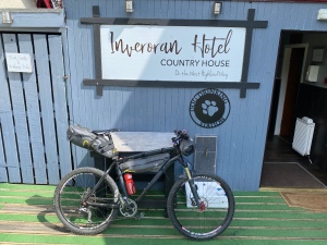
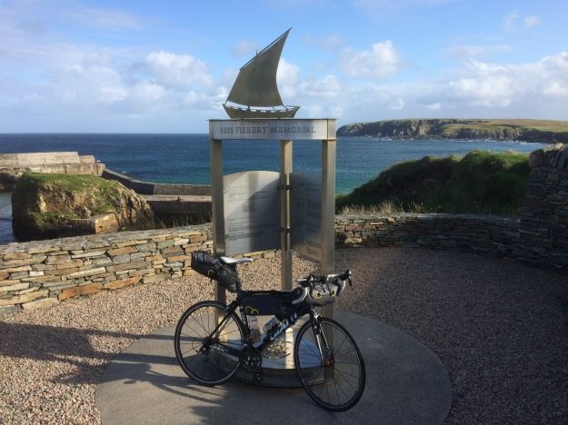
Rode past here many times but this time the temptation proved too much… 
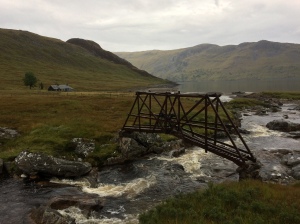
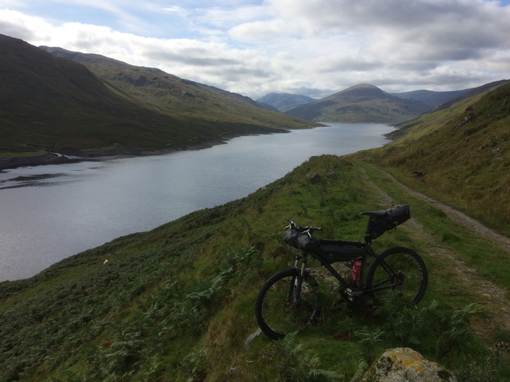
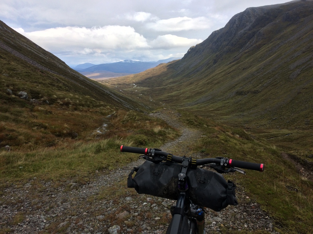
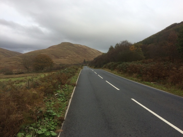
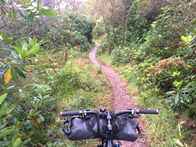
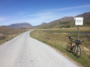
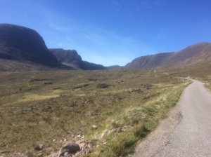
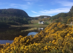
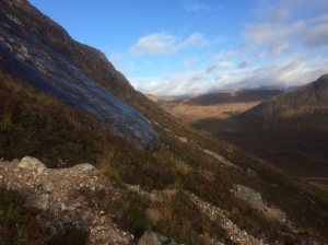
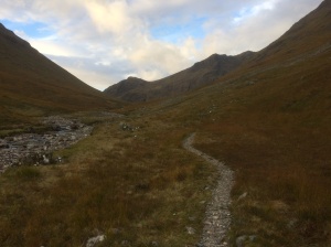
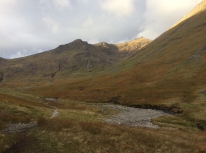
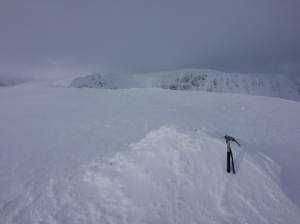
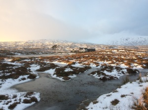
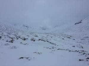
Riding West along the Abhainn Shira shortly after the Forest Lodge turnoff, heading for Glen Kinglass. 
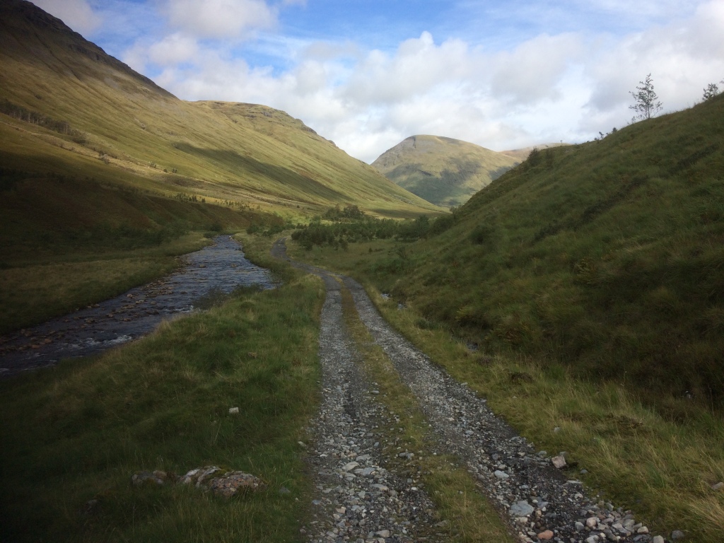
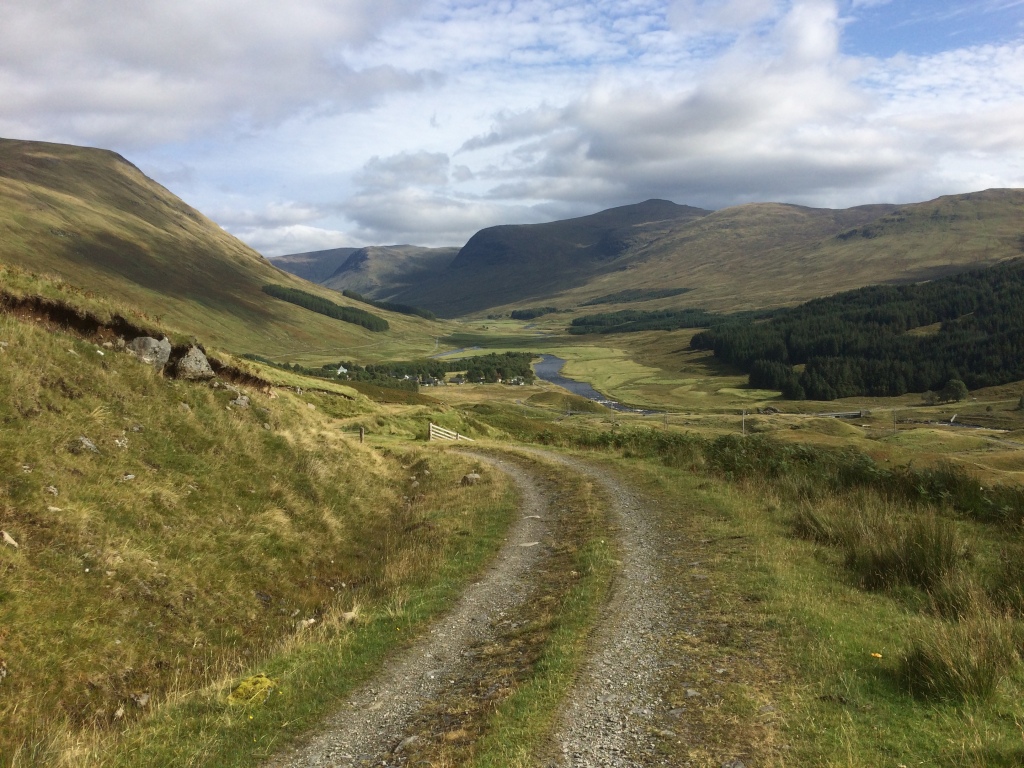
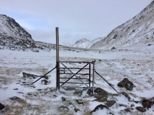
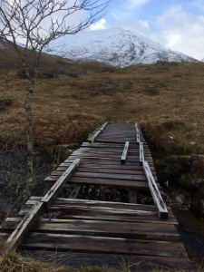
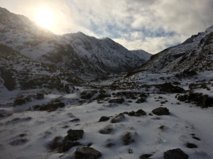
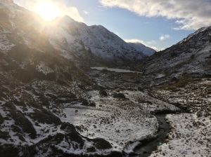
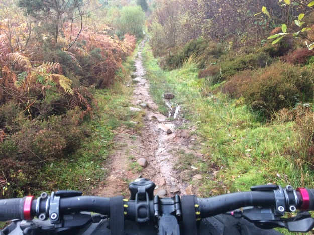
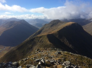
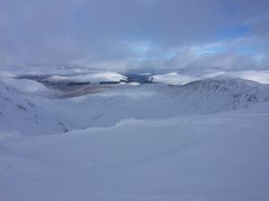
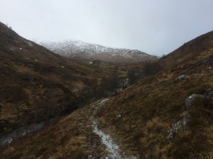
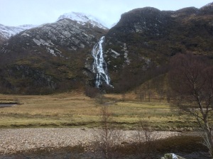
Heading West down to Loch Dochard on the way to Glen Kinglass 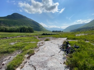
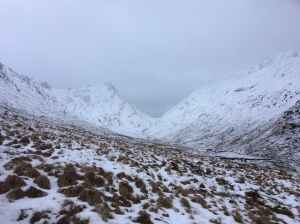
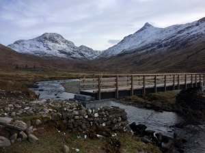
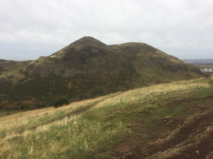
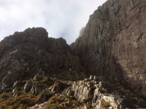
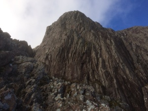
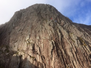
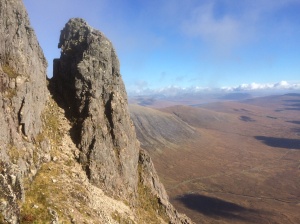
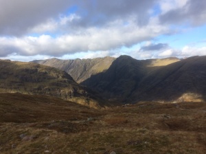
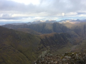
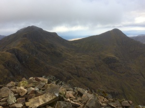
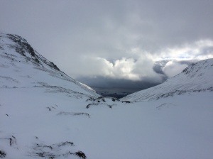
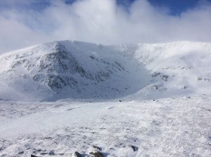
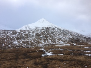
Rock slab section approaching Glenkinglass Lodge with Meall Garbh on the left 
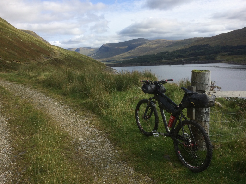
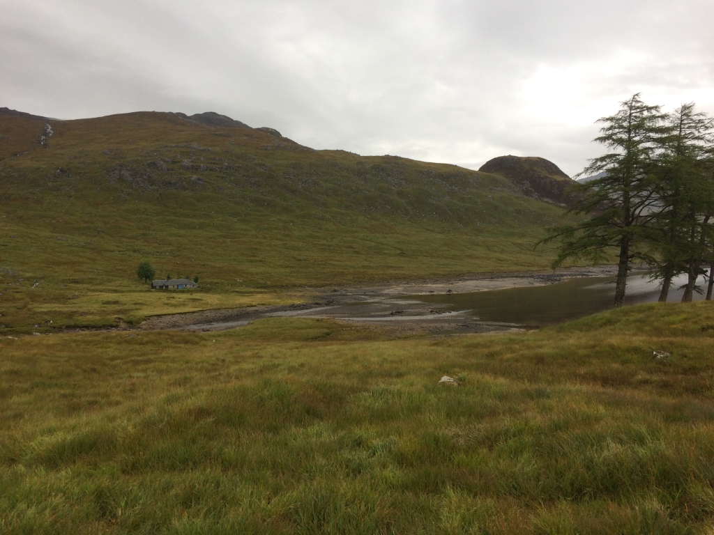
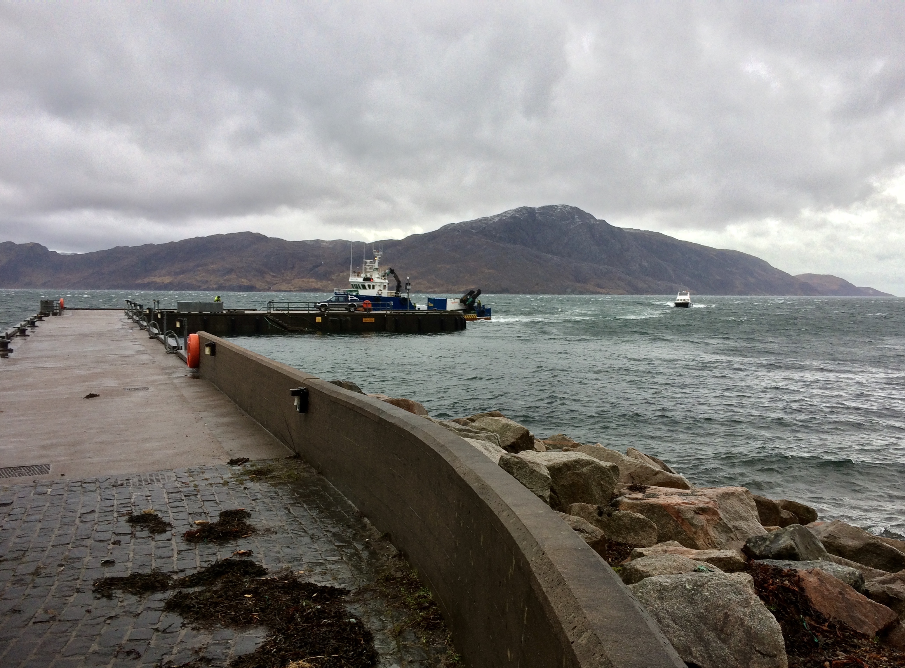
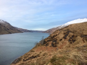
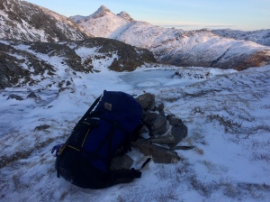
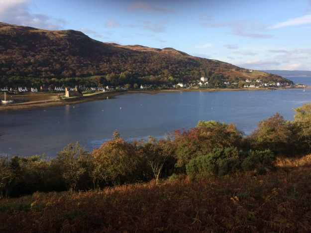
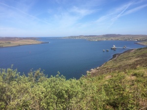
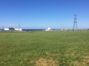
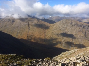
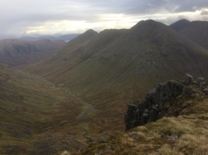
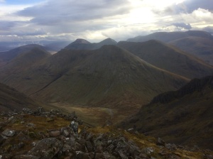
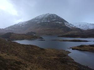
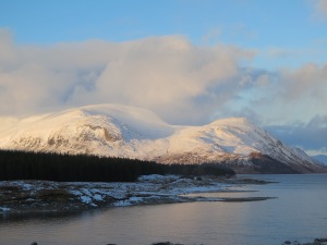
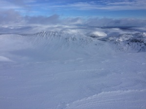
The point where the river Kinglass flows into Loch Etive with Beinn Trilleachan on the left. 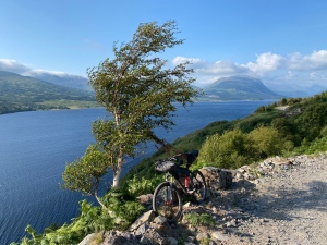
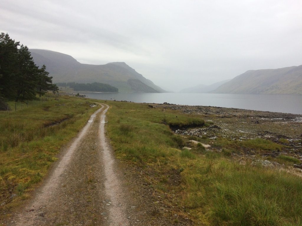
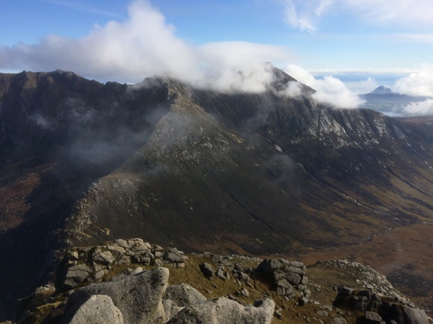
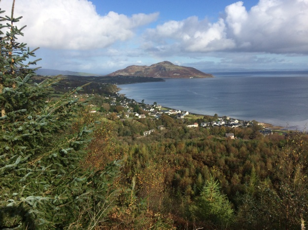
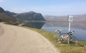
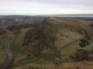
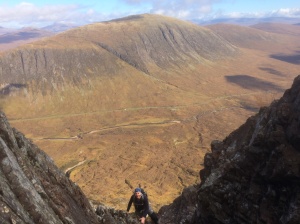
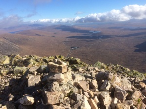
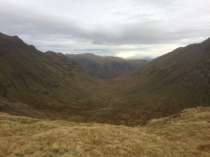
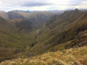
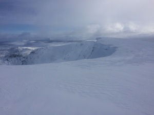
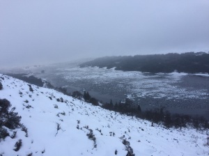
The wide trail heading South-West along Loch Etive has beautiful views but also leg sapping climbs.. 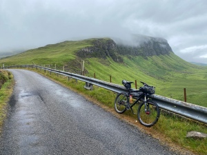
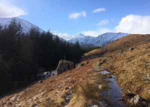
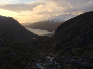
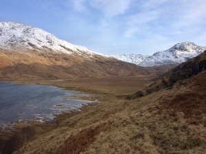
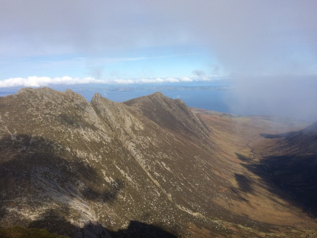
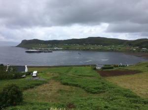
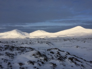
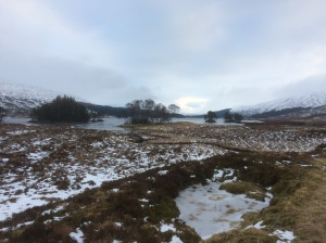
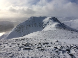
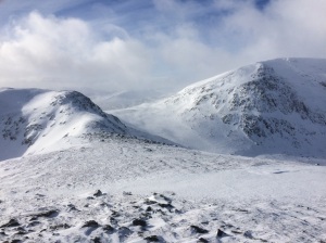
Near Balnahard approaching the wild section along Loch na Keal on Mull 
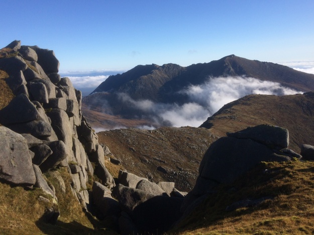
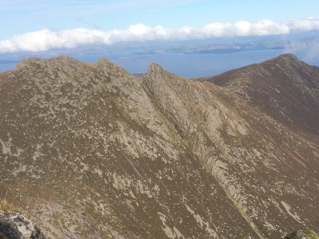
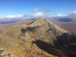
Wild rugged scenery along Loch na Keal 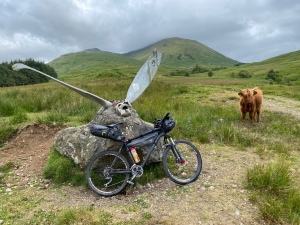
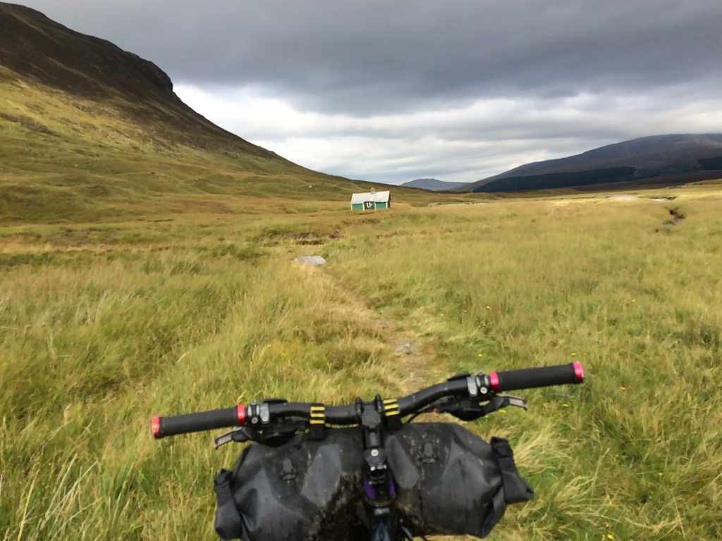
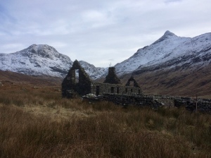
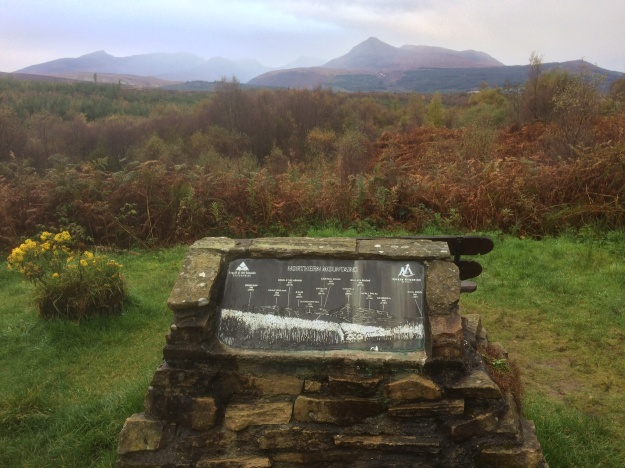
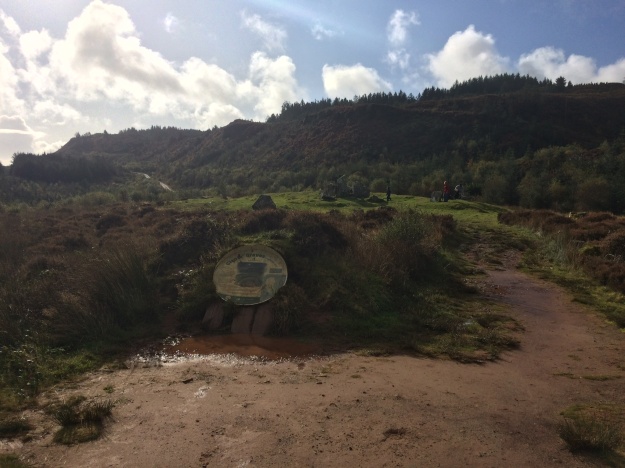
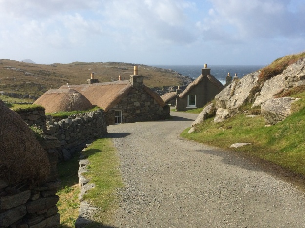
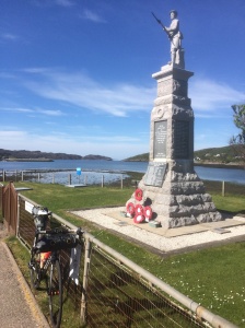
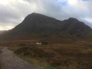
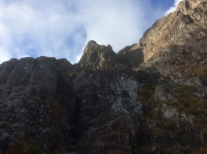
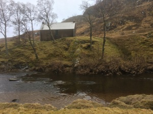
The crashed Dakota memorial just before Tomsleibhe bothy which is visible in the background 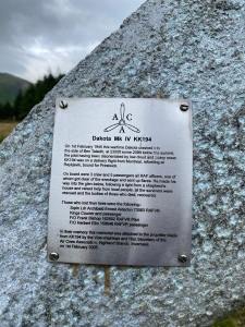
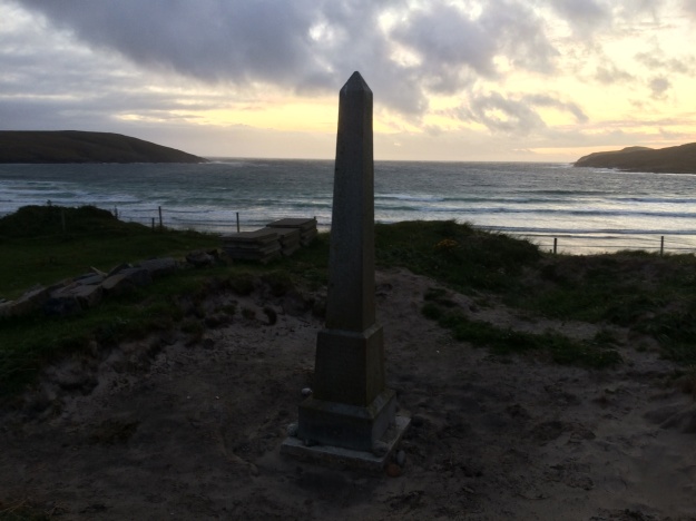
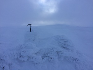
The crashed Dakota memorial inscription 
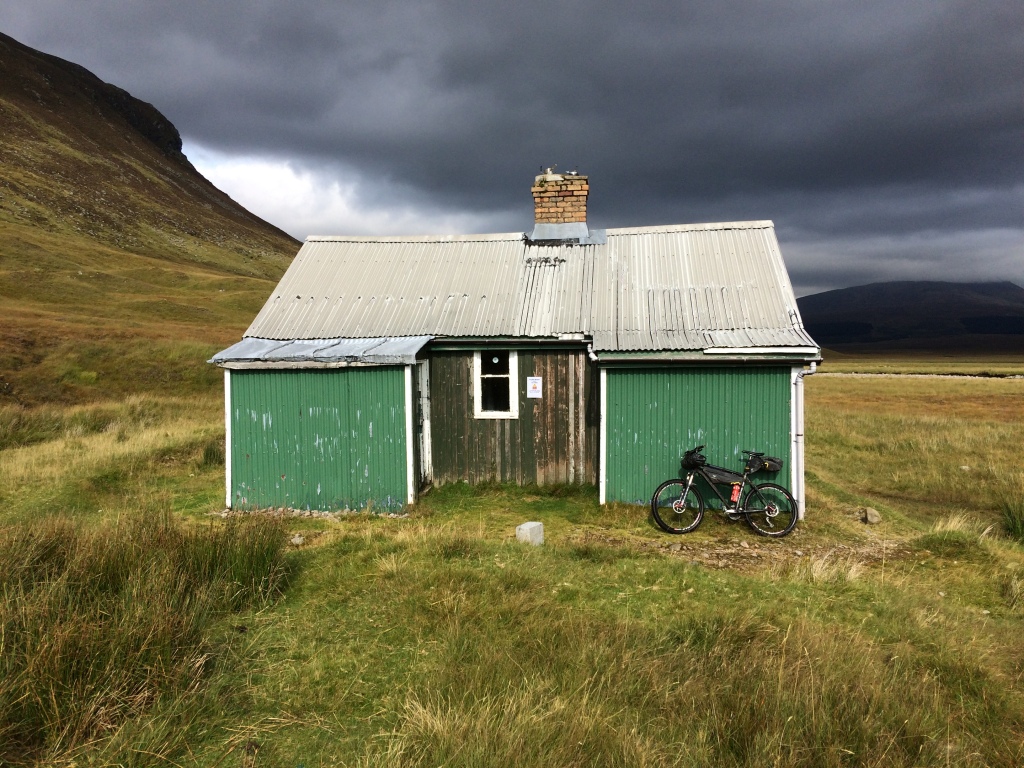
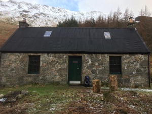
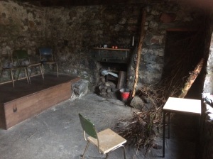
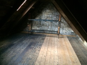
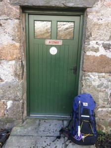
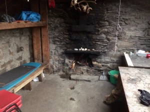
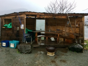
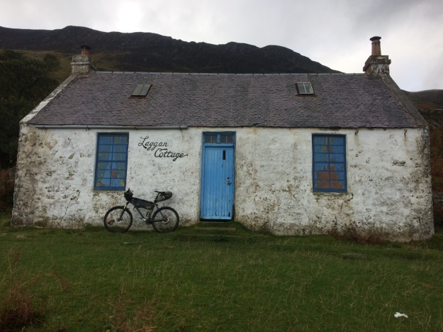
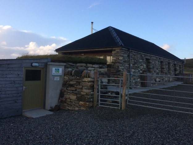
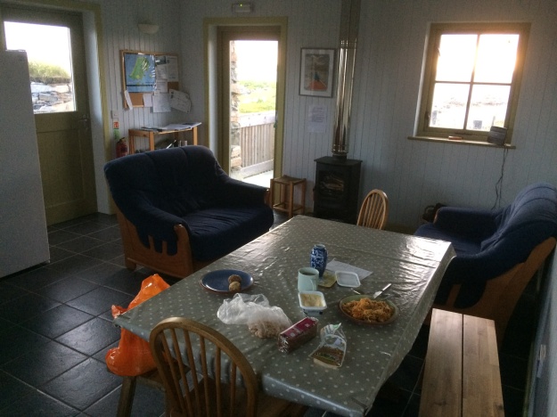
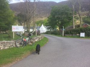
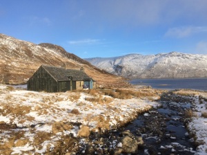
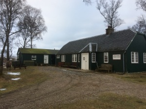
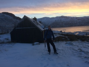
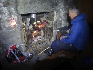
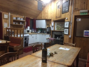
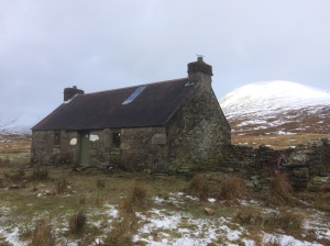
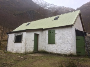
Tomsleibhe bothy 
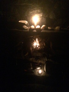
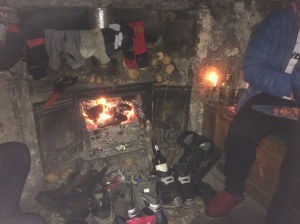
Tomsleibhe bothy (middle room) 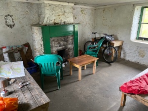
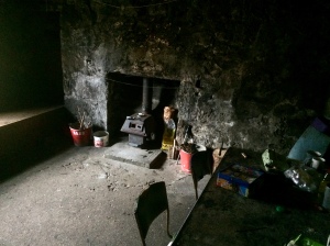
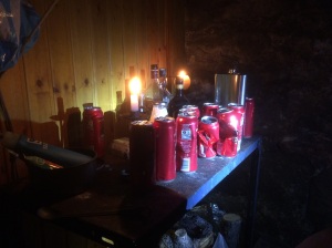
Tomsleibhe bothy 
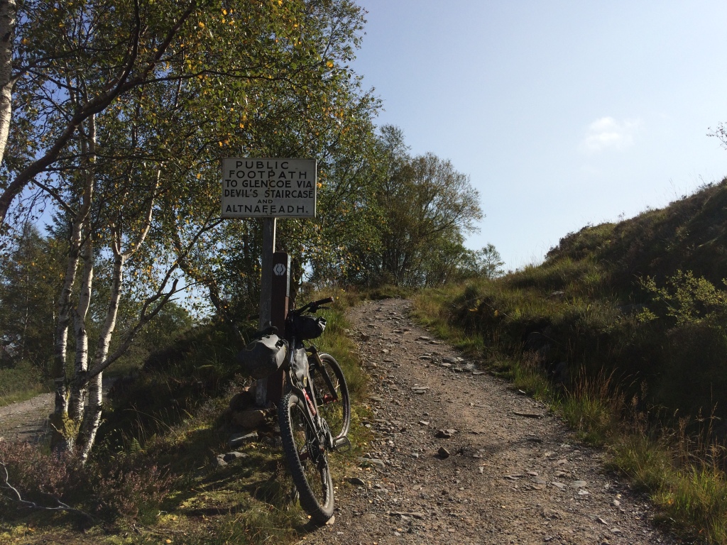
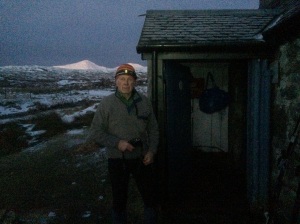
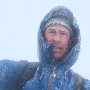
Setting off in the rain from Tomsleibhe Bothy to cycle the Northern road loop around Mull 
Calgary Bay on Mull 
The white sands at the head of Calgary Bay in North-West Mull 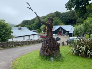
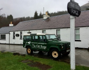
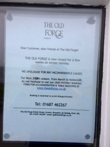
The Selkie at Calgary on Mull 
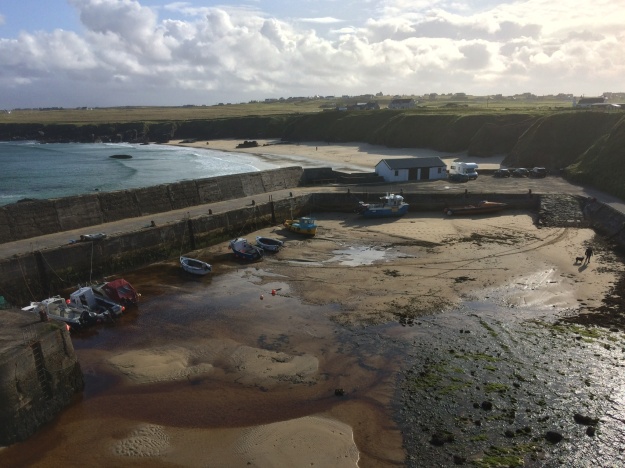
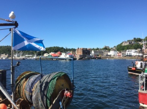
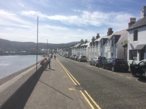
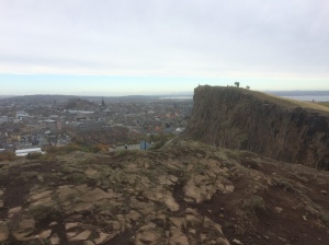
Tobermory 
Tobermory pier 
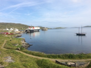
The Ardnamurchan Peninsula from the Tobermory to Kilchoan ferry 
The Tobermory to Kilchoan ferry 
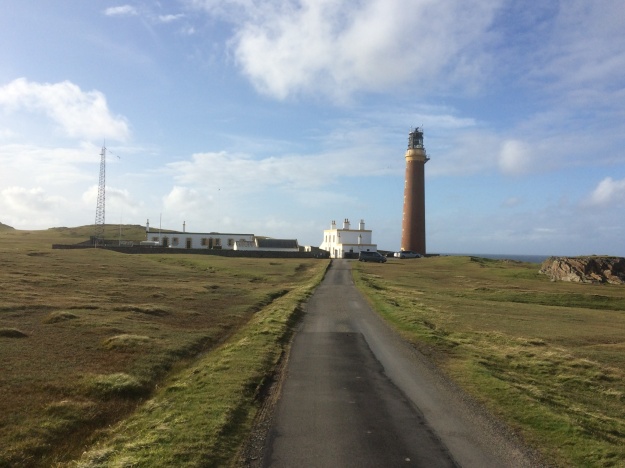
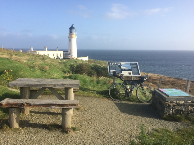
The Ardnamurchan Lighthouse built in 1849 
Indra spotted this white Sandy beach from the Lighthouse, it was a bit of a slog to get here but well worth it. 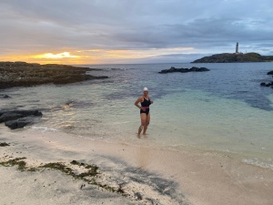
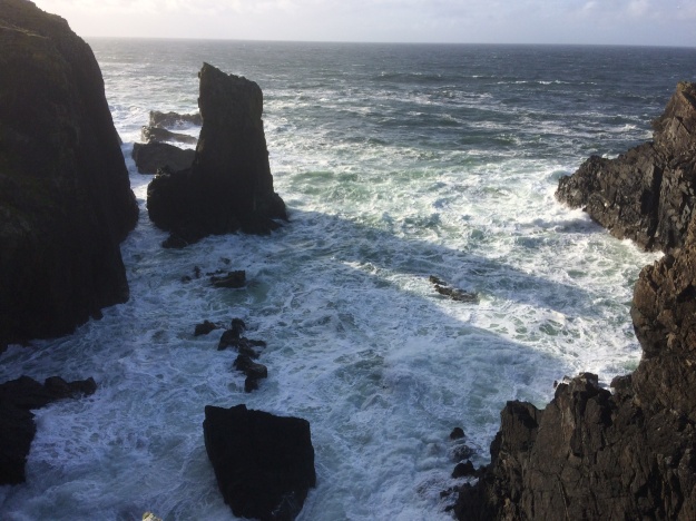
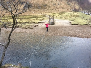
About to test the chilly sea around Mainland Britain’s most Westerly point with Ardnamurchan lighthouse in the background 
Ardnamurchan Lighthouse 
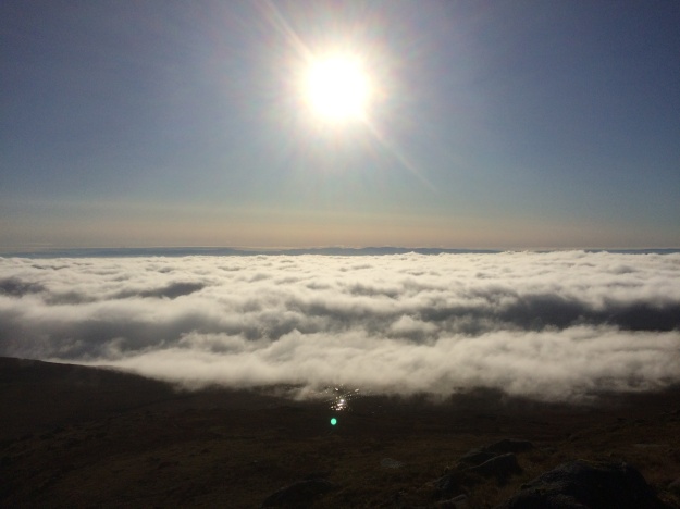
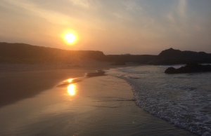
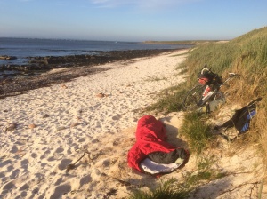
Sunset at Ardnamurchan 
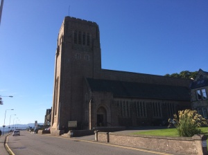
Cycling back to Kilchoan for breakfast at the Puffin Coffee Cafe. 
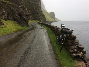
Heading East on the Ardnamurchan road near Ardslignish. 
Lunch stop at Loch Sunart 
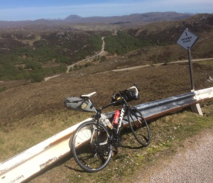
After an easy ride around the head of Loch Sunart there is a long steady climb to Gleann Gael on the way to Lochaline. 
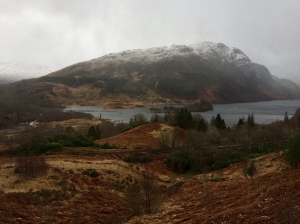
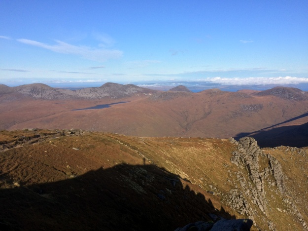
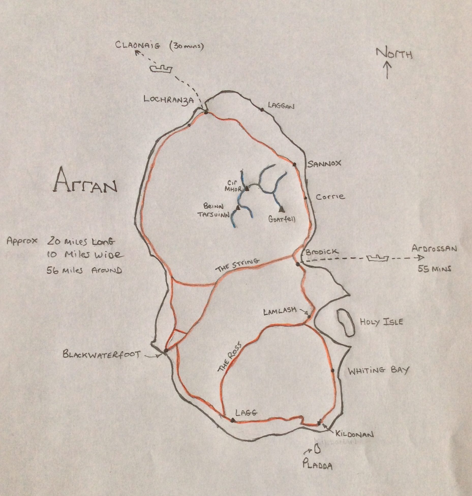
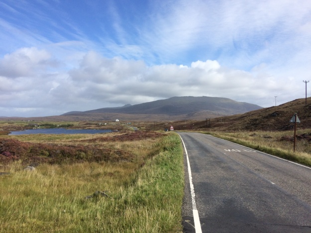
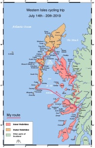
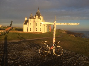
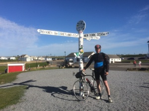
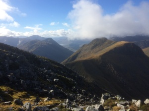
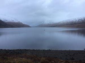
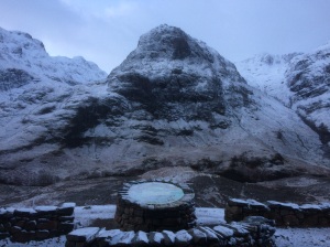
Tyndrum, Mull and Ardnamurchan